Willow Springs Topo Map California
To zoom in, hover over the map of Willow Springs
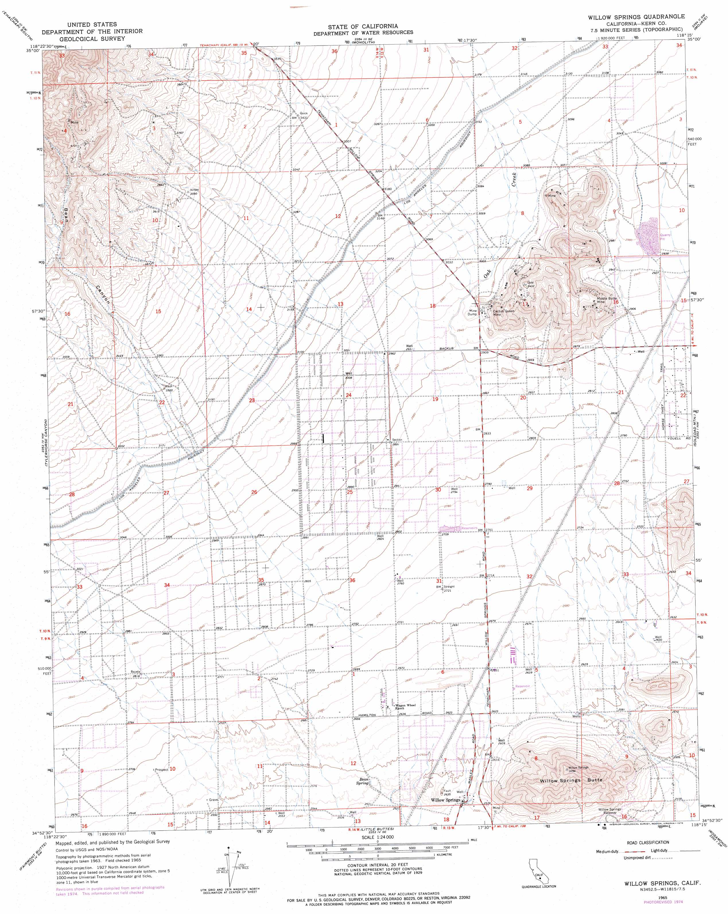
USGS Topo Quad 34118h3 - 1:24,000 scale
| Topo Map Name: | Willow Springs |
| USGS Topo Quad ID: | 34118h3 |
| Print Size: | ca. 21 1/4" wide x 27" high |
| Southeast Coordinates: | 34.875° N latitude / 118.25° W longitude |
| Map Center Coordinates: | 34.9375° N latitude / 118.3125° W longitude |
| U.S. State: | CA |
| Filename: | o34118h3.jpg |
| Download Map JPG Image: | Willow Springs topo map 1:24,000 scale |
| Map Type: | Topographic |
| Topo Series: | 7.5´ |
| Map Scale: | 1:24,000 |
| Source of Map Images: | United States Geological Survey (USGS) |
| Alternate Map Versions: |
Willow Springs CA 1965, updated 1967 Download PDF Buy paper map Willow Springs CA 1965, updated 1976 Download PDF Buy paper map Willow Springs CA 2012 Download PDF Buy paper map Willow Springs CA 2015 Download PDF Buy paper map |
1:24,000 Topo Quads surrounding Willow Springs
Keene |
Tehachapi North |
Tehachapi Ne |
Cache Peak |
Mojave Ne |
Cummings Mountain |
Tehachapi South |
Monolith |
Mojave |
Sanborn |
Liebre Twins |
Tylerhorse Canyon |
Willow Springs |
Soledad Mountain |
Bissell |
Neenach School |
Fairmont Butte |
Little Buttes |
Rosamond |
Rosamond Lake |
Burnt Peak |
Lake Hughes |
Del Sur |
Lancaster West |
Lancaster East |
> Back to 34118e1 at 1:100,000 scale
> Back to 34118a1 at 1:250,000 scale
> Back to U.S. Topo Maps home
Willow Springs topo map: Gazetteer
Willow Springs: Airports
Lloyds Landing Airport elevation 820m 2690′Willow Springs: Mines
Cactus Queen Mine elevation 988m 3241′Middle Butte Mine elevation 983m 3225′
Willow Springs: Parks
Willow Springs Stadium elevation 752m 2467′Willow Springs: Populated Places
Willow Springs elevation 769m 2522′Willow Springs: Springs
Bean Spring elevation 783m 2568′Willow Springs: Streams
Oak Creek elevation 877m 2877′Willow Springs: Summits
Willow Springs Butte elevation 998m 3274′Willow Springs: Valleys
Bean Canyon elevation 1037m 3402′Willow Springs digital topo map on disk
Buy this Willow Springs topo map showing relief, roads, GPS coordinates and other geographical features, as a high-resolution digital map file on DVD: