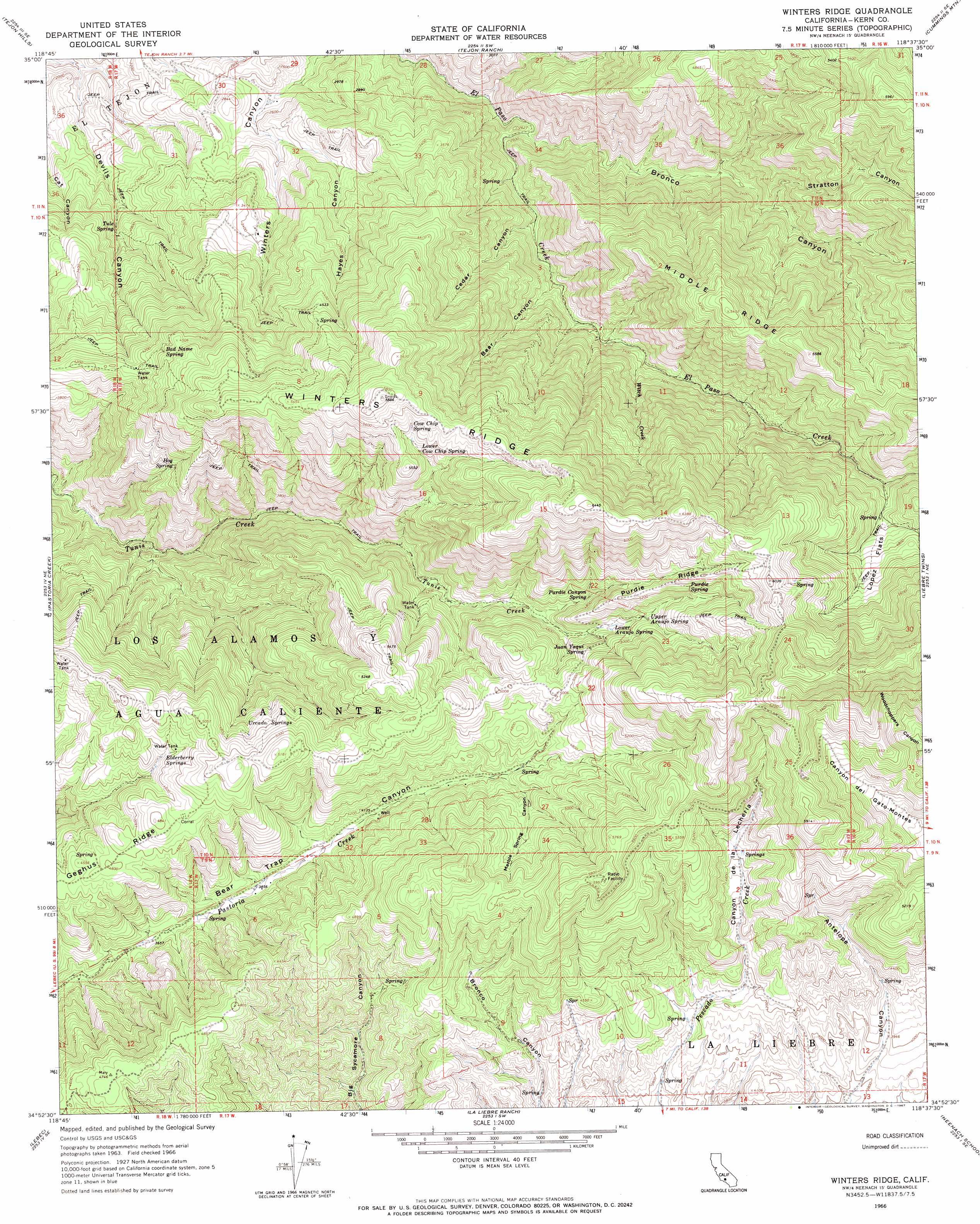
Winters Ridge Topo Map California
To zoom in, hover over the map of Winters Ridge
USGS Topo Quad 34118h6 - 1:24,000 scale
| Topo Map Name: | Winters Ridge |
| USGS Topo Quad ID: | 34118h6 |
| Print Size: | ca. 21 1/4" wide x 27" high |
| Southeast Coordinates: | 34.875° N latitude / 118.625° W longitude |
| Map Center Coordinates: | 34.9375° N latitude / 118.6875° W longitude |
| U.S. State: | CA |
| Filename: | o34118h6.jpg |
| Download Map JPG Image: | Winters Ridge topo map 1:24,000 scale |
| Map Type: | Topographic |
| Topo Series: | 7.5´ |
| Map Scale: | 1:24,000 |
| Source of Map Images: | United States Geological Survey (USGS) |
| Alternate Map Versions: |
Winters Ridge CA 1966, updated 1967 Download PDF Buy paper map Winters Ridge CA 1966, updated 1967 Download PDF Buy paper map Winters Ridge CA 2012 Download PDF Buy paper map Winters Ridge CA 2015 Download PDF Buy paper map |
1:24,000 Topo Quads surrounding Winters Ridge
Weed Patch |
Arvin |
Bear Mountain |
Keene |
Tehachapi North |
Mettler |
Tejon Hills |
Tejon Ranch |
Cummings Mountain |
Tehachapi South |
Grapevine |
Pastoria Creek |
Winters Ridge |
Liebre Twins |
Tylerhorse Canyon |
Frazier Mountain |
Lebec |
La Liebre Ranch |
Neenach School |
Fairmont Butte |
Alamo Mountain |
Black Mountain |
Liebre Mountain |
Burnt Peak |
Lake Hughes |
> Back to 34118e1 at 1:100,000 scale
> Back to 34118a1 at 1:250,000 scale
> Back to U.S. Topo Maps home
Winters Ridge topo map: Gazetteer
Winters Ridge: Flats
Lopez Flats elevation 1474m 4835′Winters Ridge: Ranges
Tehachapi Mountains elevation 1520m 4986′Winters Ridge: Ridges
Geghus Ridge elevation 1463m 4799′Middle Ridge elevation 1657m 5436′
Purdie Ridge elevation 1609m 5278′
Winters Ridge elevation 1796m 5892′
Winters Ridge: Springs
Bad Name Spring elevation 1350m 4429′Cow Chip Spring elevation 1653m 5423′
Elderberry Springs elevation 1437m 4714′
Hog Spring elevation 1231m 4038′
Juan Yaqui Spring elevation 1492m 4895′
Lower Araujo Spring elevation 1442m 4730′
Lower Cow Chip Spring elevation 1586m 5203′
Purdie Canyon Spring elevation 1442m 4730′
Purdie Spring elevation 1616m 5301′
Tule Spring elevation 780m 2559′
Upper Araujo Spring elevation 1483m 4865′
Urcado Springs elevation 1457m 4780′
Winters Ridge: Streams
Witch Creek elevation 1013m 3323′Winters Ridge: Valleys
Bear Canyon elevation 896m 2939′Bronco Canyon elevation 756m 2480′
Canyon de la Lecheria elevation 1255m 4117′
Cedar Canyon elevation 835m 2739′
Hayes Canyon elevation 818m 2683′
Marble Spring Canyon elevation 1348m 4422′
Stratton Canyon elevation 1027m 3369′
Winters Ridge digital topo map on disk
Buy this Winters Ridge topo map showing relief, roads, GPS coordinates and other geographical features, as a high-resolution digital map file on DVD: