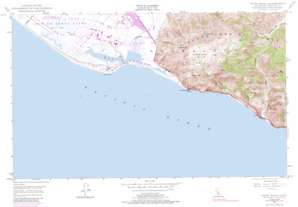
Point Mugu Topo Map California
To zoom in, hover over the map of Point Mugu
USGS Topo Quad 34119a1 - 1:24,000 scale
| Topo Map Name: | Point Mugu |
| USGS Topo Quad ID: | 34119a1 |
| Print Size: | ca. 21 1/4" wide x 27" high |
| Southeast Coordinates: | 34° N latitude / 119° W longitude |
| Map Center Coordinates: | 34.0625° N latitude / 119.0625° W longitude |
| U.S. State: | CA |
| Filename: | o34119a1.jpg |
| Download Map JPG Image: | Point Mugu topo map 1:24,000 scale |
| Map Type: | Topographic |
| Topo Series: | 7.5´ |
| Map Scale: | 1:24,000 |
| Source of Map Images: | United States Geological Survey (USGS) |
| Alternate Map Versions: |
Point Mugu CA 2012 Download PDF Buy paper map Point Mugu CA 2015 Download PDF Buy paper map |
1:24,000 Topo Quads surrounding Point Mugu
Ventura |
Saticoy |
Santa Paula |
Moorpark |
Simi Valley West |
Oxnard |
Camarillo |
Newbury Park |
Thousand Oaks |
|
Point Mugu |
Triunfo Pass |
Point Dume |
||
> Back to 34119a1 at 1:100,000 scale
> Back to 34118a1 at 1:250,000 scale
> Back to U.S. Topo Maps home
Point Mugu topo map: Gazetteer
Point Mugu: Basins
La Jolla Valley elevation 224m 734′Point Mugu: Bays
Mugu Lagoon elevation 0m 0′Point Mugu: Beaches
La Jolla Beach elevation 4m 13′Point Mugu Beach elevation 12m 39′
Point Mugu: Capes
Laguna Point elevation 4m 13′Point Mugu elevation 14m 45′
Point Mugu: Parks
Point Mugu State Park elevation 55m 180′Point Mugu: Populated Places
Sycamore Cove elevation 3m 9′Point Mugu: Streams
Calleguas Creek elevation 1m 3′Point Mugu: Summits
La Jolla Peak elevation 466m 1528′Laguna Peak elevation 433m 1420′
Mugu Peak elevation 384m 1259′
Point Mugu: Valleys
Big Sycamore Canyon elevation 1m 3′Hueneme Canyon elevation 325m 1066′
La Jolla Canyon elevation 4m 13′
Serrano Canyon elevation 28m 91′
Wood Canyon elevation 62m 203′
Point Mugu digital topo map on disk
Buy this Point Mugu topo map showing relief, roads, GPS coordinates and other geographical features, as a high-resolution digital map file on DVD:


