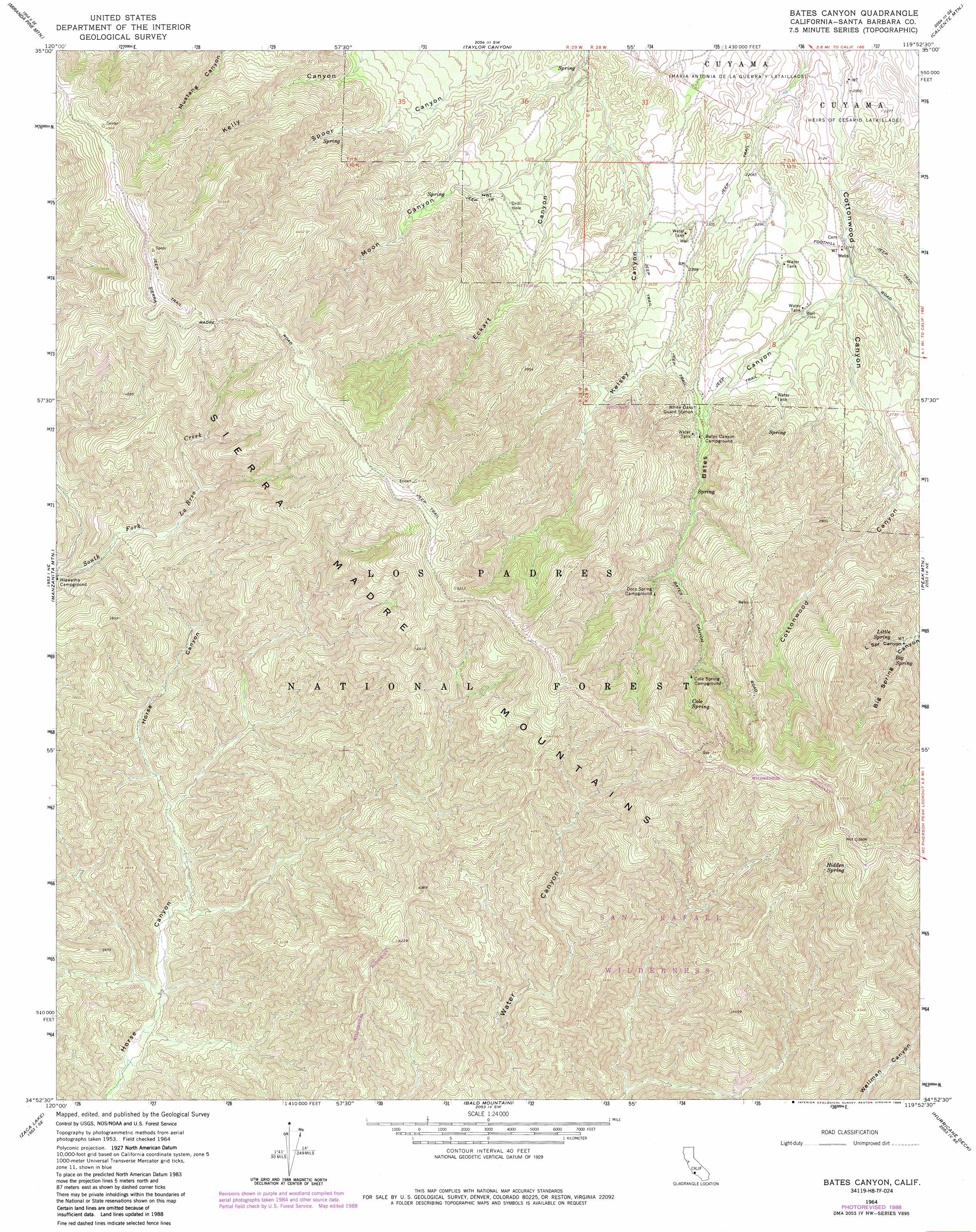
Bates Canyon Topo Map California
To zoom in, hover over the map of Bates Canyon
USGS Topo Quad 34119h8 - 1:24,000 scale
| Topo Map Name: | Bates Canyon |
| USGS Topo Quad ID: | 34119h8 |
| Print Size: | ca. 21 1/4" wide x 27" high |
| Southeast Coordinates: | 34.875° N latitude / 119.875° W longitude |
| Map Center Coordinates: | 34.9375° N latitude / 119.9375° W longitude |
| U.S. State: | CA |
| Filename: | o34119h8.jpg |
| Download Map JPG Image: | Bates Canyon topo map 1:24,000 scale |
| Map Type: | Topographic |
| Topo Series: | 7.5´ |
| Map Scale: | 1:24,000 |
| Source of Map Images: | United States Geological Survey (USGS) |
| Alternate Map Versions: |
Bates Canyon CA 1964, updated 1965 Download PDF Buy paper map Bates Canyon CA 1964, updated 1965 Download PDF Buy paper map Bates Canyon CA 1964, updated 1982 Download PDF Buy paper map Bates Canyon CA 1964, updated 1989 Download PDF Buy paper map Bates Canyon CA 1977 Download PDF Buy paper map Bates Canyon CA 1995, updated 2000 Download PDF Buy paper map Bates Canyon CA 2012 Download PDF Buy paper map Bates Canyon CA 2015 Download PDF Buy paper map |
| FStopo: | US Forest Service topo Bates Canyon is available: Download FStopo PDF Download FStopo TIF |
1:24,000 Topo Quads surrounding Bates Canyon
Los Machos Hills |
Branch Mountain |
Chimineas Ranch |
Painted Rock |
Panorama Hills |
Chimney Canyon |
Miranda Pine Mountain |
Taylor Canyon |
Caliente Mountain |
Wells Ranch |
Tepusquet Canyon |
Manzanita Mountain |
Bates Canyon |
Peak Mountain |
New Cuyama |
Foxen Canyon |
Zaca Lake |
Bald Mountain |
Hurricane Deck |
Salisbury Potrero |
Zaca Creek |
Los Olivos |
Figueroa Mountain |
San Rafael Mountain |
Big Pine Mountain |
> Back to 34119e1 at 1:100,000 scale
> Back to 34118a1 at 1:250,000 scale
> Back to U.S. Topo Maps home
Bates Canyon topo map: Gazetteer
Bates Canyon: Springs
Big Spring elevation 1065m 3494′Cole Spring elevation 1314m 4311′
Hidden Spring elevation 1571m 5154′
Little Spring elevation 1064m 3490′
Bates Canyon: Valleys
Bates Canyon elevation 694m 2276′Big Spring Canyon elevation 980m 3215′
Eckart Canyon elevation 601m 1971′
Little Spring Canyon elevation 1016m 3333′
Moon Canyon elevation 685m 2247′
Bates Canyon digital topo map on disk
Buy this Bates Canyon topo map showing relief, roads, GPS coordinates and other geographical features, as a high-resolution digital map file on DVD: