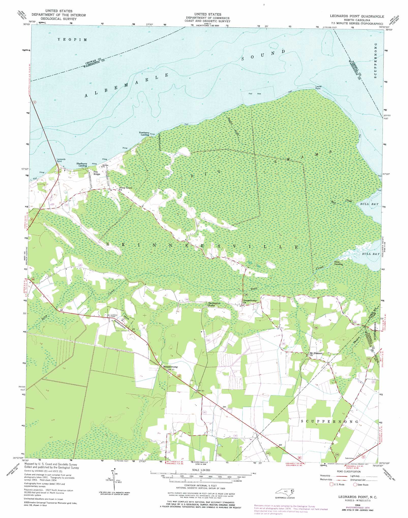
Leonards Point Topo Map North Carolina
To zoom in, hover over the map of Leonards Point
USGS Topo Quad 35076h4 - 1:24,000 scale
| Topo Map Name: | Leonards Point |
| USGS Topo Quad ID: | 35076h4 |
| Print Size: | ca. 21 1/4" wide x 27" high |
| Southeast Coordinates: | 35.875° N latitude / 76.375° W longitude |
| Map Center Coordinates: | 35.9375° N latitude / 76.4375° W longitude |
| U.S. State: | NC |
| Filename: | o35076h4.jpg |
| Download Map JPG Image: | Leonards Point topo map 1:24,000 scale |
| Map Type: | Topographic |
| Topo Series: | 7.5´ |
| Map Scale: | 1:24,000 |
| Source of Map Images: | United States Geological Survey (USGS) |
| Alternate Map Versions: |
Leonards Point NC 1954, updated 1957 Download PDF Buy paper map Leonards Point NC 1954, updated 1977 Download PDF Buy paper map Leonards Point NC 2010 Download PDF Buy paper map Leonards Point NC 2013 Download PDF Buy paper map Leonards Point NC 2016 Download PDF Buy paper map |
1:24,000 Topo Quads surrounding Leonards Point
Valhalla |
Center Hill |
Hertford |
Nixonton |
Weeksville |
Edenhouse |
Edenton |
Yeopim River |
Harvey Neck |
Stevenson Point |
Westover |
Roper North |
Leonards Point |
Columbia West |
Columbia East |
Plymouth East |
Roper South |
Creswell |
Creswell Se |
Scotia |
Pike Road |
Pungo Lake |
New Lake Nw |
New Lake |
Fairfield Nw |
> Back to 35076e1 at 1:100,000 scale
> Back to 35076a1 at 1:250,000 scale
> Back to U.S. Topo Maps home
Leonards Point topo map: Gazetteer
Leonards Point: Canals
Newberry Ditch elevation 0m 0′Leonards Point: Capes
Laurel Point elevation 1m 3′Leonards Point elevation 4m 13′
Leonards Point: Populated Places
Davenport Forks elevation 1m 3′Pea Ridge elevation 4m 13′
Scuppernong elevation 2m 6′
Leonards Point: Streams
Bull Creek elevation 0m 0′Deep Creek elevation 0m 0′
Deep Creek elevation 0m 0′
Sleights Creek elevation 0m 0′
Leonards Point: Swamps
Big Swamp elevation 0m 0′Indian Swamp elevation 1m 3′
Leonards Point digital topo map on disk
Buy this Leonards Point topo map showing relief, roads, GPS coordinates and other geographical features, as a high-resolution digital map file on DVD:
Atlantic Coast (NY, NJ, PA, DE, MD, VA, NC)
Buy digital topo maps: Atlantic Coast (NY, NJ, PA, DE, MD, VA, NC)
 map DVD")