Roper North Topo Map North Carolina
To zoom in, hover over the map of Roper North
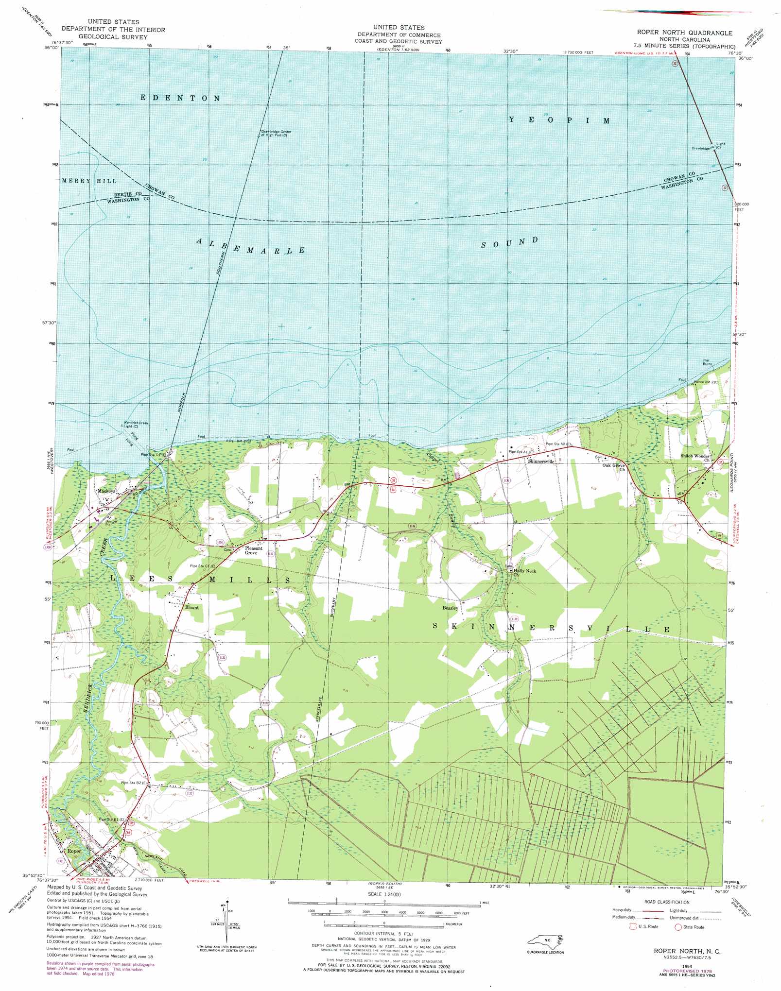
USGS Topo Quad 35076h5 - 1:24,000 scale
| Topo Map Name: | Roper North |
| USGS Topo Quad ID: | 35076h5 |
| Print Size: | ca. 21 1/4" wide x 27" high |
| Southeast Coordinates: | 35.875° N latitude / 76.5° W longitude |
| Map Center Coordinates: | 35.9375° N latitude / 76.5625° W longitude |
| U.S. State: | NC |
| Filename: | o35076h5.jpg |
| Download Map JPG Image: | Roper North topo map 1:24,000 scale |
| Map Type: | Topographic |
| Topo Series: | 7.5´ |
| Map Scale: | 1:24,000 |
| Source of Map Images: | United States Geological Survey (USGS) |
| Alternate Map Versions: |
Roper North NC 1954, updated 1957 Download PDF Buy paper map Roper North NC 1954, updated 1957 Download PDF Buy paper map Roper North NC 1954, updated 1978 Download PDF Buy paper map Roper North NC 2010 Download PDF Buy paper map Roper North NC 2013 Download PDF Buy paper map Roper North NC 2016 Download PDF Buy paper map |
1:24,000 Topo Quads surrounding Roper North
Colerain |
Valhalla |
Center Hill |
Hertford |
Nixonton |
Merry Hill |
Edenhouse |
Edenton |
Yeopim River |
Harvey Neck |
Woodard |
Westover |
Roper North |
Leonards Point |
Columbia West |
Plymouth West |
Plymouth East |
Roper South |
Creswell |
Creswell Se |
Hoke |
Pike Road |
Pungo Lake |
New Lake Nw |
New Lake |
> Back to 35076e1 at 1:100,000 scale
> Back to 35076a1 at 1:250,000 scale
> Back to U.S. Topo Maps home
Roper North topo map: Gazetteer
Roper North: Beaches
Batemans Beach elevation 0m 0′Roper North: Populated Places
Beasley elevation 3m 9′Blount elevation 4m 13′
Mackeys elevation 3m 9′
Pleasant Grove elevation 4m 13′
Roper elevation 4m 13′
Skinnersville elevation 3m 9′
Roper North: Streams
Bakers Swamp elevation 0m 0′Beaver Dam Branch elevation 0m 0′
Chapel Swamp elevation 0m 0′
Hawkins Branch elevation 0m 0′
Kendrick Creek elevation 0m 0′
Mackeys Creek elevation 0m 0′
Mill Creek elevation 1m 3′
Old Mill Creek elevation 0m 0′
Whites Creek elevation 0m 0′
Roper North digital topo map on disk
Buy this Roper North topo map showing relief, roads, GPS coordinates and other geographical features, as a high-resolution digital map file on DVD:
Atlantic Coast (NY, NJ, PA, DE, MD, VA, NC)
Buy digital topo maps: Atlantic Coast (NY, NJ, PA, DE, MD, VA, NC)
 map DVD")