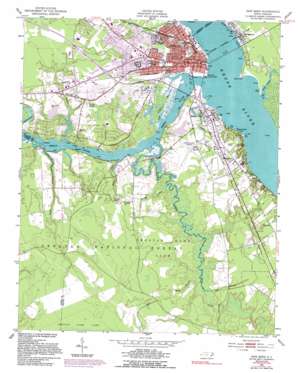
New Bern Topo Map North Carolina
To zoom in, hover over the map of New Bern
USGS Topo Quad 35077a1 - 1:24,000 scale
| Topo Map Name: | New Bern |
| USGS Topo Quad ID: | 35077a1 |
| Print Size: | ca. 21 1/4" wide x 27" high |
| Southeast Coordinates: | 35° N latitude / 77° W longitude |
| Map Center Coordinates: | 35.0625° N latitude / 77.0625° W longitude |
| U.S. State: | NC |
| Filename: | o35077a1.jpg |
| Download Map JPG Image: | New Bern topo map 1:24,000 scale |
| Map Type: | Topographic |
| Topo Series: | 7.5´ |
| Map Scale: | 1:24,000 |
| Source of Map Images: | United States Geological Survey (USGS) |
| Alternate Map Versions: |
New Bern NC 1950, updated 1952 Download PDF Buy paper map New Bern NC 1950, updated 1965 Download PDF Buy paper map New Bern NC 1950, updated 1977 Download PDF Buy paper map New Bern NC 1950, updated 1983 Download PDF Buy paper map New Bern NC 1950, updated 1992 Download PDF Buy paper map New Bern NC 1994, updated 1997 Download PDF Buy paper map New Bern NC 1994, updated 1997 Download PDF Buy paper map New Bern NC 1994, updated 2000 Download PDF Buy paper map New Bern NC 2011 Download PDF Buy paper map New Bern NC 2013 Download PDF Buy paper map New Bern NC 2016 Download PDF Buy paper map |
| FStopo: | US Forest Service topo New Bern is available: Download FStopo PDF Download FStopo TIF |
1:24,000 Topo Quads surrounding New Bern
> Back to 35077a1 at 1:100,000 scale
> Back to 35076a1 at 1:250,000 scale
> Back to U.S. Topo Maps home
New Bern topo map: Gazetteer
New Bern: Airports
Simmons Nott Airport elevation 5m 16′New Bern: Bridges
Alfred A Cunningham Bridge elevation 0m 0′New Bern: Capes
Fort Point elevation 3m 9′Green Spring Point elevation 0m 0′
Sandy Point elevation 1m 3′
Union Point elevation 0m 0′
New Bern: Lakes
Cypress Lake elevation 0m 0′Old Towne Lake elevation 0m 0′
New Bern: Parks
Brice Creek Recreation Site elevation 4m 13′Fort Totten Park elevation 3m 9′
Kafer Park elevation 4m 13′
Lawson Creek Park elevation 2m 6′
Union Point Park elevation 1m 3′
New Bern: Populated Places
Bernwood Mobile Home Park elevation 6m 19′Bowling Heights elevation 7m 22′
Brices Creek elevation 8m 26′
Bridgeton elevation 2m 6′
Circle L Mobile Home Park elevation 2m 6′
Colony Estates elevation 8m 26′
Country Club Hills elevation 6m 19′
Country Club Park elevation 3m 9′
Craven Terrace elevation 3m 9′
Creekwood elevation 5m 16′
Cypress Shores elevation 4m 13′
DeGraffenried Park elevation 4m 13′
Edgewood elevation 6m 19′
Fox Chase Village Mobile Home Park elevation 8m 26′
Fox Hollow elevation 4m 13′
Granthams elevation 8m 26′
Greenwood elevation 3m 9′
Haywood Farms elevation 6m 19′
Holly Hills elevation 6m 19′
James City elevation 4m 13′
Lilliput Landing elevation 4m 13′
Manning Park elevation 7m 22′
New Bern elevation 3m 9′
Oakdale elevation 6m 19′
Old Town Harbor elevation 2m 6′
Quail Ridge elevation 6m 19′
Snug Harbor elevation 4m 13′
Southgate elevation 6m 19′
Thurman elevation 8m 26′
Trent Shores elevation 1m 3′
Trent Woods elevation 4m 13′
Wilson Creek Heights elevation 3m 9′
New Bern: Post Offices
Bridgeton Post Office elevation 3m 9′New Bern Post Office - Downtown Office elevation 3m 9′
New Bern: Streams
Black Branch elevation 1m 3′Brice Creek elevation 0m 0′
Bridge Creek elevation 0m 0′
Duck Creek elevation 0m 0′
Georges Branch elevation 0m 0′
Hoods Creek elevation -1m -4′
Lane Branch elevation 10m 32′
Lawson Creek elevation 0m 0′
Lees Branch elevation 0m 0′
Reedy Branch elevation 0m 0′
Scotts Creek elevation 0m 0′
Trent River elevation 0m 0′
Wilson Creek elevation 0m 0′
New Bern: Swamps
Brice Creek Pocoson elevation 11m 36′Trent Marsh elevation 0m 0′
New Bern digital topo map on disk
Buy this New Bern topo map showing relief, roads, GPS coordinates and other geographical features, as a high-resolution digital map file on DVD:
Atlantic Coast (NY, NJ, PA, DE, MD, VA, NC)
Buy digital topo maps: Atlantic Coast (NY, NJ, PA, DE, MD, VA, NC)


