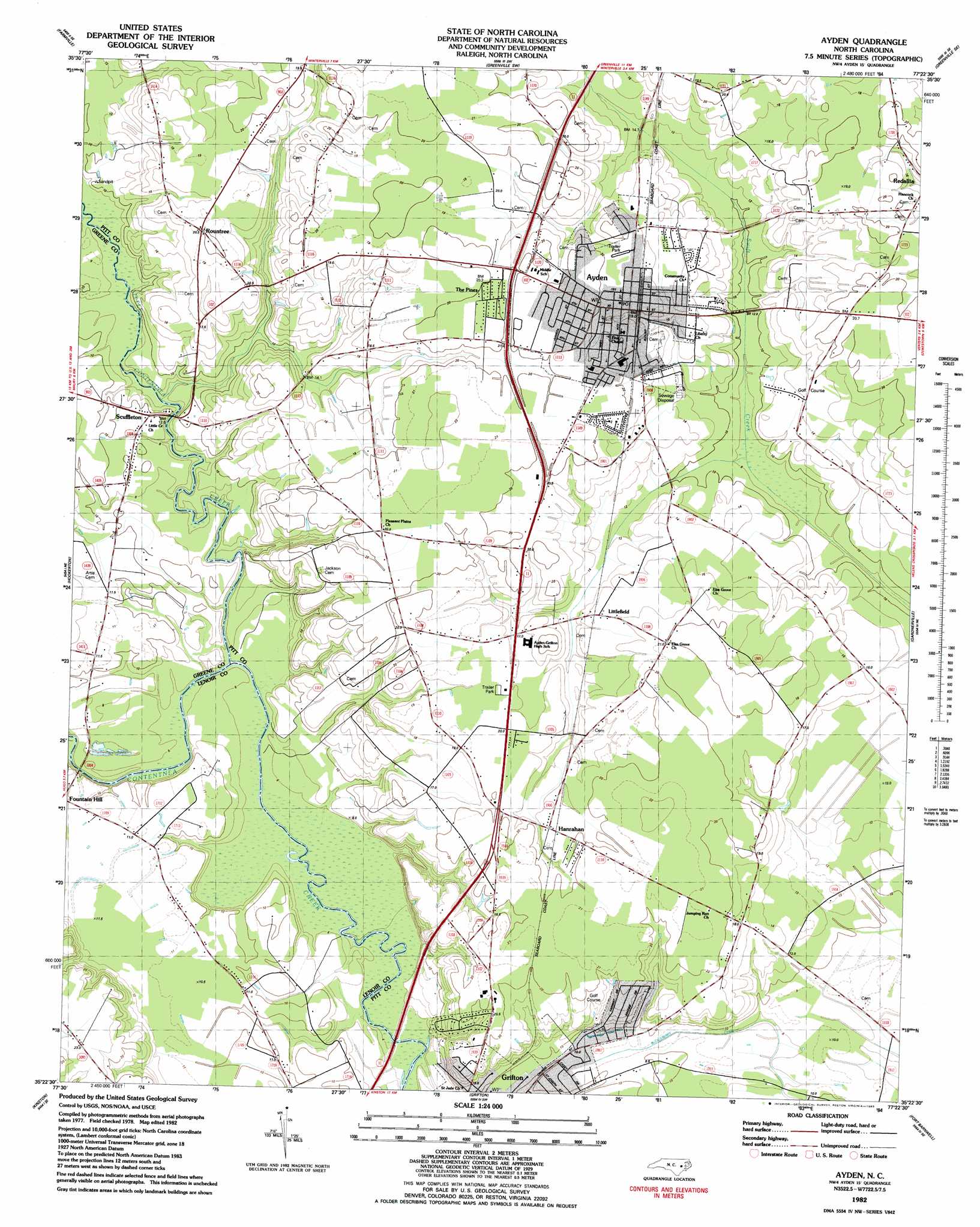
Ayden Topo Map North Carolina
To zoom in, hover over the map of Ayden
USGS Topo Quad 35077d4 - 1:24,000 scale
| Topo Map Name: | Ayden |
| USGS Topo Quad ID: | 35077d4 |
| Print Size: | ca. 21 1/4" wide x 27" high |
| Southeast Coordinates: | 35.375° N latitude / 77.375° W longitude |
| Map Center Coordinates: | 35.4375° N latitude / 77.4375° W longitude |
| U.S. State: | NC |
| Filename: | o35077d4.jpg |
| Download Map JPG Image: | Ayden topo map 1:24,000 scale |
| Map Type: | Topographic |
| Topo Series: | 7.5´ |
| Map Scale: | 1:24,000 |
| Source of Map Images: | United States Geological Survey (USGS) |
| Alternate Map Versions: |
Ayden NC 1982, updated 1983 Download PDF Buy paper map Ayden NC 2010 Download PDF Buy paper map Ayden NC 2013 Download PDF Buy paper map Ayden NC 2016 Download PDF Buy paper map |
1:24,000 Topo Quads surrounding Ayden
Fountain |
Falkland |
Greenville Nw |
Greenville Ne |
Leggetts Crossroads |
Walstonburg |
Farmville |
Greenville Sw |
Greenville Se |
Grimesland |
Snow Hill |
Hookerton |
Ayden |
Gardnerville |
Wilmar |
Falling Creek |
Kinston |
Grifton |
Fort Barnwell |
Vanceboro |
Deep Run |
Rivermont |
Dover |
Cove City |
Jasper |
> Back to 35077a1 at 1:100,000 scale
> Back to 35076a1 at 1:250,000 scale
> Back to U.S. Topo Maps home
Ayden topo map: Gazetteer
Ayden: Populated Places
Ayden elevation 20m 65′Belair Estates elevation 16m 52′
Cresent Heights Mobile Home Park elevation 19m 62′
Deerfield elevation 15m 49′
Hanrahan elevation 19m 62′
Kennedy Estates elevation 21m 68′
Littlefield elevation 16m 52′
North Hills Estates elevation 21m 68′
Pleasant Ridge elevation 19m 62′
Redallia elevation 19m 62′
Rountree elevation 20m 65′
Scuffleton elevation 10m 32′
Strawberry Banks elevation 19m 62′
The Pines elevation 20m 65′
Ayden: Post Offices
Ayden Post Office elevation 18m 59′Ayden: Streams
Little Contentnea Creek elevation 8m 26′Ayden digital topo map on disk
Buy this Ayden topo map showing relief, roads, GPS coordinates and other geographical features, as a high-resolution digital map file on DVD:
Atlantic Coast (NY, NJ, PA, DE, MD, VA, NC)
Buy digital topo maps: Atlantic Coast (NY, NJ, PA, DE, MD, VA, NC)
 map DVD")