Slocomb Topo Map North Carolina
To zoom in, hover over the map of Slocomb
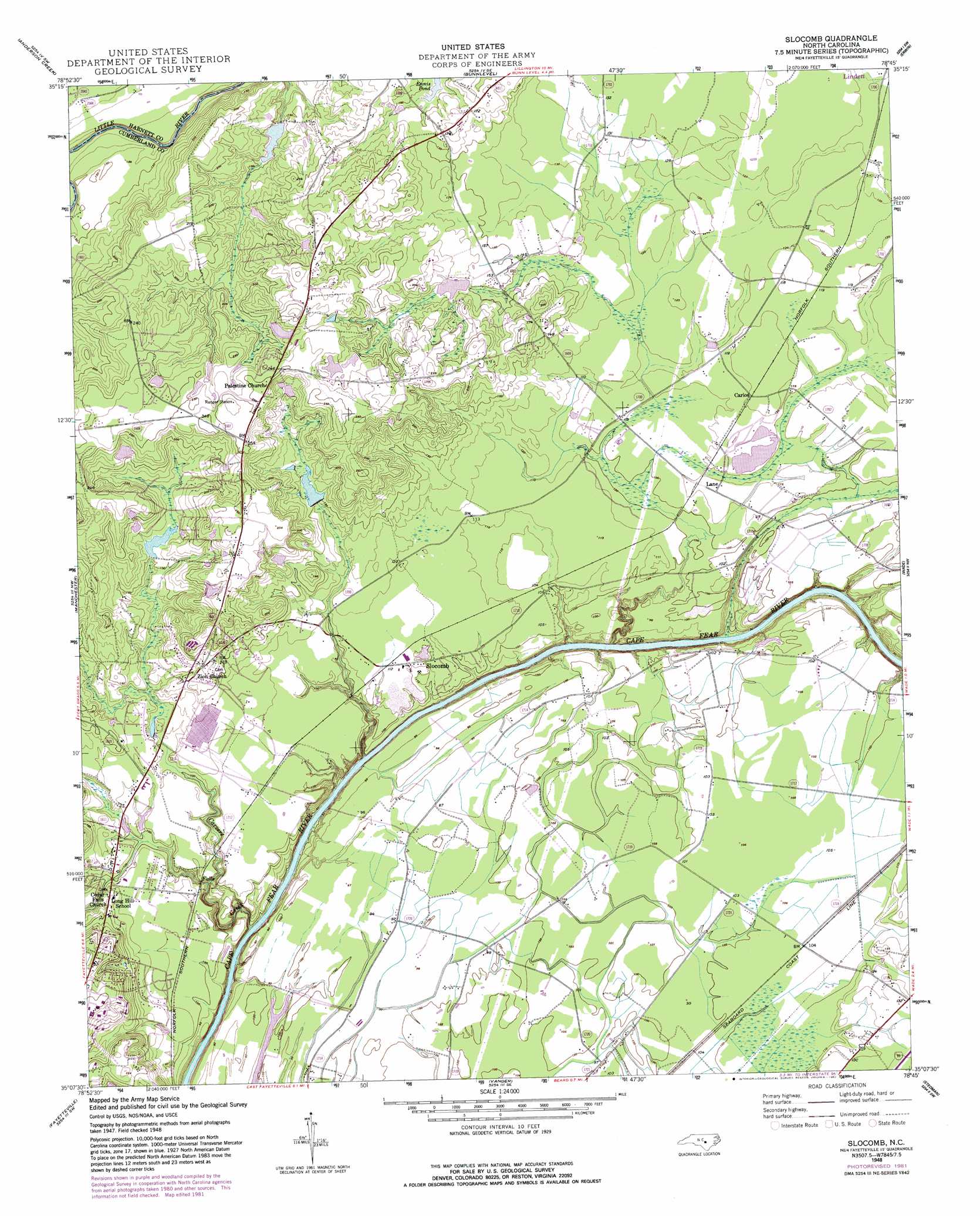
USGS Topo Quad 35078b7 - 1:24,000 scale
| Topo Map Name: | Slocomb |
| USGS Topo Quad ID: | 35078b7 |
| Print Size: | ca. 21 1/4" wide x 27" high |
| Southeast Coordinates: | 35.125° N latitude / 78.75° W longitude |
| Map Center Coordinates: | 35.1875° N latitude / 78.8125° W longitude |
| U.S. State: | NC |
| Filename: | o35078b7.jpg |
| Download Map JPG Image: | Slocomb topo map 1:24,000 scale |
| Map Type: | Topographic |
| Topo Series: | 7.5´ |
| Map Scale: | 1:24,000 |
| Source of Map Images: | United States Geological Survey (USGS) |
| Alternate Map Versions: |
Slocomb NC 1948, updated 1982 Download PDF Buy paper map Slocomb NC 1948, updated 1982 Download PDF Buy paper map Slocomb NC 1950 Download PDF Buy paper map Slocomb NC 1950, updated 1973 Download PDF Buy paper map Slocomb NC 1976, updated 1978 Download PDF Buy paper map Slocomb NC 1997, updated 2000 Download PDF Buy paper map Slocomb NC 2010 Download PDF Buy paper map Slocomb NC 2013 Download PDF Buy paper map Slocomb NC 2016 Download PDF Buy paper map |
1:24,000 Topo Quads surrounding Slocomb
Broadway |
Mamers |
Lillington |
Coats |
Benson |
Olivia |
Anderson Creek |
Bunnlevel |
Erwin |
Dunn |
Overhills |
Manchester |
Slocomb |
Wade |
Mingo |
Clifdale |
Fayetteville |
Vander |
Stedman |
Salemburg |
Parkton |
Hope Mills |
Cedar Creek |
Autryville |
Roseboro |
> Back to 35078a1 at 1:100,000 scale
> Back to 35078a1 at 1:250,000 scale
> Back to U.S. Topo Maps home
Slocomb topo map: Gazetteer
Slocomb: Dams
Barnes Lake Dam elevation 64m 209′Clarks Lake Dam elevation 43m 141′
Currin Lake Dam elevation 44m 144′
Smith Lake Dam elevation 47m 154′
Slocomb: Populated Places
Carlos elevation 35m 114′Lane elevation 34m 111′
Slocomb elevation 34m 111′
Slocomb: Reservoirs
Barnes Lake elevation 64m 209′Clarks Lake elevation 43m 141′
Currin Lake elevation 44m 144′
Smiths Lake elevation 47m 154′
Slocomb: Streams
Carvers Creek elevation 10m 32′Slocomb digital topo map on disk
Buy this Slocomb topo map showing relief, roads, GPS coordinates and other geographical features, as a high-resolution digital map file on DVD:
South Carolina, Western North Carolina & Northeastern Georgia
Buy digital topo maps: South Carolina, Western North Carolina & Northeastern Georgia