Newton Grove North Topo Map North Carolina
To zoom in, hover over the map of Newton Grove North
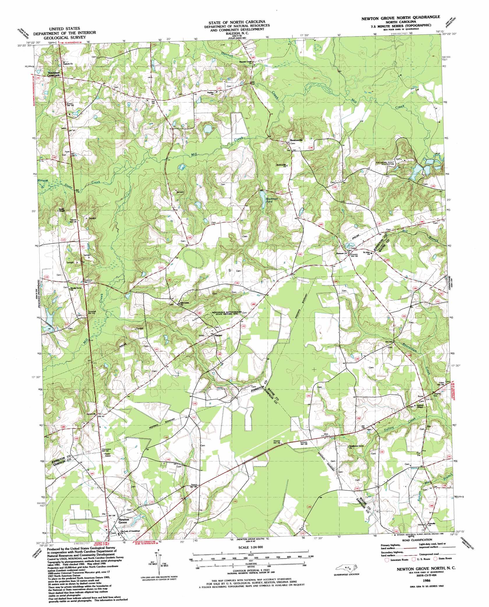
USGS Topo Quad 35078c3 - 1:24,000 scale
| Topo Map Name: | Newton Grove North |
| USGS Topo Quad ID: | 35078c3 |
| Print Size: | ca. 21 1/4" wide x 27" high |
| Southeast Coordinates: | 35.25° N latitude / 78.25° W longitude |
| Map Center Coordinates: | 35.3125° N latitude / 78.3125° W longitude |
| U.S. State: | NC |
| Filename: | o35078c3.jpg |
| Download Map JPG Image: | Newton Grove North topo map 1:24,000 scale |
| Map Type: | Topographic |
| Topo Series: | 7.5´ |
| Map Scale: | 1:24,000 |
| Source of Map Images: | United States Geological Survey (USGS) |
| Alternate Map Versions: |
Newton Grove North NC 1986, updated 1986 Download PDF Buy paper map Newton Grove North NC 1997, updated 2000 Download PDF Buy paper map Newton Grove North NC 2010 Download PDF Buy paper map Newton Grove North NC 2013 Download PDF Buy paper map Newton Grove North NC 2016 Download PDF Buy paper map |
1:24,000 Topo Quads surrounding Newton Grove North
Edmondson |
Powhatan |
Selma |
Kenly West |
Kenly East |
Benson |
Four Oaks |
Four Oaks Ne |
Princeton |
Northwest Goldsboro |
Dunn |
Peacocks Crossroads |
Newton Grove North |
Grantham |
Southwest Goldsboro |
Mingo |
Timothy |
Newton Grove South |
Dobbersville |
Mount Olive |
Salemburg |
Bearskin |
Clinton North |
Faison |
Warsaw North |
> Back to 35078a1 at 1:100,000 scale
> Back to 35078a1 at 1:250,000 scale
> Back to U.S. Topo Maps home
Newton Grove North topo map: Gazetteer
Newton Grove North: Dams
Rose Pond Dam elevation 45m 147′Newton Grove North: Populated Places
Bentonville elevation 52m 170′Harper elevation 56m 183′
Overshot elevation 52m 170′
Starlight elevation 51m 167′
Strickland Crossroads elevation 44m 144′
Newton Grove North: Post Offices
Bentonsville Beasley Post Office elevation 52m 170′Newton Grove North: Reservoirs
Blackman Pond elevation 36m 118′Rose Pond elevation 45m 147′
Newton Grove North: Streams
Beaverdam Creek elevation 41m 134′Hannah Creek elevation 26m 85′
Saw Pit Branch elevation 26m 85′
Stone Creek elevation 30m 98′
Whiteoak Branch elevation 32m 104′
Newton Grove North digital topo map on disk
Buy this Newton Grove North topo map showing relief, roads, GPS coordinates and other geographical features, as a high-resolution digital map file on DVD:
South Carolina, Western North Carolina & Northeastern Georgia
Buy digital topo maps: South Carolina, Western North Carolina & Northeastern Georgia