Lillington Topo Map North Carolina
To zoom in, hover over the map of Lillington
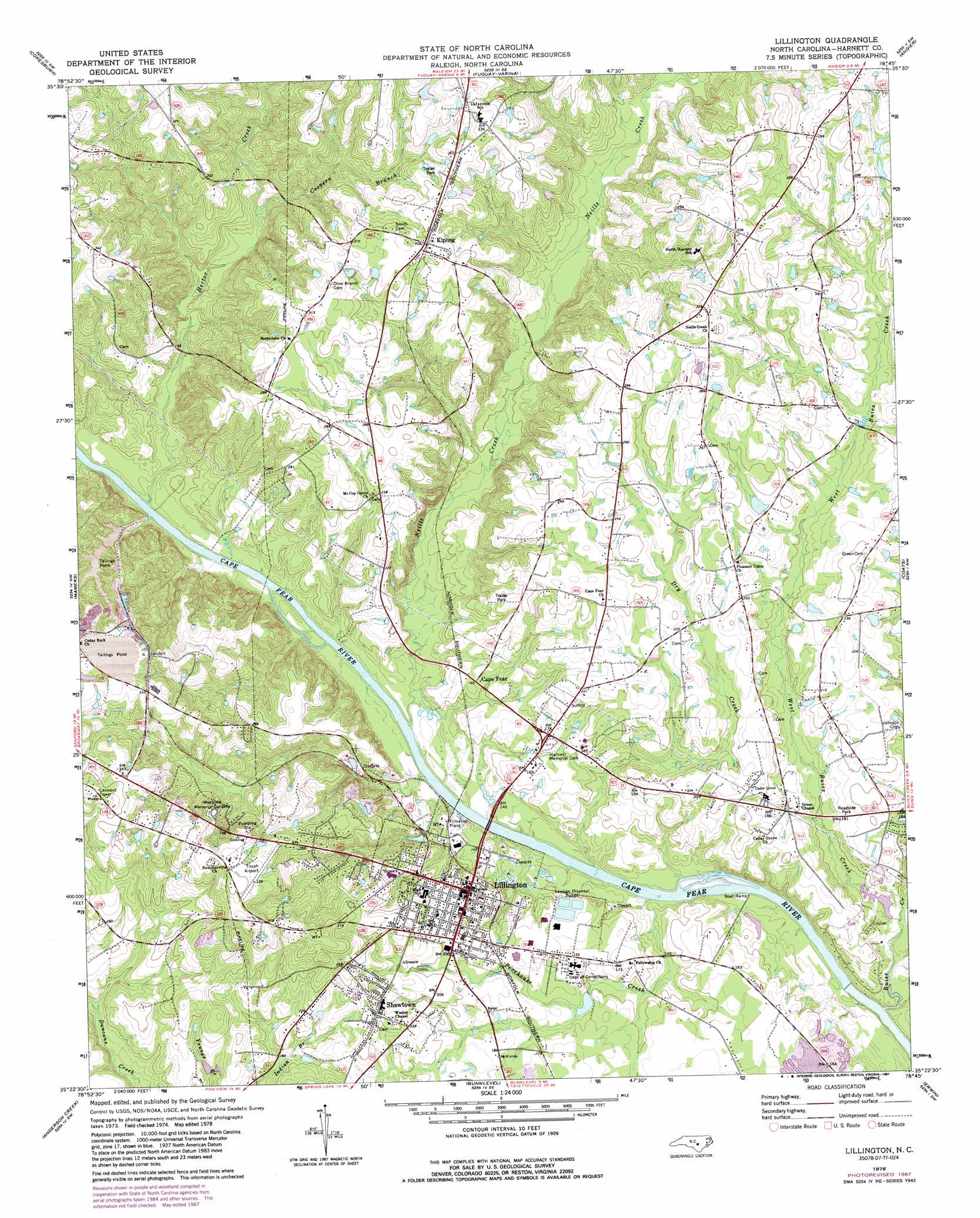
USGS Topo Quad 35078d7 - 1:24,000 scale
| Topo Map Name: | Lillington |
| USGS Topo Quad ID: | 35078d7 |
| Print Size: | ca. 21 1/4" wide x 27" high |
| Southeast Coordinates: | 35.375° N latitude / 78.75° W longitude |
| Map Center Coordinates: | 35.4375° N latitude / 78.8125° W longitude |
| U.S. State: | NC |
| Filename: | o35078d7.jpg |
| Download Map JPG Image: | Lillington topo map 1:24,000 scale |
| Map Type: | Topographic |
| Topo Series: | 7.5´ |
| Map Scale: | 1:24,000 |
| Source of Map Images: | United States Geological Survey (USGS) |
| Alternate Map Versions: |
Lillington NC 1978, updated 1978 Download PDF Buy paper map Lillington NC 1978, updated 1987 Download PDF Buy paper map Lillington NC 1997, updated 2000 Download PDF Buy paper map Lillington NC 2010 Download PDF Buy paper map Lillington NC 2013 Download PDF Buy paper map Lillington NC 2016 Download PDF Buy paper map |
1:24,000 Topo Quads surrounding Lillington
Merry Oaks |
New Hill |
Apex |
Lake Wheeler |
Garner |
Moncure |
Cokesbury |
Fuquay-Varina |
Angier |
Edmondson |
Broadway |
Mamers |
Lillington |
Coats |
Benson |
Olivia |
Anderson Creek |
Bunnlevel |
Erwin |
Dunn |
Overhills |
Manchester |
Slocomb |
Wade |
Mingo |
> Back to 35078a1 at 1:100,000 scale
> Back to 35078a1 at 1:250,000 scale
> Back to U.S. Topo Maps home
Lillington topo map: Gazetteer
Lillington: Airports
Tirzah Airport elevation 94m 308′Lillington: Dams
A J White Dam elevation 48m 157′Lillington: Populated Places
Cape Fear elevation 49m 160′Kipling elevation 93m 305′
Lillington elevation 59m 193′
Shawtown elevation 78m 255′
Lillington: Streams
Buies Creek elevation 33m 108′Coopers Branch elevation 47m 154′
Dry Creek elevation 34m 111′
Fish Creek elevation 40m 131′
Hector Creek elevation 37m 121′
Neills Creek elevation 37m 121′
Poorhouse Creek elevation 36m 118′
West Buies Creek elevation 37m 121′
Lillington digital topo map on disk
Buy this Lillington topo map showing relief, roads, GPS coordinates and other geographical features, as a high-resolution digital map file on DVD:
South Carolina, Western North Carolina & Northeastern Georgia
Buy digital topo maps: South Carolina, Western North Carolina & Northeastern Georgia