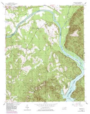
Mangum Topo Map North Carolina
To zoom in, hover over the map of Mangum
USGS Topo Quad 35079a8 - 1:24,000 scale
| Topo Map Name: | Mangum |
| USGS Topo Quad ID: | 35079a8 |
| Print Size: | ca. 21 1/4" wide x 27" high |
| Southeast Coordinates: | 35° N latitude / 79.875° W longitude |
| Map Center Coordinates: | 35.0625° N latitude / 79.9375° W longitude |
| U.S. State: | NC |
| Filename: | o35079a8.jpg |
| Download Map JPG Image: | Mangum topo map 1:24,000 scale |
| Map Type: | Topographic |
| Topo Series: | 7.5´ |
| Map Scale: | 1:24,000 |
| Source of Map Images: | United States Geological Survey (USGS) |
| Alternate Map Versions: |
Mangum NC 1956, updated 1957 Download PDF Buy paper map Mangum NC 1956, updated 1976 Download PDF Buy paper map Mangum NC 1956, updated 1983 Download PDF Buy paper map Mangum NC 1976, updated 1978 Download PDF Buy paper map Mangum NC 2002, updated 2002 Download PDF Buy paper map Mangum NC 2010 Download PDF Buy paper map Mangum NC 2013 Download PDF Buy paper map Mangum NC 2016 Download PDF Buy paper map |
1:24,000 Topo Quads surrounding Mangum
> Back to 35079a1 at 1:100,000 scale
> Back to 35078a1 at 1:250,000 scale
> Back to U.S. Topo Maps home
Mangum topo map: Gazetteer
Mangum: Bays
Bell Pond elevation 53m 173′Petty Gulf elevation 53m 173′
Mangum: Islands
Grassy Islands elevation 53m 173′Mangum: Populated Places
Ingram elevation 68m 223′Lookout (historical) elevation 161m 528′
Mangum elevation 87m 285′
Pee Dee (historical) elevation 99m 324′
Mangum: Streams
Big Mountain Creek elevation 53m 173′Buffalo Creek elevation 53m 173′
Buffalo Creek elevation 57m 187′
Cedar Creek elevation 55m 180′
Colemans Creek elevation 53m 173′
Dry Creek elevation 60m 196′
Jenkins Branch elevation 53m 173′
Little River elevation 54m 177′
Naked Creek elevation 53m 173′
Reeder Branch elevation 53m 173′
Savannah Creek elevation 57m 187′
Slink Branch elevation 58m 190′
Turkey Top Creek elevation 55m 180′
Mangum: Summits
Ingram Mountain elevation 161m 528′Mangum digital topo map on disk
Buy this Mangum topo map showing relief, roads, GPS coordinates and other geographical features, as a high-resolution digital map file on DVD:
South Carolina, Western North Carolina & Northeastern Georgia
Buy digital topo maps: South Carolina, Western North Carolina & Northeastern Georgia


