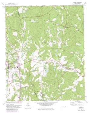
Candor Topo Map North Carolina
To zoom in, hover over the map of Candor
USGS Topo Quad 35079c6 - 1:24,000 scale
| Topo Map Name: | Candor |
| USGS Topo Quad ID: | 35079c6 |
| Print Size: | ca. 21 1/4" wide x 27" high |
| Southeast Coordinates: | 35.25° N latitude / 79.625° W longitude |
| Map Center Coordinates: | 35.3125° N latitude / 79.6875° W longitude |
| U.S. State: | NC |
| Filename: | o35079c6.jpg |
| Download Map JPG Image: | Candor topo map 1:24,000 scale |
| Map Type: | Topographic |
| Topo Series: | 7.5´ |
| Map Scale: | 1:24,000 |
| Source of Map Images: | United States Geological Survey (USGS) |
| Alternate Map Versions: |
Candor NC 1974, updated 1977 Download PDF Buy paper map Candor NC 1974, updated 1982 Download PDF Buy paper map Candor NC 1994, updated 1998 Download PDF Buy paper map Candor NC 2011 Download PDF Buy paper map Candor NC 2013 Download PDF Buy paper map Candor NC 2016 Download PDF Buy paper map |
| FStopo: | US Forest Service topo Candor is available: Download FStopo PDF Download FStopo TIF |
1:24,000 Topo Quads surrounding Candor
> Back to 35079a1 at 1:100,000 scale
> Back to 35078a1 at 1:250,000 scale
> Back to U.S. Topo Maps home
Candor topo map: Gazetteer
Candor: Dams
Archie McDuffie Dam elevation 197m 646′Arthur Williams and Son Number One Dam elevation 192m 629′
Arthur Williams and Son Number Two Dam elevation 193m 633′
Arthur Williams and Sons Dam Number Three elevation 190m 623′
Arthur Williams Dam elevation 189m 620′
Arthur Williams Dam Number Two elevation 199m 652′
Baldwin Pond Dam elevation 209m 685′
Bengston Lake Dam Number Three elevation 189m 620′
Candor City Reservoir Dam elevation 172m 564′
Cunningham Lake Dam elevation 199m 652′
Ed Harris Dam elevation 200m 656′
Ed Harris Dam Number One elevation 220m 721′
Ed Harris Dam Number Two elevation 200m 656′
Ewing Lake Dam elevation 199m 652′
Jordan Pond Dam elevation 195m 639′
McCauley Pond Dam elevation 210m 688′
Phillip Benston Dam Number Four elevation 186m 610′
Upper Pompelli Lake Dam elevation 208m 682′
V W Burkhead Dam Number One elevation 190m 623′
V W Burkhead Dam Number Two elevation 210m 688′
W T Lewis Dam elevation 196m 643′
Candor: Populated Places
Candor elevation 224m 734′Eagle Springs elevation 204m 669′
Elberta elevation 201m 659′
Samarcand elevation 213m 698′
Candor: Reservoirs
Baldwin Pond elevation 209m 685′Candor City Reservoir elevation 172m 564′
Cunningham Lake elevation 199m 652′
Ewing Lake elevation 199m 652′
Jordan Pond elevation 195m 639′
McCauley Pond elevation 210m 688′
Noname elevation 210m 688′
Noname elevation 190m 623′
Upper Pompelli Lake elevation 208m 682′
Candor: Streams
Sings Creek elevation 132m 433′Candor digital topo map on disk
Buy this Candor topo map showing relief, roads, GPS coordinates and other geographical features, as a high-resolution digital map file on DVD:
South Carolina, Western North Carolina & Northeastern Georgia
Buy digital topo maps: South Carolina, Western North Carolina & Northeastern Georgia


