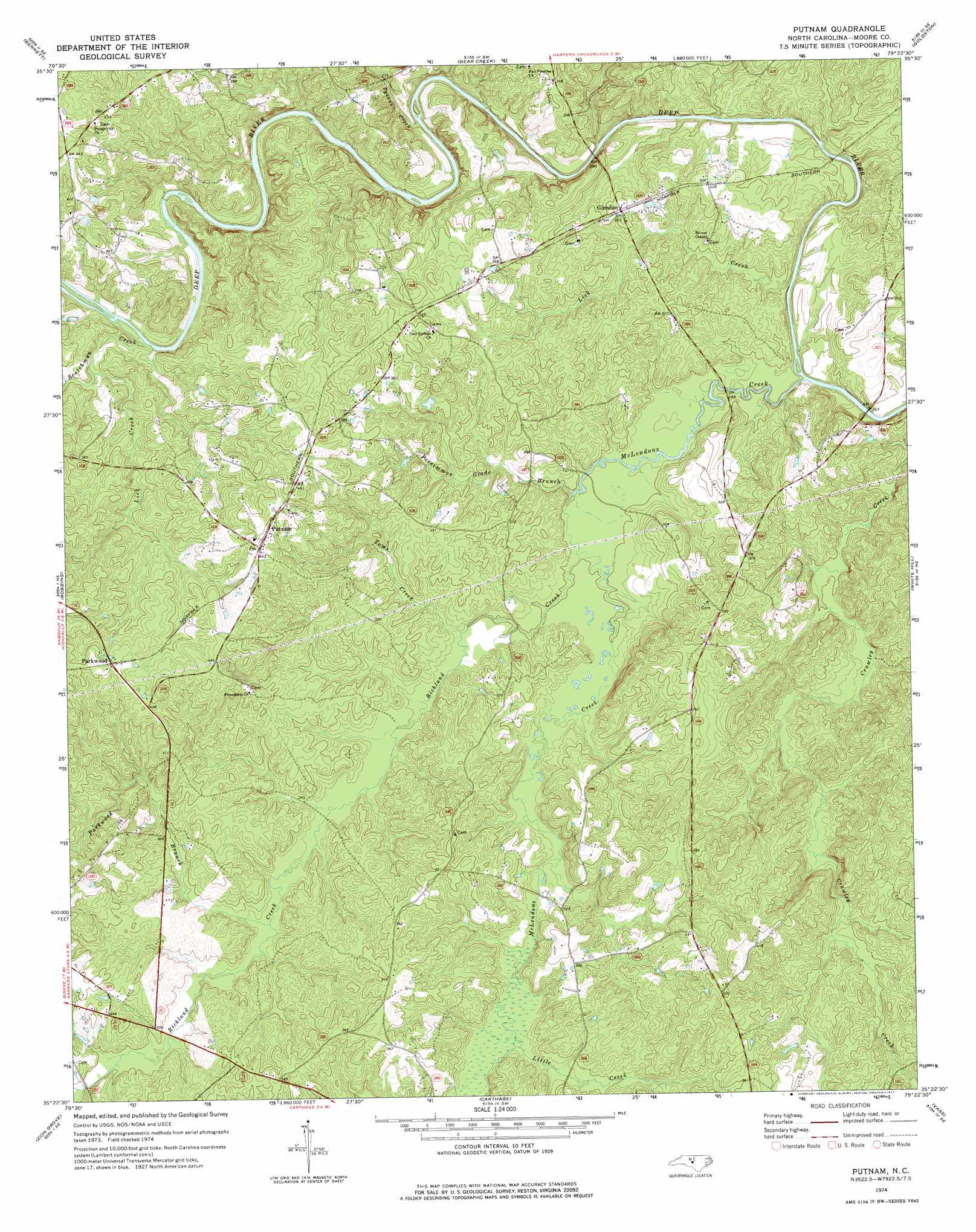
Putnam Topo Map North Carolina
To zoom in, hover over the map of Putnam
USGS Topo Quad 35079d4 - 1:24,000 scale
| Topo Map Name: | Putnam |
| USGS Topo Quad ID: | 35079d4 |
| Print Size: | ca. 21 1/4" wide x 27" high |
| Southeast Coordinates: | 35.375° N latitude / 79.375° W longitude |
| Map Center Coordinates: | 35.4375° N latitude / 79.4375° W longitude |
| U.S. State: | NC |
| Filename: | o35079d4.jpg |
| Download Map JPG Image: | Putnam topo map 1:24,000 scale |
| Map Type: | Topographic |
| Topo Series: | 7.5´ |
| Map Scale: | 1:24,000 |
| Source of Map Images: | United States Geological Survey (USGS) |
| Alternate Map Versions: |
Putnam NC 1974, updated 1977 Download PDF Buy paper map Putnam NC 2010 Download PDF Buy paper map Putnam NC 2013 Download PDF Buy paper map Putnam NC 2016 Download PDF Buy paper map |
1:24,000 Topo Quads surrounding Putnam
Ramseur |
Coleridge |
Siler City |
Siler City Ne |
Pittsboro |
Erect |
Bennett |
Bear Creek |
Goldston |
Colon |
Spies |
Robbins |
Putnam |
White Hill |
Sanford |
Candor |
Zion Grove |
Carthage |
Vass |
Murchisontown |
Norman |
West End |
Southern Pines |
Niagara |
Lobelia |
> Back to 35079a1 at 1:100,000 scale
> Back to 35078a1 at 1:250,000 scale
> Back to U.S. Topo Maps home
Putnam topo map: Gazetteer
Putnam: Populated Places
Glendon elevation 93m 305′Parkwood elevation 134m 439′
Putnam elevation 138m 452′
Putnam: Streams
Lick Creek elevation 76m 249′Lick Creek elevation 83m 272′
Little Creek elevation 83m 272′
McLendons Creek elevation 73m 239′
Parkwood Branch elevation 83m 272′
Persimmon Glade Branch elevation 75m 246′
Richland Creek elevation 75m 246′
Scotchman Creek elevation 77m 252′
Toms Creek elevation 77m 252′
Tysons Creek elevation 72m 236′
Putnam digital topo map on disk
Buy this Putnam topo map showing relief, roads, GPS coordinates and other geographical features, as a high-resolution digital map file on DVD:
South Carolina, Western North Carolina & Northeastern Georgia
Buy digital topo maps: South Carolina, Western North Carolina & Northeastern Georgia