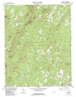
Lovejoy Topo Map North Carolina
To zoom in, hover over the map of Lovejoy
USGS Topo Quad 35079d8 - 1:24,000 scale
| Topo Map Name: | Lovejoy |
| USGS Topo Quad ID: | 35079d8 |
| Print Size: | ca. 21 1/4" wide x 27" high |
| Southeast Coordinates: | 35.375° N latitude / 79.875° W longitude |
| Map Center Coordinates: | 35.4375° N latitude / 79.9375° W longitude |
| U.S. State: | NC |
| Filename: | o35079d8.jpg |
| Download Map JPG Image: | Lovejoy topo map 1:24,000 scale |
| Map Type: | Topographic |
| Topo Series: | 7.5´ |
| Map Scale: | 1:24,000 |
| Source of Map Images: | United States Geological Survey (USGS) |
| Alternate Map Versions: |
Lovejoy NC 1983, updated 1983 Download PDF Buy paper map Lovejoy NC 1994, updated 1996 Download PDF Buy paper map Lovejoy NC 2011 Download PDF Buy paper map Lovejoy NC 2013 Download PDF Buy paper map Lovejoy NC 2016 Download PDF Buy paper map |
| FStopo: | US Forest Service topo Lovejoy is available: Download FStopo PDF Download FStopo TIF |
1:24,000 Topo Quads surrounding Lovejoy
> Back to 35079a1 at 1:100,000 scale
> Back to 35078a1 at 1:250,000 scale
> Back to U.S. Topo Maps home
Lovejoy topo map: Gazetteer
Lovejoy: Dams
Hewitt Pond Dam elevation 185m 606′McNair Lake Dam elevation 245m 803′
Lovejoy: Forests
Uwharrie National Forest elevation 219m 718′Lovejoy: Populated Places
Abner elevation 230m 754′Flint Hill elevation 202m 662′
Immer elevation 198m 649′
Lovejoy elevation 220m 721′
Ophir elevation 158m 518′
Refuge Mission elevation 223m 731′
Shiloh (historical) elevation 186m 610′
Lovejoy: Reservoirs
Hewitt Pond elevation 185m 606′McNair Lake elevation 245m 803′
Lovejoy: Streams
Arnett Branch elevation 153m 501′Bishop Creek elevation 147m 482′
Bud Cagle Branch elevation 173m 567′
Cattail Creek elevation 118m 387′
Dumas Creek elevation 140m 459′
Flat Rock Branch elevation 176m 577′
Haystack Branch elevation 170m 557′
Hogpen Branch elevation 102m 334′
Little Dumas Creek elevation 167m 547′
Mile Branch elevation 229m 751′
Panther Branch elevation 113m 370′
Peggy Mountain Branch elevation 174m 570′
Poison Fork elevation 139m 456′
Sand Branch elevation 151m 495′
Still Branch elevation 158m 518′
Lovejoy: Summits
Abner Mountain elevation 263m 862′Buck Mountain elevation 254m 833′
Bunnel Mountain elevation 185m 606′
Cottonstone Mountain elevation 253m 830′
Dark Mountain elevation 285m 935′
Flint Hill elevation 275m 902′
Horse Mountain elevation 259m 849′
Jenny Wright Mountain elevation 270m 885′
Joe Mountain elevation 233m 764′
Long Mountain elevation 263m 862′
Millstone Mountain elevation 201m 659′
Morris Mountain elevation 246m 807′
Round Mountain elevation 228m 748′
Wysner Mountain elevation 280m 918′
Lovejoy: Trails
Uwharrie Jeep Trail elevation 199m 652′Lovejoy digital topo map on disk
Buy this Lovejoy topo map showing relief, roads, GPS coordinates and other geographical features, as a high-resolution digital map file on DVD:
South Carolina, Western North Carolina & Northeastern Georgia
Buy digital topo maps: South Carolina, Western North Carolina & Northeastern Georgia


