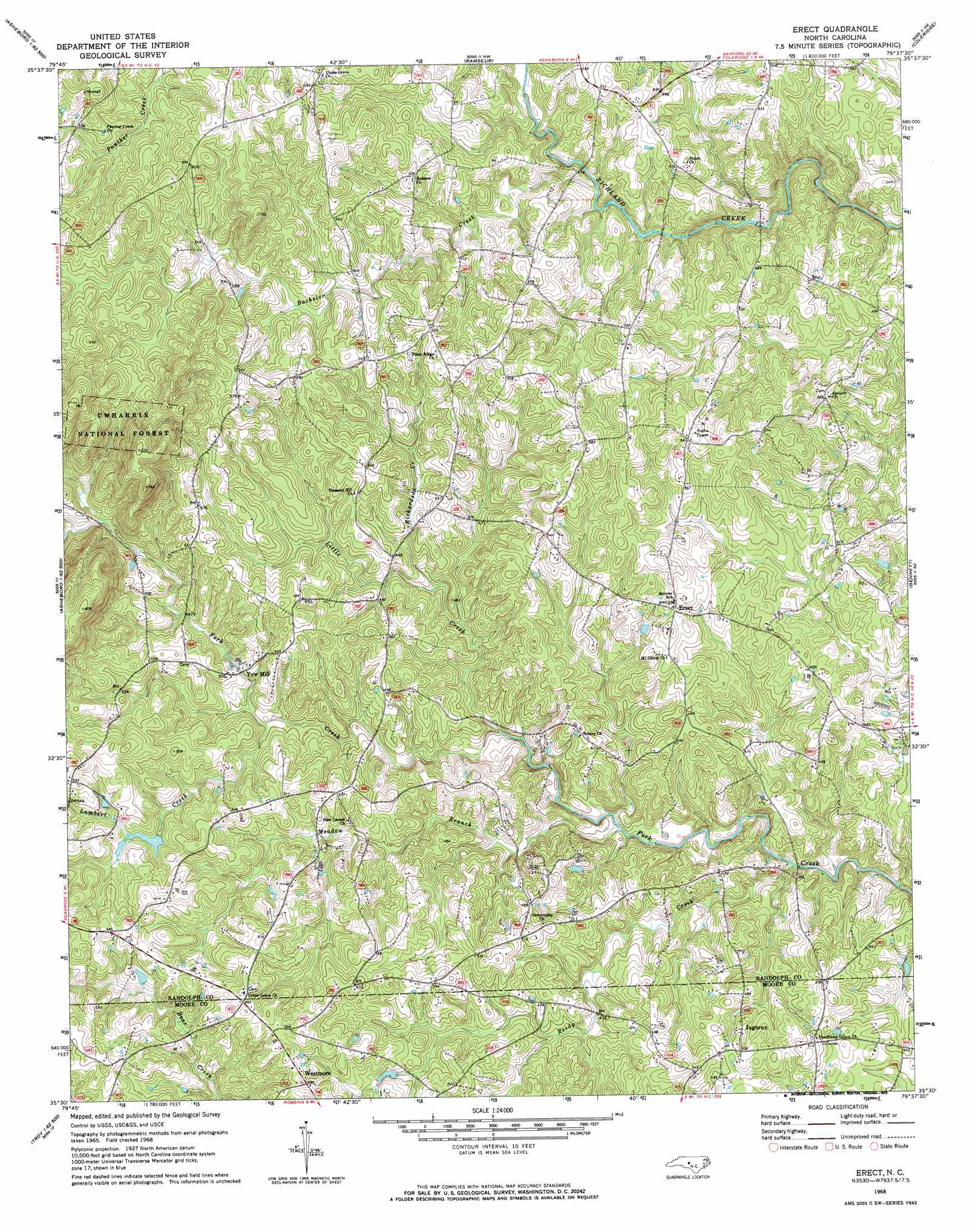
Erect Topo Map North Carolina
To zoom in, hover over the map of Erect
USGS Topo Quad 35079e6 - 1:24,000 scale
| Topo Map Name: | Erect |
| USGS Topo Quad ID: | 35079e6 |
| Print Size: | ca. 21 1/4" wide x 27" high |
| Southeast Coordinates: | 35.5° N latitude / 79.625° W longitude |
| Map Center Coordinates: | 35.5625° N latitude / 79.6875° W longitude |
| U.S. State: | NC |
| Filename: | o35079e6.jpg |
| Download Map JPG Image: | Erect topo map 1:24,000 scale |
| Map Type: | Topographic |
| Topo Series: | 7.5´ |
| Map Scale: | 1:24,000 |
| Source of Map Images: | United States Geological Survey (USGS) |
| Alternate Map Versions: |
Erect NC 1968, updated 1973 Download PDF Buy paper map Erect NC 1994, updated 1998 Download PDF Buy paper map Erect NC 2011 Download PDF Buy paper map Erect NC 2013 Download PDF Buy paper map Erect NC 2016 Download PDF Buy paper map |
| FStopo: | US Forest Service topo Erect is available: Download FStopo PDF Download FStopo TIF |
1:24,000 Topo Quads surrounding Erect
Glenola |
Randleman |
Grays Chapel |
Liberty |
Crutchfield Crossroads |
Farmer |
Asheboro |
Ramseur |
Coleridge |
Siler City |
Eleazer |
Seagrove |
Erect |
Bennett |
Bear Creek |
Lovejoy |
Star |
Spies |
Robbins |
Putnam |
Troy |
Biscoe |
Candor |
Zion Grove |
Carthage |
> Back to 35079e1 at 1:100,000 scale
> Back to 35078a1 at 1:250,000 scale
> Back to U.S. Topo Maps home
Erect topo map: Gazetteer
Erect: Dams
Goss Lake Dam elevation 157m 515′Lambert Mill Dam elevation 155m 508′
Erect: Populated Places
Jugtown elevation 149m 488′Westmore elevation 177m 580′
Yow Mill elevation 148m 485′
Erect: Reservoirs
Goss Lake elevation 157m 515′Lambert Mill Dam elevation 155m 508′
Erect: Streams
Bachelor Creek elevation 137m 449′Lambert Creek elevation 138m 452′
Little Creek elevation 125m 410′
Meadow Branch elevation 118m 387′
Reedy Creek elevation 112m 367′
Richardson Creek elevation 136m 446′
Erect: Summits
Pond Mountain elevation 230m 754′Erect digital topo map on disk
Buy this Erect topo map showing relief, roads, GPS coordinates and other geographical features, as a high-resolution digital map file on DVD:
South Carolina, Western North Carolina & Northeastern Georgia
Buy digital topo maps: South Carolina, Western North Carolina & Northeastern Georgia