Ramseur Topo Map North Carolina
To zoom in, hover over the map of Ramseur
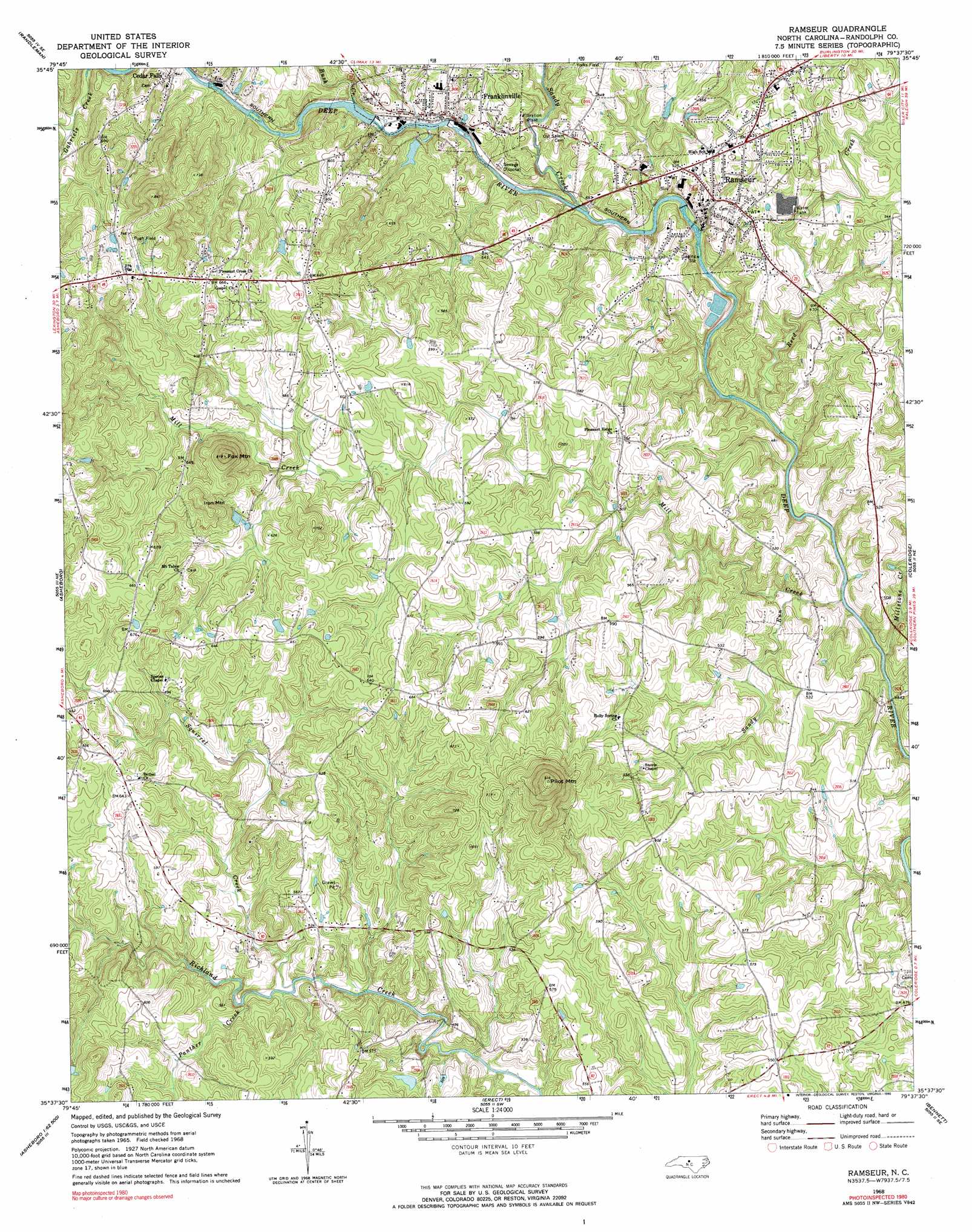
USGS Topo Quad 35079f6 - 1:24,000 scale
| Topo Map Name: | Ramseur |
| USGS Topo Quad ID: | 35079f6 |
| Print Size: | ca. 21 1/4" wide x 27" high |
| Southeast Coordinates: | 35.625° N latitude / 79.625° W longitude |
| Map Center Coordinates: | 35.6875° N latitude / 79.6875° W longitude |
| U.S. State: | NC |
| Filename: | o35079f6.jpg |
| Download Map JPG Image: | Ramseur topo map 1:24,000 scale |
| Map Type: | Topographic |
| Topo Series: | 7.5´ |
| Map Scale: | 1:24,000 |
| Source of Map Images: | United States Geological Survey (USGS) |
| Alternate Map Versions: |
Ramseur NC 1968, updated 1973 Download PDF Buy paper map Ramseur NC 1968, updated 1990 Download PDF Buy paper map Ramseur NC 2010 Download PDF Buy paper map Ramseur NC 2013 Download PDF Buy paper map Ramseur NC 2016 Download PDF Buy paper map |
1:24,000 Topo Quads surrounding Ramseur
High Point East |
Pleasant Garden |
Climax |
Kimesville |
Snow Camp |
Glenola |
Randleman |
Grays Chapel |
Liberty |
Crutchfield Crossroads |
Farmer |
Asheboro |
Ramseur |
Coleridge |
Siler City |
Eleazer |
Seagrove |
Erect |
Bennett |
Bear Creek |
Lovejoy |
Star |
Spies |
Robbins |
Putnam |
> Back to 35079e1 at 1:100,000 scale
> Back to 35078a1 at 1:250,000 scale
> Back to U.S. Topo Maps home
Ramseur topo map: Gazetteer
Ramseur: Airports
Pugh Field elevation 195m 639′Ramseur: Dams
Carter Lake Dam elevation 188m 616′Ramseur Lake Dam elevation 140m 459′
Randolph Mill Dam elevation 144m 472′
Ramseur: Parks
Allen H Leonard Memorial Park elevation 145m 475′Ramseur: Populated Places
Franklinville elevation 143m 469′Ramseur elevation 148m 485′
Ramseur: Reservoirs
Carter Lake elevation 188m 616′Ramseur Lake elevation 140m 459′
Randolph Mill Lake elevation 144m 472′
Ramseur: Streams
Bush Creek elevation 148m 485′Mill Creek elevation 125m 410′
Millstone Creek elevation 130m 426′
Panther Creek elevation 150m 492′
Reed Creek elevation 125m 410′
Sandy Creek elevation 135m 442′
Sandy Run elevation 131m 429′
Squirrel Creek elevation 147m 482′
Ramseur: Summits
Fox Mountain elevation 224m 734′Iron Mountain elevation 228m 748′
Pilot Mountain elevation 278m 912′
Ramseur digital topo map on disk
Buy this Ramseur topo map showing relief, roads, GPS coordinates and other geographical features, as a high-resolution digital map file on DVD:
South Carolina, Western North Carolina & Northeastern Georgia
Buy digital topo maps: South Carolina, Western North Carolina & Northeastern Georgia