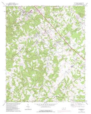
Matthews Topo Map North Carolina
To zoom in, hover over the map of Matthews
USGS Topo Quad 35080a6 - 1:24,000 scale
| Topo Map Name: | Matthews |
| USGS Topo Quad ID: | 35080a6 |
| Print Size: | ca. 21 1/4" wide x 27" high |
| Southeast Coordinates: | 35° N latitude / 80.625° W longitude |
| Map Center Coordinates: | 35.0625° N latitude / 80.6875° W longitude |
| U.S. State: | NC |
| Filename: | o35080a6.jpg |
| Download Map JPG Image: | Matthews topo map 1:24,000 scale |
| Map Type: | Topographic |
| Topo Series: | 7.5´ |
| Map Scale: | 1:24,000 |
| Source of Map Images: | United States Geological Survey (USGS) |
| Alternate Map Versions: |
Matthews NC 1971, updated 1973 Download PDF Buy paper map Matthews NC 1971, updated 1981 Download PDF Buy paper map Matthews NC 1971, updated 1988 Download PDF Buy paper map Matthews NC 2010 Download PDF Buy paper map Matthews NC 2013 Download PDF Buy paper map Matthews NC 2016 Download PDF Buy paper map |
1:24,000 Topo Quads surrounding Matthews
> Back to 35080a1 at 1:100,000 scale
> Back to 35080a1 at 1:250,000 scale
> Back to U.S. Topo Maps home
Matthews topo map: Gazetteer
Matthews: Dams
Charlotte Plastics Lake Dam Number Two elevation 195m 639′Matthews: Parks
Goodman Park elevation 209m 685′Matthews: Populated Places
Club View Acres elevation 221m 725′Fox Run elevation 187m 613′
Gatewood elevation 207m 679′
Hemby Bridge elevation 194m 636′
Hoods (historical) elevation 212m 695′
Indian Trail elevation 213m 698′
Lake Park elevation 200m 656′
Matthews elevation 222m 728′
Matthews Park elevation 233m 764′
Providence (historical) elevation 206m 675′
Providence Woods elevation 218m 715′
Rain Forest elevation 212m 695′
Southminister Woods elevation 214m 702′
Stallings elevation 228m 748′
Stouts elevation 199m 652′
Water Oak elevation 198m 649′
Wellington Woods elevation 202m 662′
Wesley Chapel elevation 186m 610′
White Oak elevation 213m 698′
Matthews: Reservoirs
Charlotte Plastics Lake Number Two elevation 195m 639′Matthews: Streams
Davis Mine Creek elevation 179m 587′Matthews: Summits
Red Hill elevation 213m 698′Matthews digital topo map on disk
Buy this Matthews topo map showing relief, roads, GPS coordinates and other geographical features, as a high-resolution digital map file on DVD:
South Carolina, Western North Carolina & Northeastern Georgia
Buy digital topo maps: South Carolina, Western North Carolina & Northeastern Georgia


