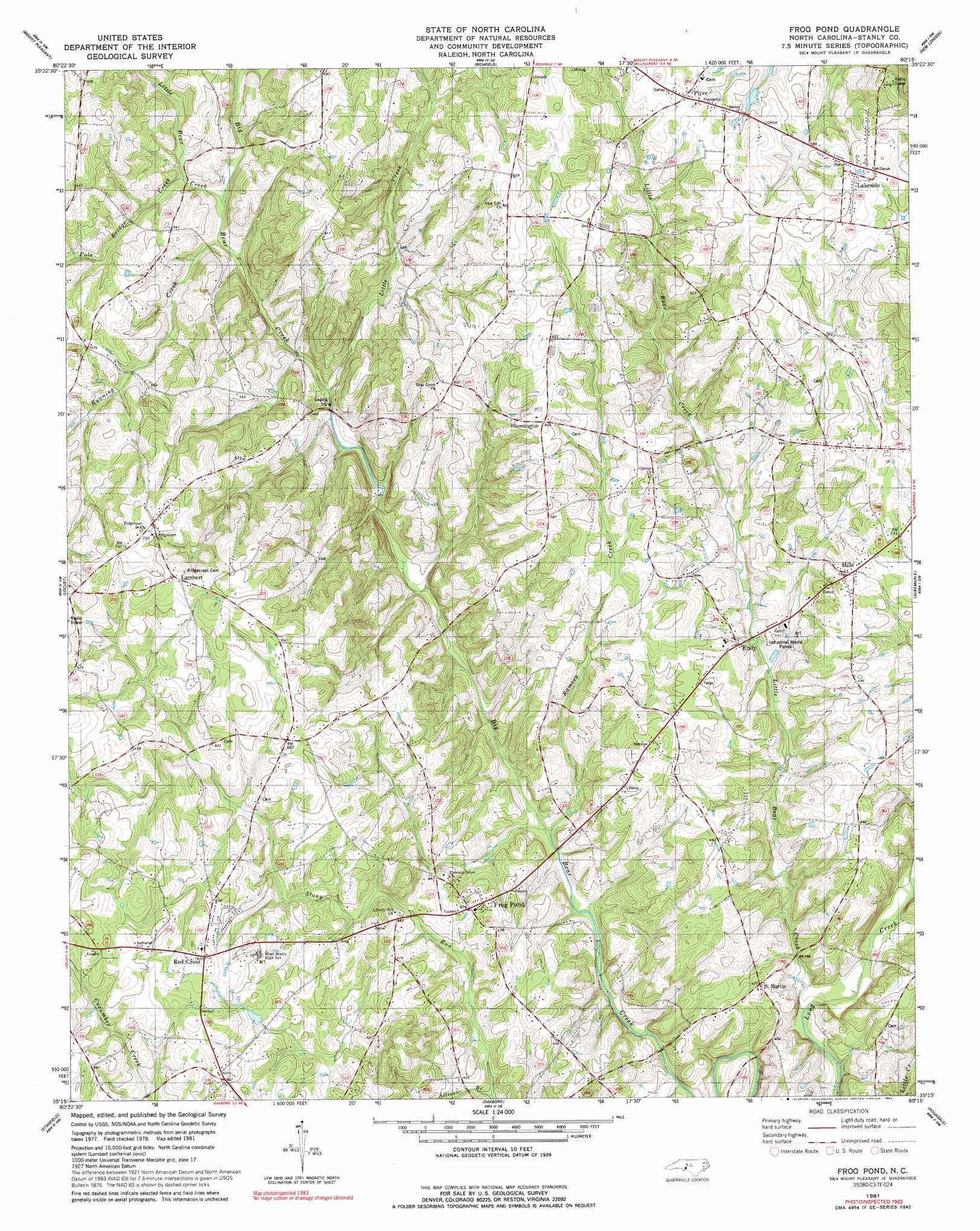
Frog Pond Topo Map North Carolina
To zoom in, hover over the map of Frog Pond
USGS Topo Quad 35080c3 - 1:24,000 scale
| Topo Map Name: | Frog Pond |
| USGS Topo Quad ID: | 35080c3 |
| Print Size: | ca. 21 1/4" wide x 27" high |
| Southeast Coordinates: | 35.25° N latitude / 80.25° W longitude |
| Map Center Coordinates: | 35.3125° N latitude / 80.3125° W longitude |
| U.S. State: | NC |
| Filename: | o35080c3.jpg |
| Download Map JPG Image: | Frog Pond topo map 1:24,000 scale |
| Map Type: | Topographic |
| Topo Series: | 7.5´ |
| Map Scale: | 1:24,000 |
| Source of Map Images: | United States Geological Survey (USGS) |
| Alternate Map Versions: |
Frog Pond NC 1981, updated 1981 Download PDF Buy paper map Frog Pond NC 1981, updated 1992 Download PDF Buy paper map Frog Pond NC 2002, updated 2003 Download PDF Buy paper map Frog Pond NC 2010 Download PDF Buy paper map Frog Pond NC 2013 Download PDF Buy paper map Frog Pond NC 2016 Download PDF Buy paper map |
1:24,000 Topo Quads surrounding Frog Pond
China Grove |
Rockwell |
Gold Hill |
High Rock |
Handy |
Concord |
Mount Pleasant |
Richfield |
New London |
Badin |
Concord Se |
Locust |
Frog Pond |
Albemarle |
Morrow Mountain |
Midland |
Stanfield |
Oakboro |
Aquadale |
Mount Gilead West |
Bakers |
Watson |
Olive Branch |
Polkton |
Ansonville |
> Back to 35080a1 at 1:100,000 scale
> Back to 35080a1 at 1:250,000 scale
> Back to U.S. Topo Maps home
Frog Pond topo map: Gazetteer
Frog Pond: Populated Places
Bloomington elevation 188m 616′Endy elevation 135m 442′
Frog Pond elevation 144m 472′
Hills elevation 160m 524′
Lakeside elevation 196m 643′
Lambert elevation 208m 682′
Plyer elevation 193m 633′
Red Cross elevation 194m 636′
Saint Martin elevation 129m 423′
Frog Pond: Streams
Allison Branch elevation 119m 390′Little Bear Creek elevation 141m 462′
Little Bear Creek elevation 100m 328′
Little Creek elevation 135m 442′
Pole Bridge Creek elevation 144m 472′
Ramsey Creek elevation 114m 374′
Running Creek elevation 147m 482′
Stony Run elevation 100m 328′
Frog Pond digital topo map on disk
Buy this Frog Pond topo map showing relief, roads, GPS coordinates and other geographical features, as a high-resolution digital map file on DVD:
South Carolina, Western North Carolina & Northeastern Georgia
Buy digital topo maps: South Carolina, Western North Carolina & Northeastern Georgia