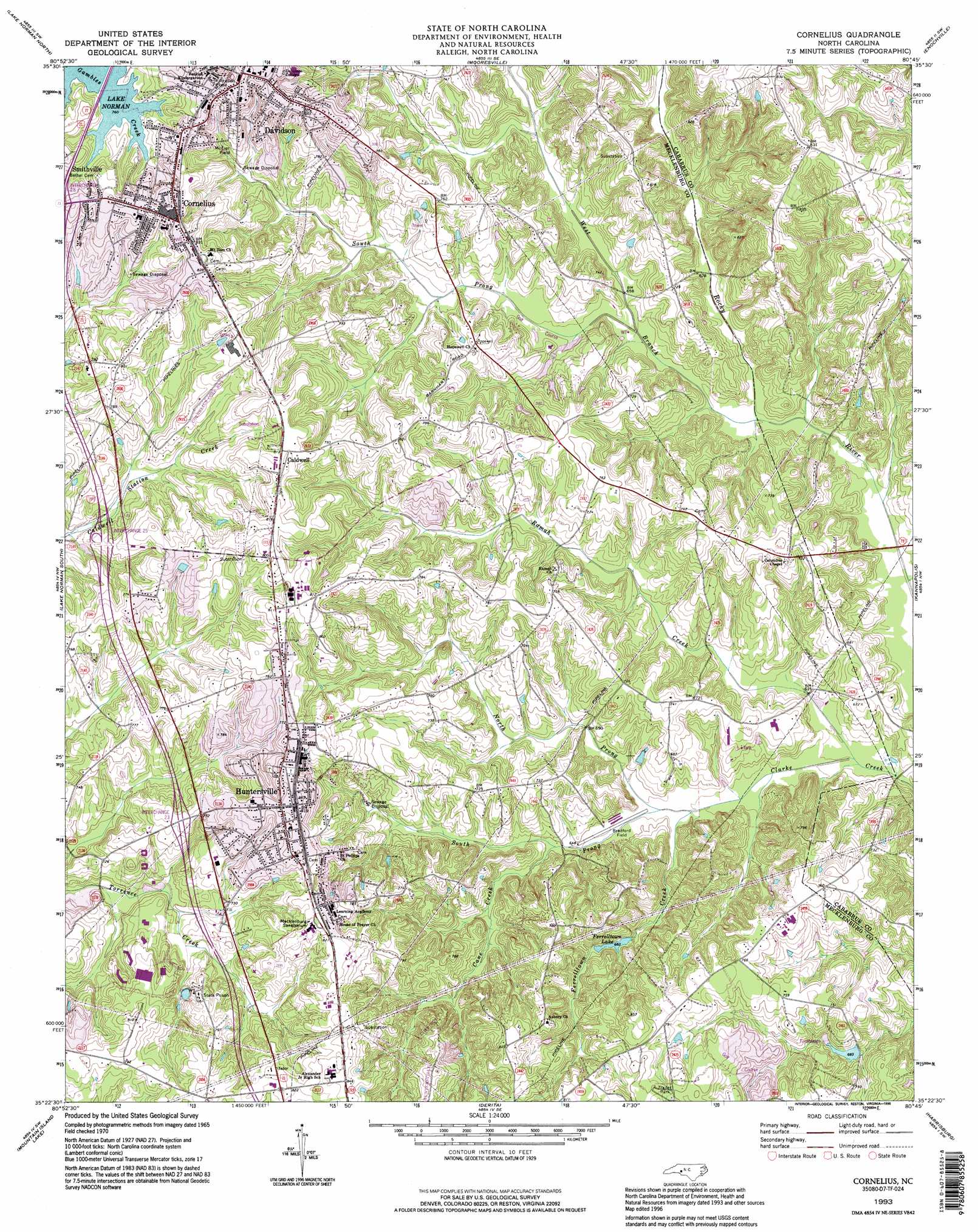
Cornelius Topo Map North Carolina
To zoom in, hover over the map of Cornelius
USGS Topo Quad 35080d7 - 1:24,000 scale
| Topo Map Name: | Cornelius |
| USGS Topo Quad ID: | 35080d7 |
| Print Size: | ca. 21 1/4" wide x 27" high |
| Southeast Coordinates: | 35.375° N latitude / 80.75° W longitude |
| Map Center Coordinates: | 35.4375° N latitude / 80.8125° W longitude |
| U.S. State: | NC |
| Filename: | o35080d7.jpg |
| Download Map JPG Image: | Cornelius topo map 1:24,000 scale |
| Map Type: | Topographic |
| Topo Series: | 7.5´ |
| Map Scale: | 1:24,000 |
| Source of Map Images: | United States Geological Survey (USGS) |
| Alternate Map Versions: |
Cornelius NC 1970, updated 1972 Download PDF Buy paper map Cornelius NC 1970, updated 1989 Download PDF Buy paper map Cornelius NC 1993, updated 1996 Download PDF Buy paper map Cornelius NC 2010 Download PDF Buy paper map Cornelius NC 2013 Download PDF Buy paper map Cornelius NC 2016 Download PDF Buy paper map |
1:24,000 Topo Quads surrounding Cornelius
Catawba |
Troutman |
Shepherds |
Cleveland |
Rowan Mills |
Denver |
Lake Norman North |
Mooresville |
Enochville |
China Grove |
Lowesville |
Lake Norman South |
Cornelius |
Kannapolis |
Concord |
Mount Holly |
Mountain Island Lake |
Derita |
Harrisburg |
Concord Se |
Belmont |
Charlotte West |
Charlotte East |
Mint Hill |
Midland |
> Back to 35080a1 at 1:100,000 scale
> Back to 35080a1 at 1:250,000 scale
> Back to U.S. Topo Maps home
Cornelius topo map: Gazetteer
Cornelius: Airports
Bradford Field elevation 196m 643′Cornelius: Lakes
Barger Lake elevation 218m 715′Dream Lake elevation 232m 761′
MacConnell Lake elevation 215m 705′
Willis Lake elevation 211m 692′
Cornelius: Populated Places
Caldwell elevation 247m 810′Cornelius elevation 239m 784′
Davidson elevation 250m 820′
Hopewell elevation 228m 748′
Huntersville elevation 247m 810′
Oak Lawn (historical) elevation 240m 787′
Smithville elevation 248m 813′
Wallace Store (historical) elevation 229m 751′
Cornelius: Reservoirs
Ferrelltown Lake elevation 209m 685′Cornelius: Streams
Cane Creek elevation 196m 643′Ferrelltown Creek elevation 191m 626′
North Prong Clark Creek elevation 190m 623′
Ramah Creek elevation 187m 613′
South Prong Clark Creek elevation 191m 626′
South Prong West Branch Rocky River elevation 197m 646′
West Branch Rocky River elevation 194m 636′
Cornelius digital topo map on disk
Buy this Cornelius topo map showing relief, roads, GPS coordinates and other geographical features, as a high-resolution digital map file on DVD:
South Carolina, Western North Carolina & Northeastern Georgia
Buy digital topo maps: South Carolina, Western North Carolina & Northeastern Georgia