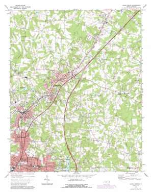
China Grove Topo Map North Carolina
To zoom in, hover over the map of China Grove
USGS Topo Quad 35080e5 - 1:24,000 scale
| Topo Map Name: | China Grove |
| USGS Topo Quad ID: | 35080e5 |
| Print Size: | ca. 21 1/4" wide x 27" high |
| Southeast Coordinates: | 35.5° N latitude / 80.5° W longitude |
| Map Center Coordinates: | 35.5625° N latitude / 80.5625° W longitude |
| U.S. State: | NC |
| Filename: | o35080e5.jpg |
| Download Map JPG Image: | China Grove topo map 1:24,000 scale |
| Map Type: | Topographic |
| Topo Series: | 7.5´ |
| Map Scale: | 1:24,000 |
| Source of Map Images: | United States Geological Survey (USGS) |
| Alternate Map Versions: |
China Grove NC 1970, updated 1972 Download PDF Buy paper map China Grove NC 1970, updated 1987 Download PDF Buy paper map China Grove NC 2010 Download PDF Buy paper map China Grove NC 2013 Download PDF Buy paper map China Grove NC 2016 Download PDF Buy paper map |
1:24,000 Topo Quads surrounding China Grove
> Back to 35080e1 at 1:100,000 scale
> Back to 35080a1 at 1:250,000 scale
> Back to U.S. Topo Maps home
China Grove topo map: Gazetteer
China Grove: Airports
China Grove Airport elevation 257m 843′Mount Girl-Bradley Field elevation 235m 770′
China Grove: Dams
Lake Corrier Dam elevation 236m 774′China Grove: Parks
Corriher Field elevation 263m 862′China Grove: Populated Places
Bostian Heights elevation 254m 833′China Grove elevation 252m 826′
Five Forks elevation 260m 853′
Grimes (historical) elevation 238m 780′
Landis elevation 265m 869′
Lock (historical) elevation 239m 784′
North Kannapolis elevation 259m 849′
Orchard Hills elevation 248m 813′
China Grove: Reservoirs
Lake Corriher elevation 236m 774′China Grove: Streams
Flat Rock Branch elevation 231m 757′China Grove digital topo map on disk
Buy this China Grove topo map showing relief, roads, GPS coordinates and other geographical features, as a high-resolution digital map file on DVD:
South Carolina, Western North Carolina & Northeastern Georgia
Buy digital topo maps: South Carolina, Western North Carolina & Northeastern Georgia


