Welcome Topo Map North Carolina
To zoom in, hover over the map of Welcome
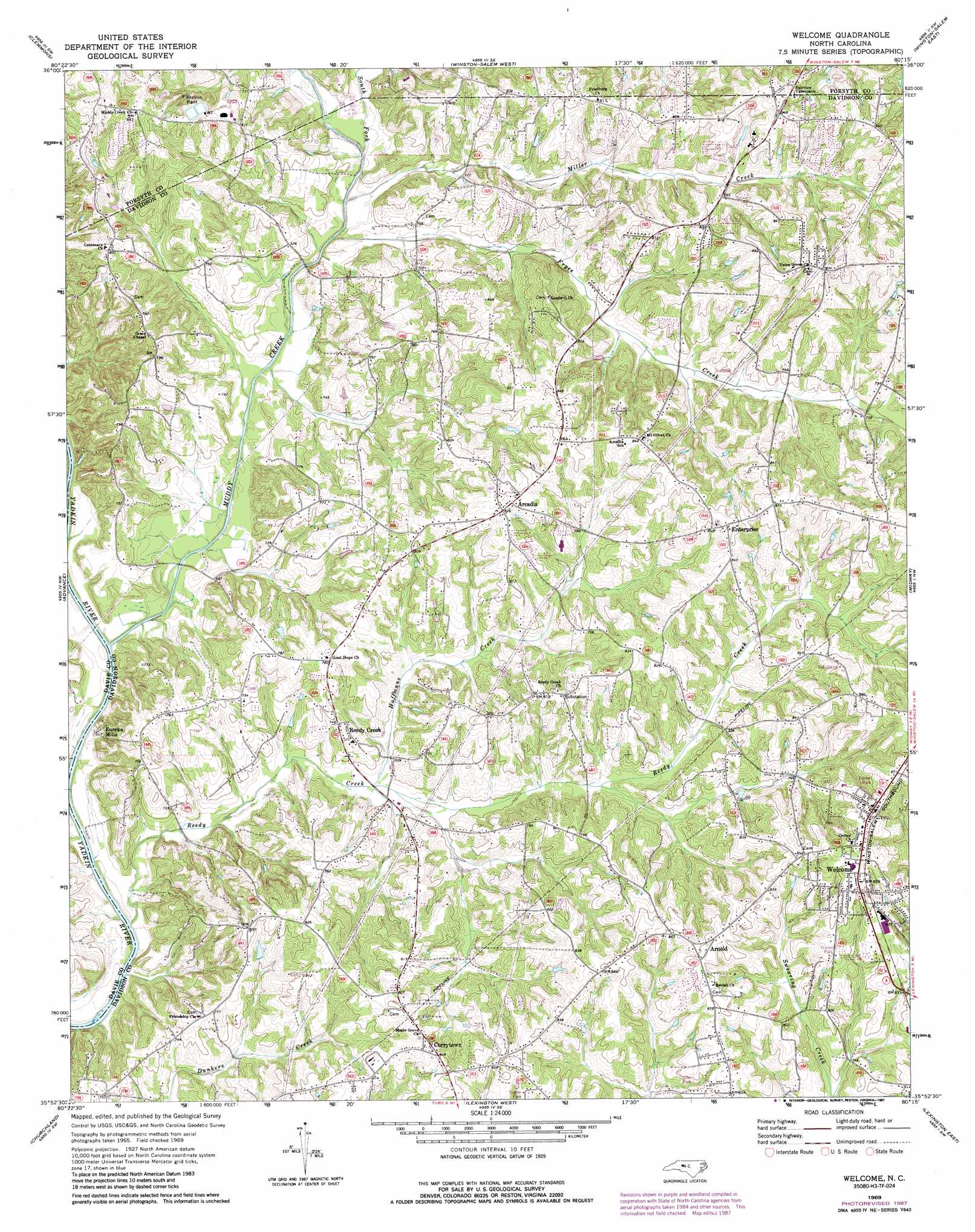
USGS Topo Quad 35080h3 - 1:24,000 scale
| Topo Map Name: | Welcome |
| USGS Topo Quad ID: | 35080h3 |
| Print Size: | ca. 21 1/4" wide x 27" high |
| Southeast Coordinates: | 35.875° N latitude / 80.25° W longitude |
| Map Center Coordinates: | 35.9375° N latitude / 80.3125° W longitude |
| U.S. State: | NC |
| Filename: | o35080h3.jpg |
| Download Map JPG Image: | Welcome topo map 1:24,000 scale |
| Map Type: | Topographic |
| Topo Series: | 7.5´ |
| Map Scale: | 1:24,000 |
| Source of Map Images: | United States Geological Survey (USGS) |
| Alternate Map Versions: |
Welcome NC 1969, updated 1972 Download PDF Buy paper map Welcome NC 1969, updated 1987 Download PDF Buy paper map Welcome NC 2010 Download PDF Buy paper map Welcome NC 2013 Download PDF Buy paper map Welcome NC 2016 Download PDF Buy paper map |
1:24,000 Topo Quads surrounding Welcome
East Bend |
Vienna |
Rural Hall |
Walkertown |
Belews Creek |
Farmington |
Clemmons |
Winston-Salem West |
Winston-Salem East |
Kernersville |
Mocksville |
Advance |
Welcome |
Midway |
High Point West |
Cooleemee |
Churchland |
Lexington West |
Lexington East |
Fair Grove |
Rowan Mills |
Salisbury |
Southmont |
Denton Nw |
Denton |
> Back to 35080e1 at 1:100,000 scale
> Back to 35080a1 at 1:250,000 scale
> Back to U.S. Topo Maps home
Welcome topo map: Gazetteer
Welcome: Populated Places
Arcadia elevation 254m 833′Arnold elevation 258m 846′
Creadmore elevation 217m 711′
Currytown elevation 253m 830′
Enterprise elevation 263m 862′
Eureka Mills elevation 215m 705′
Friedburg elevation 242m 793′
Munroe (historical) elevation 247m 810′
Nestleway Acres elevation 244m 800′
Old Mill elevation 216m 708′
Reedy Creek elevation 227m 744′
Walks (historical) elevation 255m 836′
Welcome elevation 264m 866′
Welcome: Streams
Fryes Creek elevation 208m 682′Huffmans Creek elevation 209m 685′
Miller Creek elevation 206m 675′
Muddy Creek elevation 200m 656′
Reedy Creek elevation 202m 662′
South Fork Muddy Creek elevation 208m 682′
Welcome digital topo map on disk
Buy this Welcome topo map showing relief, roads, GPS coordinates and other geographical features, as a high-resolution digital map file on DVD:
South Carolina, Western North Carolina & Northeastern Georgia
Buy digital topo maps: South Carolina, Western North Carolina & Northeastern Georgia