Fingerville East Topo Map North Carolina
To zoom in, hover over the map of Fingerville East
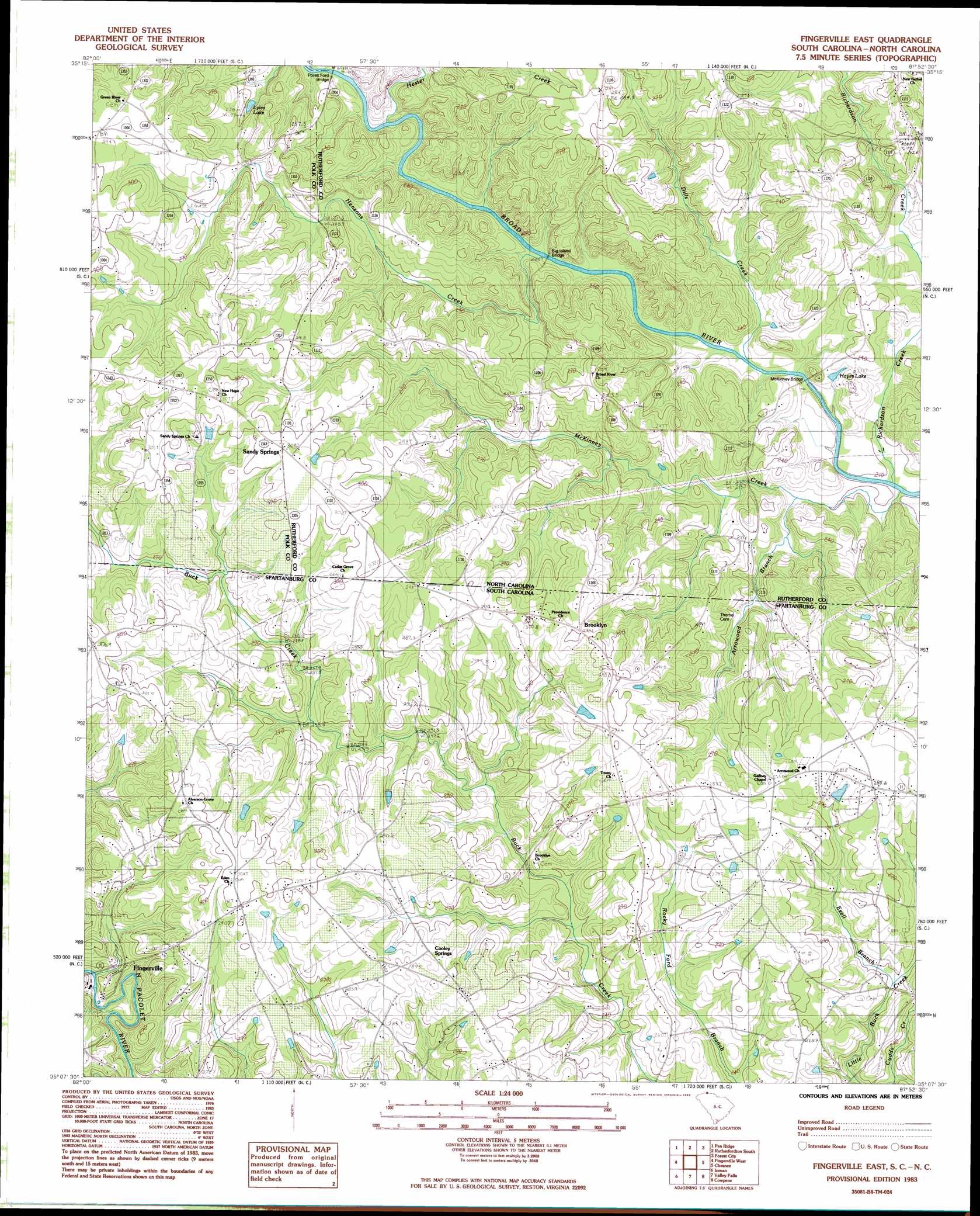
USGS Topo Quad 35081b8 - 1:24,000 scale
| Topo Map Name: | Fingerville East |
| USGS Topo Quad ID: | 35081b8 |
| Print Size: | ca. 21 1/4" wide x 27" high |
| Southeast Coordinates: | 35.125° N latitude / 81.875° W longitude |
| Map Center Coordinates: | 35.1875° N latitude / 81.9375° W longitude |
| U.S. States: | NC, SC |
| Filename: | o35081b8.jpg |
| Download Map JPG Image: | Fingerville East topo map 1:24,000 scale |
| Map Type: | Topographic |
| Topo Series: | 7.5´ |
| Map Scale: | 1:24,000 |
| Source of Map Images: | United States Geological Survey (USGS) |
| Alternate Map Versions: |
Cowpens NW SC 1975, updated 1979 Download PDF Buy paper map Fingerville East SC 1983, updated 1983 Download PDF Buy paper map Fingerville East SC 1993, updated 1996 Download PDF Buy paper map Fingerville East SC 2011 Download PDF Buy paper map Fingerville East SC 2014 Download PDF Buy paper map |
1:24,000 Topo Quads surrounding Fingerville East
Lake Lure |
Shingle Hollow |
Rutherfordton North |
Sunshine |
Polkville |
Mill Spring |
Pea Ridge |
Rutherfordton South |
Forest City |
Boiling Springs North |
Landrum |
Fingerville West |
Fingerville East |
Chesnee |
Boiling Springs South |
Campobello |
Inman |
Valley Falls |
Cowpens |
Gaffney |
Greer |
Wellford |
Spartanburg |
Pacolet |
Pacolet Mills |
> Back to 35081a1 at 1:100,000 scale
> Back to 35080a1 at 1:250,000 scale
> Back to U.S. Topo Maps home
Fingerville East topo map: Gazetteer
Fingerville East: Bridges
Big Island Bridge elevation 213m 698′McKinney Bridge elevation 217m 711′
Pores Ford Bridge elevation 219m 718′
Fingerville East: Dams
Cooley Pond Dam D-2718 elevation 276m 905′L B Davidson Pond Dam D-3321 elevation 283m 928′
L Keeney Pond Dam D-2722 elevation 289m 948′
Fingerville East: Lakes
Hayes Lake elevation 221m 725′Lyles Lake elevation 234m 767′
Fingerville East: Populated Places
Arrowwood elevation 291m 954′Brooklyn elevation 299m 980′
Cooley Springs elevation 279m 915′
Sandy Springs elevation 308m 1010′
Fingerville East: Streams
Arrowood Branch elevation 219m 718′Dills Creek elevation 212m 695′
Ezell Branch elevation 245m 803′
Hensons Creek elevation 214m 702′
Jarretts Creek elevation 222m 728′
Little Buck Creek elevation 263m 862′
McKinney Creek elevation 209m 685′
Richardson Creek elevation 212m 695′
Fingerville East digital topo map on disk
Buy this Fingerville East topo map showing relief, roads, GPS coordinates and other geographical features, as a high-resolution digital map file on DVD:
South Carolina, Western North Carolina & Northeastern Georgia
Buy digital topo maps: South Carolina, Western North Carolina & Northeastern Georgia