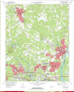
Mount Holly Topo Map North Carolina
To zoom in, hover over the map of Mount Holly
USGS Topo Quad 35081c1 - 1:24,000 scale
| Topo Map Name: | Mount Holly |
| USGS Topo Quad ID: | 35081c1 |
| Print Size: | ca. 21 1/4" wide x 27" high |
| Southeast Coordinates: | 35.25° N latitude / 81° W longitude |
| Map Center Coordinates: | 35.3125° N latitude / 81.0625° W longitude |
| U.S. State: | NC |
| Filename: | o35081c1.jpg |
| Download Map JPG Image: | Mount Holly topo map 1:24,000 scale |
| Map Type: | Topographic |
| Topo Series: | 7.5´ |
| Map Scale: | 1:24,000 |
| Source of Map Images: | United States Geological Survey (USGS) |
| Alternate Map Versions: |
Mount Holly NC 1970, updated 1972 Download PDF Buy paper map Mount Holly NC 1993, updated 1996 Download PDF Buy paper map Mount Holly NC 2010 Download PDF Buy paper map Mount Holly NC 2013 Download PDF Buy paper map Mount Holly NC 2016 Download PDF Buy paper map |
1:24,000 Topo Quads surrounding Mount Holly
> Back to 35081a1 at 1:100,000 scale
> Back to 35080a1 at 1:250,000 scale
> Back to U.S. Topo Maps home
Mount Holly topo map: Gazetteer
Mount Holly: Dams
Martin Pond Number Two Dam elevation 195m 639′McAdenville Lake Dam elevation 178m 583′
R E Rankin Lake Dam elevation 185m 606′
Rowland Lake Dam Number One elevation 214m 702′
Sodyeco Lagoon Dam elevation 173m 567′
Mount Holly: Parks
Stanley Park elevation 237m 777′Mount Holly: Populated Places
Beech Brook elevation 196m 643′Brown Town elevation 197m 646′
Caldwell (historical) elevation 187m 613′
Catawba Heights elevation 212m 695′
Cathey (historical) elevation 230m 754′
Craig Heights elevation 240m 787′
Goshen Grove elevation 224m 734′
Hutchinson elevation 199m 652′
Lowell elevation 239m 784′
McAdenville elevation 180m 590′
Mount Holly elevation 187m 613′
Murphy Heights elevation 239m 784′
Nims elevation 208m 682′
North Belmont elevation 221m 725′
Spencer Mountain elevation 204m 669′
Springwood elevation 236m 774′
Stanley elevation 256m 839′
Taylor Heights elevation 243m 797′
West Cramerton elevation 219m 718′
Woodland (historical) elevation 215m 705′
Mount Holly: Reservoirs
Martin Pond Number Two elevation 195m 639′McAdenville Lake elevation 178m 583′
R E Rankin Lake elevation 185m 606′
Rowland Lake Number One elevation 214m 702′
Sodyeco Lagoon elevation 173m 567′
Mount Holly: Streams
Dutchmans Creek elevation 173m 567′Fites Creek elevation 173m 567′
Little Long Creek elevation 196m 643′
Long Creek elevation 193m 633′
Long Creek elevation 173m 567′
South Stanley Creek elevation 179m 587′
Stanley Creek elevation 178m 583′
Taylors Creek elevation 173m 567′
Mount Holly: Summits
Spencer Mountain elevation 382m 1253′Mount Holly digital topo map on disk
Buy this Mount Holly topo map showing relief, roads, GPS coordinates and other geographical features, as a high-resolution digital map file on DVD:
South Carolina, Western North Carolina & Northeastern Georgia
Buy digital topo maps: South Carolina, Western North Carolina & Northeastern Georgia


