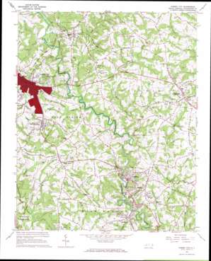
Forest City Topo Map North Carolina
To zoom in, hover over the map of Forest City
USGS Topo Quad 35081c7 - 1:24,000 scale
| Topo Map Name: | Forest City |
| USGS Topo Quad ID: | 35081c7 |
| Print Size: | ca. 21 1/4" wide x 27" high |
| Southeast Coordinates: | 35.25° N latitude / 81.75° W longitude |
| Map Center Coordinates: | 35.3125° N latitude / 81.8125° W longitude |
| U.S. State: | NC |
| Filename: | o35081c7.jpg |
| Download Map JPG Image: | Forest City topo map 1:24,000 scale |
| Map Type: | Topographic |
| Topo Series: | 7.5´ |
| Map Scale: | 1:24,000 |
| Source of Map Images: | United States Geological Survey (USGS) |
| Alternate Map Versions: |
Forest City NC 1966, updated 1968 Download PDF Buy paper map Forest City NC 1993, updated 1996 Download PDF Buy paper map Forest City NC 2002, updated 2003 Download PDF Buy paper map Forest City NC 2010 Download PDF Buy paper map Forest City NC 2013 Download PDF Buy paper map Forest City NC 2016 Download PDF Buy paper map |
1:24,000 Topo Quads surrounding Forest City
> Back to 35081a1 at 1:100,000 scale
> Back to 35080a1 at 1:250,000 scale
> Back to U.S. Topo Maps home
Forest City topo map: Gazetteer
Forest City: Dams
Cone Mills Lake Dam elevation 228m 748′Forest City: Populated Places
Alexander Mills elevation 297m 974′Avondale elevation 264m 866′
Bostic elevation 282m 925′
Caroleen elevation 257m 843′
Concord elevation 292m 958′
Corinth elevation 309m 1013′
Ellenboro elevation 320m 1049′
Forest City elevation 309m 1013′
Henrietta elevation 239m 784′
River Hills elevation 248m 813′
Sandy Mush elevation 290m 951′
Forest City: Post Offices
Bostic Post Office elevation 288m 944′Forest City: Reservoirs
Cone Mills Lake elevation 228m 748′Forest City: Streams
Big Spring Branch elevation 242m 793′Bracketts Creek elevation 235m 770′
Buck Branch elevation 244m 800′
Catheys Creek elevation 252m 826′
Copper Mine Branch elevation 243m 797′
Hogpen Branch elevation 220m 721′
Morrow Creek elevation 241m 790′
Puzzle Creek elevation 240m 787′
Roberson Creek elevation 246m 807′
Webbs Creek elevation 238m 780′
Forest City: Summits
Piney Mountain elevation 364m 1194′Forest City digital topo map on disk
Buy this Forest City topo map showing relief, roads, GPS coordinates and other geographical features, as a high-resolution digital map file on DVD:
South Carolina, Western North Carolina & Northeastern Georgia
Buy digital topo maps: South Carolina, Western North Carolina & Northeastern Georgia


