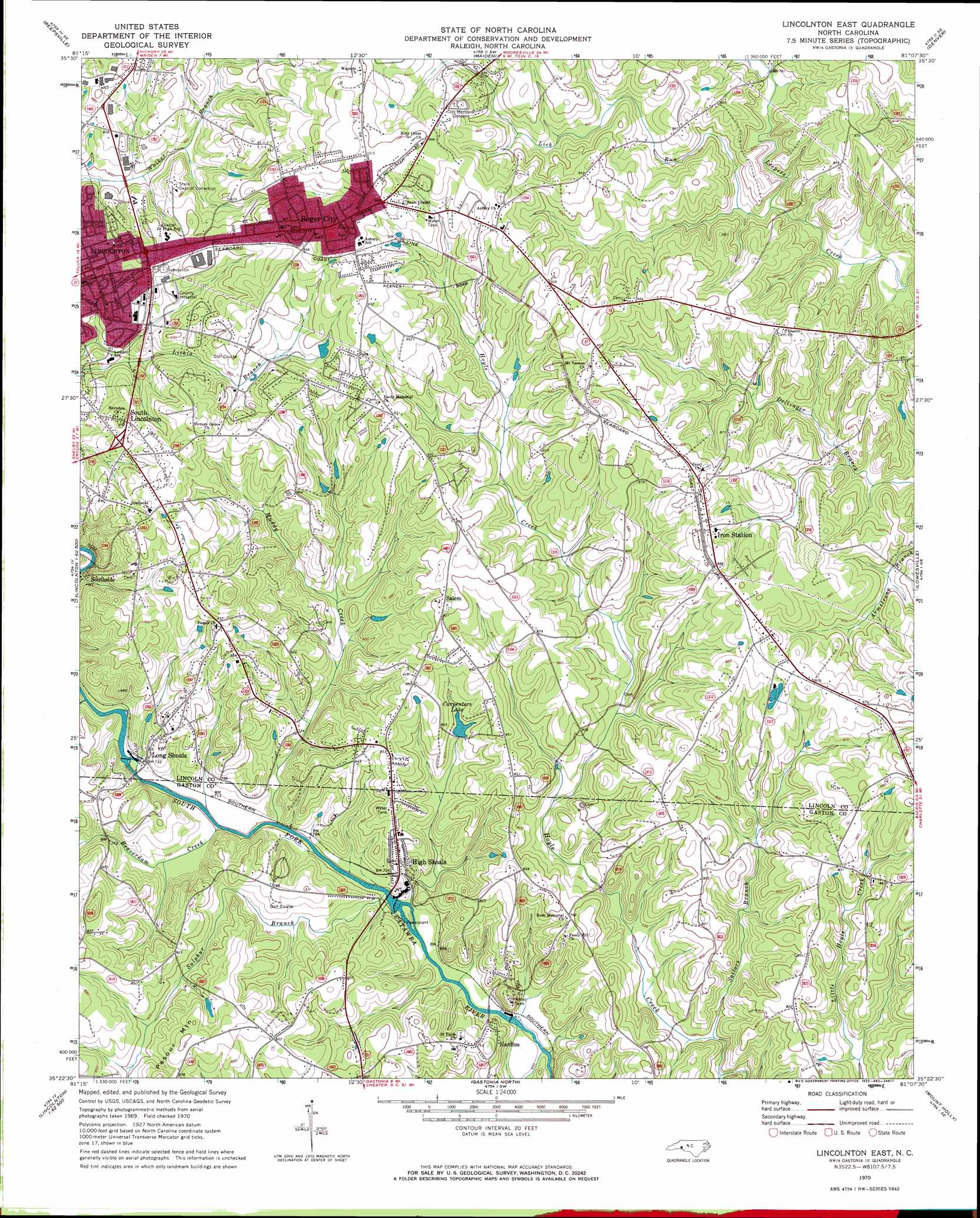
Lincolnton East Topo Map North Carolina
To zoom in, hover over the map of Lincolnton East
USGS Topo Quad 35081d2 - 1:24,000 scale
| Topo Map Name: | Lincolnton East |
| USGS Topo Quad ID: | 35081d2 |
| Print Size: | ca. 21 1/4" wide x 27" high |
| Southeast Coordinates: | 35.375° N latitude / 81.125° W longitude |
| Map Center Coordinates: | 35.4375° N latitude / 81.1875° W longitude |
| U.S. State: | NC |
| Filename: | o35081d2.jpg |
| Download Map JPG Image: | Lincolnton East topo map 1:24,000 scale |
| Map Type: | Topographic |
| Topo Series: | 7.5´ |
| Map Scale: | 1:24,000 |
| Source of Map Images: | United States Geological Survey (USGS) |
| Alternate Map Versions: |
Lincolnton East NC 1970, updated 1972 Download PDF Buy paper map Lincolnton East NC 1970, updated 1972 Download PDF Buy paper map Lincolnton East NC 1993, updated 1996 Download PDF Buy paper map Lincolnton East NC 2010 Download PDF Buy paper map Lincolnton East NC 2013 Download PDF Buy paper map Lincolnton East NC 2016 Download PDF Buy paper map |
1:24,000 Topo Quads surrounding Lincolnton East
Longview |
Hickory |
Newton |
Catawba |
Troutman |
Banoak |
Reepsville |
Maiden |
Denver |
Lake Norman North |
Cherryville |
Lincolnton West |
Lincolnton East |
Lowesville |
Lake Norman South |
Waco |
Bessemer City |
Gastonia North |
Mount Holly |
Mountain Island Lake |
Grover |
Kings Mountain |
Gastonia South |
Belmont |
Charlotte West |
> Back to 35081a1 at 1:100,000 scale
> Back to 35080a1 at 1:250,000 scale
> Back to U.S. Topo Maps home
Lincolnton East topo map: Gazetteer
Lincolnton East: Airports
Lincoln County Airport elevation 264m 866′Lincolnton East: Dams
Carpenters Lake Dam elevation 238m 780′Dallas Lake Dam elevation 228m 748′
High Shoals Lake Dam elevation 215m 705′
Long Shoals Lake Dam elevation 215m 705′
Lincolnton East: Populated Places
Boger City elevation 300m 984′Goodsonville elevation 298m 977′
Hardins elevation 226m 741′
High Shoals elevation 235m 770′
Iron Station elevation 268m 879′
Lithia Springs elevation 264m 866′
Long Shoals elevation 218m 715′
Salem elevation 275m 902′
South Lincolnton elevation 269m 882′
Southside elevation 255m 836′
Lincolnton East: Reservoirs
Carpenters Lake elevation 238m 780′Dallas Lake elevation 228m 748′
High Shoals Lake elevation 215m 705′
Long Shoals Lake elevation 215m 705′
Lincolnton East: Streams
Beaverdam Creek elevation 212m 695′Indian Creek elevation 218m 715′
Lick Run elevation 230m 754′
Muddy Creek elevation 212m 695′
Ore Bank Branch elevation 237m 777′
Rattle Shoal Creek elevation 197m 646′
Sailors Branch elevation 209m 685′
Sulphur Branch elevation 213m 698′
Lincolnton East digital topo map on disk
Buy this Lincolnton East topo map showing relief, roads, GPS coordinates and other geographical features, as a high-resolution digital map file on DVD:
South Carolina, Western North Carolina & Northeastern Georgia
Buy digital topo maps: South Carolina, Western North Carolina & Northeastern Georgia