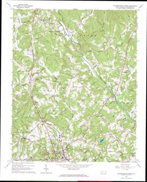
Rutherfordton North Topo Map North Carolina
To zoom in, hover over the map of Rutherfordton North
USGS Topo Quad 35081d8 - 1:24,000 scale
| Topo Map Name: | Rutherfordton North |
| USGS Topo Quad ID: | 35081d8 |
| Print Size: | ca. 21 1/4" wide x 27" high |
| Southeast Coordinates: | 35.375° N latitude / 81.875° W longitude |
| Map Center Coordinates: | 35.4375° N latitude / 81.9375° W longitude |
| U.S. State: | NC |
| Filename: | o35081d8.jpg |
| Download Map JPG Image: | Rutherfordton North topo map 1:24,000 scale |
| Map Type: | Topographic |
| Topo Series: | 7.5´ |
| Map Scale: | 1:24,000 |
| Source of Map Images: | United States Geological Survey (USGS) |
| Alternate Map Versions: |
Rutherfordton North NC 1966, updated 1968 Download PDF Buy paper map Rutherfordton North NC 1993, updated 1996 Download PDF Buy paper map Rutherfordton North NC 2002, updated 2003 Download PDF Buy paper map Rutherfordton North NC 2010 Download PDF Buy paper map Rutherfordton North NC 2013 Download PDF Buy paper map Rutherfordton North NC 2016 Download PDF Buy paper map |
1:24,000 Topo Quads surrounding Rutherfordton North
> Back to 35081a1 at 1:100,000 scale
> Back to 35080a1 at 1:250,000 scale
> Back to U.S. Topo Maps home
Rutherfordton North topo map: Gazetteer
Rutherfordton North: Airports
Rutherford County Airport elevation 325m 1066′Rutherfordton North: Populated Places
Fernwood elevation 335m 1099′Gilkey elevation 331m 1085′
Harmon (historical) elevation 299m 980′
Logan elevation 271m 889′
Mount Pisgah (historical) elevation 295m 967′
Mount Vernon elevation 312m 1023′
Ruth elevation 316m 1036′
Tate (historical) elevation 289m 948′
Thermal Valley elevation 301m 987′
Union Mills elevation 328m 1076′
Westminster elevation 309m 1013′
Rutherfordton North: Streams
Big Camp Creek elevation 261m 856′Buncomb Branch elevation 290m 951′
Cane Creek elevation 256m 839′
Case Branch elevation 265m 869′
Cherry Creek elevation 274m 898′
Crawley Branch elevation 285m 935′
Frog Creek elevation 272m 892′
Harris Creek elevation 309m 1013′
Hollands Creek elevation 253m 830′
Little Camp Creek elevation 262m 859′
Mill Creek elevation 290m 951′
Rutherfordton North digital topo map on disk
Buy this Rutherfordton North topo map showing relief, roads, GPS coordinates and other geographical features, as a high-resolution digital map file on DVD:
South Carolina, Western North Carolina & Northeastern Georgia
Buy digital topo maps: South Carolina, Western North Carolina & Northeastern Georgia


