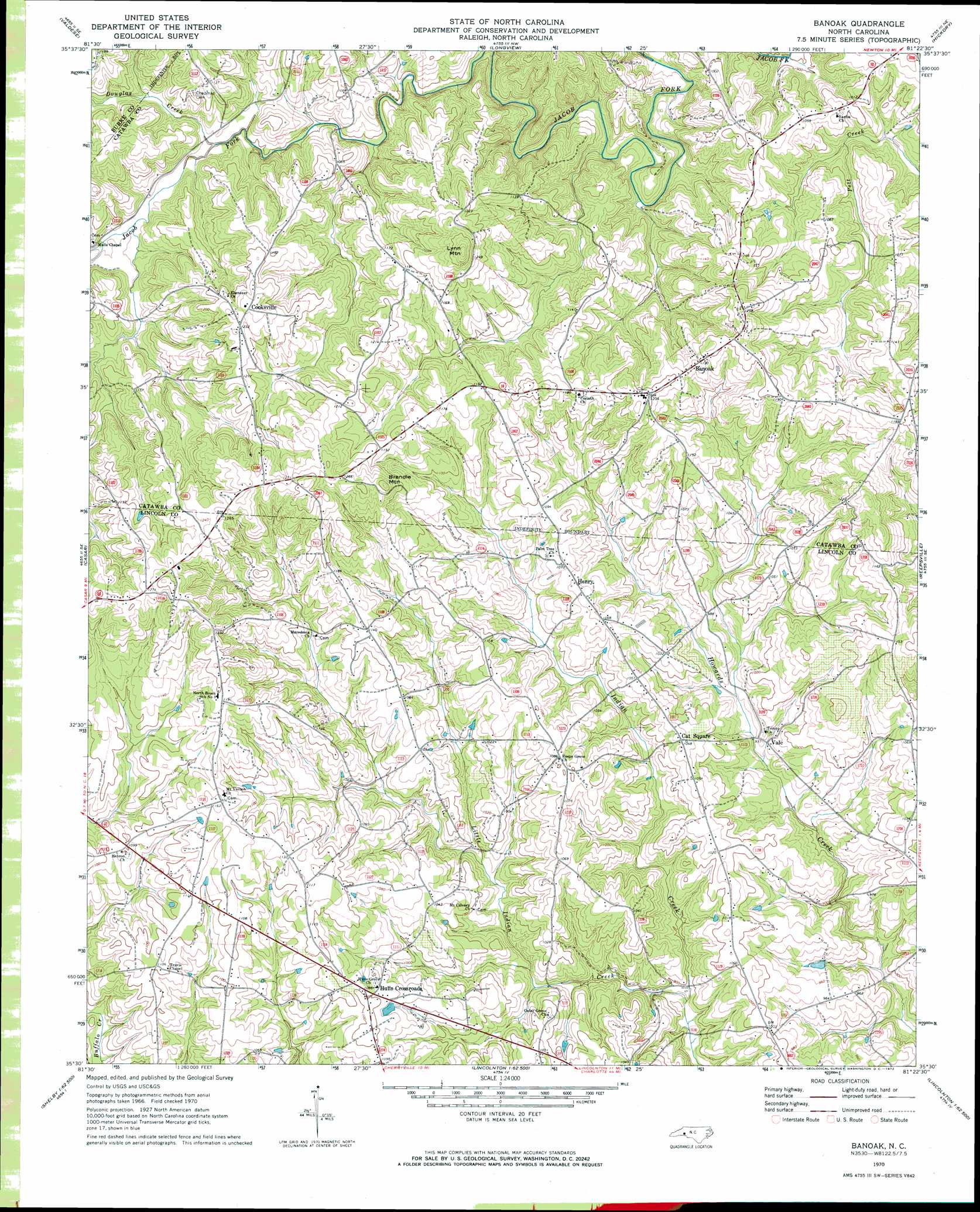
Banoak Topo Map North Carolina
To zoom in, hover over the map of Banoak
USGS Topo Quad 35081e4 - 1:24,000 scale
| Topo Map Name: | Banoak |
| USGS Topo Quad ID: | 35081e4 |
| Print Size: | ca. 21 1/4" wide x 27" high |
| Southeast Coordinates: | 35.5° N latitude / 81.375° W longitude |
| Map Center Coordinates: | 35.5625° N latitude / 81.4375° W longitude |
| U.S. State: | NC |
| Filename: | o35081e4.jpg |
| Download Map JPG Image: | Banoak topo map 1:24,000 scale |
| Map Type: | Topographic |
| Topo Series: | 7.5´ |
| Map Scale: | 1:24,000 |
| Source of Map Images: | United States Geological Survey (USGS) |
| Alternate Map Versions: |
Banoak NC 1970, updated 1972 Download PDF Buy paper map Banoak NC 2002, updated 2003 Download PDF Buy paper map Banoak NC 2010 Download PDF Buy paper map Banoak NC 2013 Download PDF Buy paper map Banoak NC 2016 Download PDF Buy paper map |
1:24,000 Topo Quads surrounding Banoak
Morganton North |
Drexel |
Granite Falls |
Bethlehem |
Millersville |
Morganton South |
Valdese |
Longview |
Hickory |
Newton |
Benn Knob |
Casar |
Banoak |
Reepsville |
Maiden |
Polkville |
Lawndale |
Cherryville |
Lincolnton West |
Lincolnton East |
Boiling Springs North |
Shelby |
Waco |
Bessemer City |
Gastonia North |
> Back to 35081e1 at 1:100,000 scale
> Back to 35080a1 at 1:250,000 scale
> Back to U.S. Topo Maps home
Banoak topo map: Gazetteer
Banoak: Dams
Taylors Lake Dam elevation 326m 1069′Banoak: Populated Places
Banoak elevation 358m 1174′Cat Square elevation 317m 1040′
Cooksville elevation 380m 1246′
Henry elevation 331m 1085′
Hulls Crossroads elevation 334m 1095′
Seagles Store (historical) elevation 290m 951′
Vale elevation 286m 938′
Banoak: Reservoirs
Taylors Lake elevation 326m 1069′Banoak: Streams
Douglas Creek elevation 304m 997′Little Indian Creek elevation 267m 875′
Rock Creek elevation 310m 1017′
Banoak: Summits
Brendle Mountain elevation 405m 1328′Lynn Mountain elevation 422m 1384′
Banoak digital topo map on disk
Buy this Banoak topo map showing relief, roads, GPS coordinates and other geographical features, as a high-resolution digital map file on DVD:
South Carolina, Western North Carolina & Northeastern Georgia
Buy digital topo maps: South Carolina, Western North Carolina & Northeastern Georgia