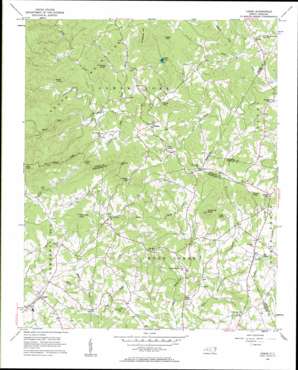
Casar Topo Map North Carolina
To zoom in, hover over the map of Casar
USGS Topo Quad 35081e5 - 1:24,000 scale
| Topo Map Name: | Casar |
| USGS Topo Quad ID: | 35081e5 |
| Print Size: | ca. 21 1/4" wide x 27" high |
| Southeast Coordinates: | 35.5° N latitude / 81.5° W longitude |
| Map Center Coordinates: | 35.5625° N latitude / 81.5625° W longitude |
| U.S. State: | NC |
| Filename: | o35081e5.jpg |
| Download Map JPG Image: | Casar topo map 1:24,000 scale |
| Map Type: | Topographic |
| Topo Series: | 7.5´ |
| Map Scale: | 1:24,000 |
| Source of Map Images: | United States Geological Survey (USGS) |
| Alternate Map Versions: |
Casar NC 1956, updated 1958 Download PDF Buy paper map Casar NC 2010 Download PDF Buy paper map Casar NC 2013 Download PDF Buy paper map Casar NC 2016 Download PDF Buy paper map |
1:24,000 Topo Quads surrounding Casar
> Back to 35081e1 at 1:100,000 scale
> Back to 35080a1 at 1:250,000 scale
> Back to U.S. Topo Maps home
Casar topo map: Gazetteer
Casar: Dams
Willis Lake Dam elevation 370m 1213′Casar: Gaps
Leman Gap elevation 431m 1414′Ward Gap elevation 402m 1318′
Casar: Populated Places
Camp Creek elevation 372m 1220′Casar elevation 346m 1135′
Knob Creek elevation 310m 1017′
Laurel Hill elevation 384m 1259′
Olive Grove elevation 366m 1200′
Pine Mountain Lakes elevation 359m 1177′
Ramsey elevation 393m 1289′
Shoups Ford elevation 337m 1105′
Toluca elevation 332m 1089′
Casar: Reservoirs
Willis Lake elevation 372m 1220′Casar: Ridges
Gilead Ridge elevation 519m 1702′Casar: Streams
Bald Knob Creek elevation 285m 935′Camp Creek elevation 323m 1059′
Little River elevation 361m 1184′
Poundingmill Creek elevation 276m 905′
Queens Creek elevation 343m 1125′
Seeley Creek elevation 341m 1118′
Tim Creek elevation 328m 1076′
White Oak Creek elevation 344m 1128′
Whitener Creek elevation 328m 1076′
Casar: Summits
Brushy Knob elevation 507m 1663′Buffalo Knob elevation 453m 1486′
Carpenter Knob elevation 480m 1574′
Doublehead Mountain elevation 530m 1738′
High Rock elevation 678m 2224′
Little Knob elevation 411m 1348′
Noah Mountain elevation 489m 1604′
Old Sheep Knob elevation 450m 1476′
Queens Mountain elevation 507m 1663′
Swenk Knob elevation 508m 1666′
Casar digital topo map on disk
Buy this Casar topo map showing relief, roads, GPS coordinates and other geographical features, as a high-resolution digital map file on DVD:
South Carolina, Western North Carolina & Northeastern Georgia
Buy digital topo maps: South Carolina, Western North Carolina & Northeastern Georgia


