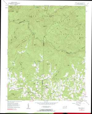
Benn Knob Topo Map North Carolina
To zoom in, hover over the map of Benn Knob
USGS Topo Quad 35081e6 - 1:24,000 scale
| Topo Map Name: | Benn Knob |
| USGS Topo Quad ID: | 35081e6 |
| Print Size: | ca. 21 1/4" wide x 27" high |
| Southeast Coordinates: | 35.5° N latitude / 81.625° W longitude |
| Map Center Coordinates: | 35.5625° N latitude / 81.6875° W longitude |
| U.S. State: | NC |
| Filename: | o35081e6.jpg |
| Download Map JPG Image: | Benn Knob topo map 1:24,000 scale |
| Map Type: | Topographic |
| Topo Series: | 7.5´ |
| Map Scale: | 1:24,000 |
| Source of Map Images: | United States Geological Survey (USGS) |
| Alternate Map Versions: |
Benn Knob NC 1956, updated 1958 Download PDF Buy paper map Benn Knob NC 1956, updated 1984 Download PDF Buy paper map Benn Knob NC 2010 Download PDF Buy paper map Benn Knob NC 2013 Download PDF Buy paper map Benn Knob NC 2016 Download PDF Buy paper map |
1:24,000 Topo Quads surrounding Benn Knob
> Back to 35081e1 at 1:100,000 scale
> Back to 35080a1 at 1:250,000 scale
> Back to U.S. Topo Maps home
Benn Knob topo map: Gazetteer
Benn Knob: Dams
Morganton Watershed Dam elevation 523m 1715′Benn Knob: Gaps
Gibbs Gap elevation 774m 2539′Walnut Gap elevation 653m 2142′
Woods Gap elevation 788m 2585′
Benn Knob: Parks
South Mountains State Park elevation 668m 2191′Benn Knob: Populated Places
New Home elevation 339m 1112′Benn Knob: Ranges
South Mountains elevation 796m 2611′Benn Knob: Reservoirs
Morganton Watershed Lake elevation 523m 1715′Benn Knob: Ridges
Ball Alley elevation 696m 2283′Grass Ridge elevation 730m 2395′
Horse Ridge elevation 671m 2201′
Red Spur elevation 627m 2057′
Richland Mountain Ridge elevation 723m 2372′
Benn Knob: Streams
Beaverdam Creek elevation 316m 1036′Brier Creek elevation 289m 948′
Cox Creek elevation 288m 944′
He Creek elevation 512m 1679′
Nettle Branch elevation 565m 1853′
Pheasant Creek elevation 300m 984′
Pot Branch elevation 336m 1102′
Shinny Creek elevation 417m 1368′
Benn Knob: Summits
Benn Knob elevation 882m 2893′Black Mountain elevation 789m 2588′
Bumgarther Mountain elevation 807m 2647′
Buzzard Roost elevation 906m 2972′
Camp Knob elevation 570m 1870′
Chestnut Knob elevation 697m 2286′
Cove Mountain elevation 672m 2204′
Covington Mountain elevation 613m 2011′
Dogwood Stamp Mountain elevation 777m 2549′
Hickory Knob elevation 911m 2988′
Hickorynut Mountain elevation 874m 2867′
High Peak elevation 833m 2732′
Huckleberry Mountain elevation 630m 2066′
Lisenberry Mountain elevation 574m 1883′
No Business Mountain elevation 546m 1791′
Paine Mountain elevation 595m 1952′
Painter Knob elevation 808m 2650′
Printers Knob elevation 702m 2303′
Rainbow Mountain elevation 873m 2864′
Rich Mountain elevation 820m 2690′
Skull Knob elevation 872m 2860′
Squire Knob elevation 645m 2116′
West Mountain elevation 400m 1312′
Benn Knob digital topo map on disk
Buy this Benn Knob topo map showing relief, roads, GPS coordinates and other geographical features, as a high-resolution digital map file on DVD:
South Carolina, Western North Carolina & Northeastern Georgia
Buy digital topo maps: South Carolina, Western North Carolina & Northeastern Georgia


