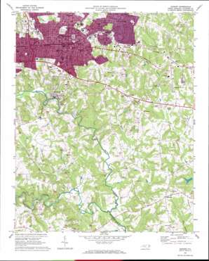
Hickory Topo Map North Carolina
To zoom in, hover over the map of Hickory
USGS Topo Quad 35081f3 - 1:24,000 scale
| Topo Map Name: | Hickory |
| USGS Topo Quad ID: | 35081f3 |
| Print Size: | ca. 21 1/4" wide x 27" high |
| Southeast Coordinates: | 35.625° N latitude / 81.25° W longitude |
| Map Center Coordinates: | 35.6875° N latitude / 81.3125° W longitude |
| U.S. State: | NC |
| Filename: | o35081f3.jpg |
| Download Map JPG Image: | Hickory topo map 1:24,000 scale |
| Map Type: | Topographic |
| Topo Series: | 7.5´ |
| Map Scale: | 1:24,000 |
| Source of Map Images: | United States Geological Survey (USGS) |
| Alternate Map Versions: |
Hickory NC 1970, updated 1973 Download PDF Buy paper map Hickory NC 1993, updated 1996 Download PDF Buy paper map Hickory NC 2010 Download PDF Buy paper map Hickory NC 2013 Download PDF Buy paper map Hickory NC 2016 Download PDF Buy paper map |
1:24,000 Topo Quads surrounding Hickory
> Back to 35081e1 at 1:100,000 scale
> Back to 35080a1 at 1:250,000 scale
> Back to U.S. Topo Maps home
Hickory topo map: Gazetteer
Hickory: Dams
Gaither Dam elevation 280m 918′Griffin Dam elevation 266m 872′
James Dam elevation 267m 875′
Martin-Marietta Dam elevation 300m 984′
Shuford Mills Dam elevation 268m 879′
Hickory: Parks
Saint Pauls Memorial Park elevation 295m 967′Weavers Avenue Park elevation 342m 1122′
Hickory: Populated Places
Brookford elevation 286m 938′Fairbrook elevation 324m 1062′
Fairgrove elevation 297m 974′
Hickory elevation 350m 1148′
Mountain View elevation 336m 1102′
Rhoney elevation 291m 954′
Startown elevation 296m 971′
Sweetwater elevation 343m 1125′
Viewmont elevation 342m 1122′
Hickory: Reservoirs
Gaither Lake elevation 280m 918′Griffin Lake elevation 266m 872′
James Lake elevation 267m 875′
Martin-Marietta Lake elevation 300m 984′
Shuford Mills Lake elevation 268m 879′
Hickory: Streams
Barger Branch elevation 256m 839′Cline Creek elevation 259m 849′
Cripple Creek elevation 301m 987′
Frye Creek elevation 301m 987′
Geitner Branch elevation 264m 866′
Henry Fork elevation 244m 800′
Hop Creek elevation 249m 816′
Jacob Fork elevation 244m 800′
Longview Creek elevation 264m 866′
Miller Branch elevation 271m 889′
Muddy Creek elevation 249m 816′
Hickory digital topo map on disk
Buy this Hickory topo map showing relief, roads, GPS coordinates and other geographical features, as a high-resolution digital map file on DVD:
South Carolina, Western North Carolina & Northeastern Georgia
Buy digital topo maps: South Carolina, Western North Carolina & Northeastern Georgia


