Valdese Topo Map North Carolina
To zoom in, hover over the map of Valdese
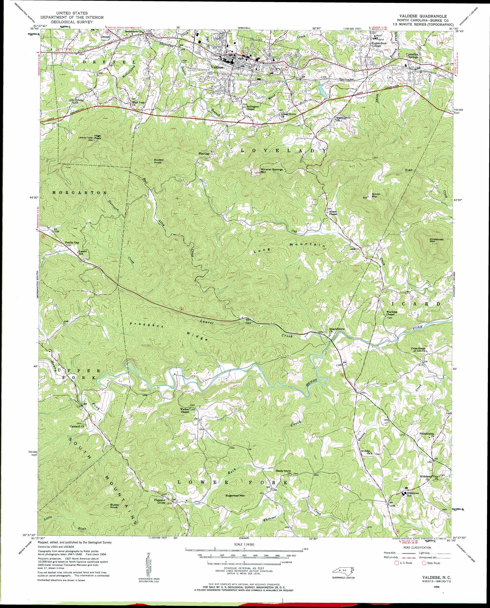
USGS Topo Quad 35081f5 - 1:24,000 scale
| Topo Map Name: | Valdese |
| USGS Topo Quad ID: | 35081f5 |
| Print Size: | ca. 21 1/4" wide x 27" high |
| Southeast Coordinates: | 35.625° N latitude / 81.5° W longitude |
| Map Center Coordinates: | 35.6875° N latitude / 81.5625° W longitude |
| U.S. State: | NC |
| Filename: | o35081f5.jpg |
| Download Map JPG Image: | Valdese topo map 1:24,000 scale |
| Map Type: | Topographic |
| Topo Series: | 7.5´ |
| Map Scale: | 1:24,000 |
| Source of Map Images: | United States Geological Survey (USGS) |
| Alternate Map Versions: |
Valdese NC 1956, updated 1958 Download PDF Buy paper map Valdese NC 1956, updated 1984 Download PDF Buy paper map Valdese NC 1993, updated 1996 Download PDF Buy paper map Valdese NC 2002, updated 2003 Download PDF Buy paper map Valdese NC 2010 Download PDF Buy paper map Valdese NC 2013 Download PDF Buy paper map Valdese NC 2016 Download PDF Buy paper map |
1:24,000 Topo Quads surrounding Valdese
Chestnut Mountain |
Collettsville |
Lenoir |
Kings Creek |
Ellendale |
Oak Hill |
Morganton North |
Drexel |
Granite Falls |
Bethlehem |
Glen Alpine |
Morganton South |
Valdese |
Longview |
Hickory |
Dysartsville |
Benn Knob |
Casar |
Banoak |
Reepsville |
Sunshine |
Polkville |
Lawndale |
Cherryville |
Lincolnton West |
> Back to 35081e1 at 1:100,000 scale
> Back to 35080a1 at 1:250,000 scale
> Back to U.S. Topo Maps home
Valdese topo map: Gazetteer
Valdese: Dams
McCorkle Dam elevation 372m 1220′Valdese Lake Dam elevation 357m 1171′
Valdese: Populated Places
Connelly Springs elevation 358m 1174′Flat Gap elevation 403m 1322′
Petche Gap elevation 389m 1276′
Pleasant Grove elevation 420m 1377′
Rutherford College elevation 368m 1207′
Valdese elevation 368m 1207′
Valdese: Reservoirs
McCorkle Lake elevation 372m 1220′Noname elevation 357m 1171′
Valdese: Ridges
Long Mountain elevation 437m 1433′Montague Hills elevation 534m 1751′
Prospect Ridge elevation 395m 1295′
Valdese: Streams
Ball Alley Creek elevation 324m 1062′Cub Creek elevation 301m 987′
Double Branch elevation 335m 1099′
Garrison Creek elevation 364m 1194′
Laurel Creek elevation 314m 1030′
Queens Creek elevation 334m 1095′
Rock Creek elevation 313m 1026′
Smith Branch elevation 342m 1122′
Valdese: Summits
Butler Knob elevation 601m 1971′High Peak elevation 647m 2122′
Hildebran Mountain elevation 620m 2034′
Mineral Springs Mountain elevation 576m 1889′
Rector Knob elevation 632m 2073′
Smith Mountain elevation 634m 2080′
Sugarloaf Mountain elevation 472m 1548′
Valdese digital topo map on disk
Buy this Valdese topo map showing relief, roads, GPS coordinates and other geographical features, as a high-resolution digital map file on DVD:
South Carolina, Western North Carolina & Northeastern Georgia
Buy digital topo maps: South Carolina, Western North Carolina & Northeastern Georgia