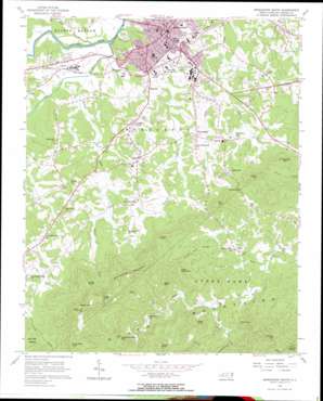
Morganton South Topo Map North Carolina
To zoom in, hover over the map of Morganton South
USGS Topo Quad 35081f6 - 1:24,000 scale
| Topo Map Name: | Morganton South |
| USGS Topo Quad ID: | 35081f6 |
| Print Size: | ca. 21 1/4" wide x 27" high |
| Southeast Coordinates: | 35.625° N latitude / 81.625° W longitude |
| Map Center Coordinates: | 35.6875° N latitude / 81.6875° W longitude |
| U.S. State: | NC |
| Filename: | o35081f6.jpg |
| Download Map JPG Image: | Morganton South topo map 1:24,000 scale |
| Map Type: | Topographic |
| Topo Series: | 7.5´ |
| Map Scale: | 1:24,000 |
| Source of Map Images: | United States Geological Survey (USGS) |
| Alternate Map Versions: |
Morganton South NC 1956, updated 1958 Download PDF Buy paper map Morganton South NC 1956, updated 1966 Download PDF Buy paper map Morganton South NC 1993, updated 1996 Download PDF Buy paper map Morganton South NC 2010 Download PDF Buy paper map Morganton South NC 2013 Download PDF Buy paper map Morganton South NC 2016 Download PDF Buy paper map |
1:24,000 Topo Quads surrounding Morganton South
> Back to 35081e1 at 1:100,000 scale
> Back to 35080a1 at 1:250,000 scale
> Back to U.S. Topo Maps home
Morganton South topo map: Gazetteer
Morganton South: Airports
Silver Creek Airport elevation 310m 1017′Morganton South: Dams
Leonhart Dam elevation 347m 1138′Morganton South: Gaps
Horse Mountain Gap elevation 479m 1571′Morganton South: Parks
Bethel Road Park elevation 362m 1187′Carbon City Park elevation 327m 1072′
Collett Street Recreation Center elevation 354m 1161′
Freedom Park elevation 318m 1043′
Morganton South: Populated Places
Burkemont elevation 382m 1253′Calvin elevation 321m 1053′
Chambers (historical) elevation 350m 1148′
Enola elevation 408m 1338′
Hickory Grove (historical) elevation 309m 1013′
Magnolia elevation 366m 1200′
Morganton elevation 352m 1154′
Petersburg elevation 356m 1167′
Pumpkin Center elevation 368m 1207′
Salem elevation 371m 1217′
Sunnyside elevation 376m 1233′
Tarkey Tail (historical) elevation 318m 1043′
Yellow Gap elevation 434m 1423′
Morganton South: Reservoirs
Leonhart Lake elevation 347m 1138′Morganton South: Ridges
Black Fox Ridge elevation 494m 1620′Morganton South: Streams
Bailey Fork elevation 309m 1013′Canoe Creek elevation 306m 1003′
East Prong Hunting Creek elevation 319m 1046′
Fiddlers Run elevation 322m 1056′
Hipp Creek elevation 432m 1417′
Ivy Creek elevation 406m 1332′
Little Silver Creek elevation 311m 1020′
Silver Creek elevation 325m 1066′
Stacy Creek elevation 369m 1210′
Morganton South: Summits
Bob Knob elevation 610m 2001′Burkemont Mountain elevation 776m 2545′
Cedar Mountain elevation 653m 2142′
Hipp Knob elevation 569m 1866′
Ironmonger Mountain elevation 541m 1774′
Jimmy Knob elevation 774m 2539′
Kaylor Knob elevation 811m 2660′
Keller Knob elevation 538m 1765′
Krunkleton Knob elevation 836m 2742′
Little Cedar Mountain elevation 657m 2155′
Pine Mountain elevation 547m 1794′
Roper Knob elevation 699m 2293′
Simms Hill elevation 631m 2070′
Walker Top elevation 885m 2903′
Yellow Mountain elevation 576m 1889′
Morganton South digital topo map on disk
Buy this Morganton South topo map showing relief, roads, GPS coordinates and other geographical features, as a high-resolution digital map file on DVD:
South Carolina, Western North Carolina & Northeastern Georgia
Buy digital topo maps: South Carolina, Western North Carolina & Northeastern Georgia


