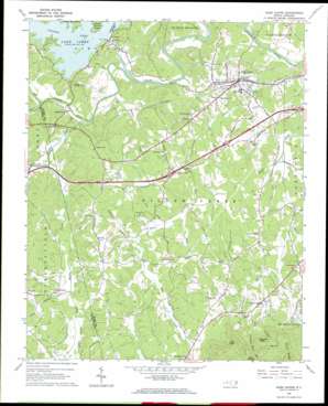
Glen Alpine Topo Map North Carolina
To zoom in, hover over the map of Glen Alpine
USGS Topo Quad 35081f7 - 1:24,000 scale
| Topo Map Name: | Glen Alpine |
| USGS Topo Quad ID: | 35081f7 |
| Print Size: | ca. 21 1/4" wide x 27" high |
| Southeast Coordinates: | 35.625° N latitude / 81.75° W longitude |
| Map Center Coordinates: | 35.6875° N latitude / 81.8125° W longitude |
| U.S. State: | NC |
| Filename: | o35081f7.jpg |
| Download Map JPG Image: | Glen Alpine topo map 1:24,000 scale |
| Map Type: | Topographic |
| Topo Series: | 7.5´ |
| Map Scale: | 1:24,000 |
| Source of Map Images: | United States Geological Survey (USGS) |
| Alternate Map Versions: |
Glen Alpine NC 1962, updated 1964 Download PDF Buy paper map Glen Alpine NC 1993, updated 1996 Download PDF Buy paper map Glen Alpine NC 1994, updated 1998 Download PDF Buy paper map Glen Alpine NC 2011 Download PDF Buy paper map Glen Alpine NC 2013 Download PDF Buy paper map Glen Alpine NC 2016 Download PDF Buy paper map |
| FStopo: | US Forest Service topo Glen Alpine is available: Download FStopo PDF Download FStopo TIF |
1:24,000 Topo Quads surrounding Glen Alpine
> Back to 35081e1 at 1:100,000 scale
> Back to 35080a1 at 1:250,000 scale
> Back to U.S. Topo Maps home
Glen Alpine topo map: Gazetteer
Glen Alpine: Dams
Bridgewater Dam elevation 372m 1220′Broughton Hospital Dam elevation 381m 1250′
Henredon Dam elevation 380m 1246′
Lake James Dam elevation 353m 1158′
Linville Dam elevation 346m 1135′
Paddy Creek Dam elevation 358m 1174′
Paddys Creek Dam elevation 373m 1223′
Glen Alpine: Populated Places
Bridgewater elevation 365m 1197′Brindletown elevation 368m 1207′
Glen Alpine elevation 370m 1213′
Hardaway (historical) elevation 335m 1099′
Parkhill elevation 381m 1250′
Patten elevation 350m 1148′
Rollins (historical) elevation 399m 1309′
Glen Alpine: Reservoirs
Broughton Hospital Reservoir elevation 381m 1250′Henredon Lake elevation 380m 1246′
Lake James elevation 353m 1158′
Glen Alpine: Ridges
Stony Ridge elevation 676m 2217′Glen Alpine: Streams
Anderson Branch elevation 338m 1108′Chestnut Flat Branch elevation 375m 1230′
Clear Creek elevation 317m 1040′
Double Branch elevation 322m 1056′
Hall Creek elevation 343m 1125′
Hoppers Creek elevation 340m 1115′
Jack Branch elevation 334m 1095′
James Branch elevation 331m 1085′
Linville River elevation 375m 1230′
Long Branch elevation 337m 1105′
Muddy Creek elevation 332m 1089′
North Muddy Creek elevation 329m 1079′
Old Catawba River elevation 320m 1049′
Old Paddy Creek elevation 327m 1072′
Reedy Creek elevation 332m 1089′
Shadrick Creek elevation 327m 1072′
Shoal Creek elevation 336m 1102′
South Muddy Creek elevation 331m 1085′
Sutterwhite Creek elevation 332m 1089′
Glen Alpine: Summits
England Knob elevation 522m 1712′Hall Knob elevation 606m 1988′
Glen Alpine digital topo map on disk
Buy this Glen Alpine topo map showing relief, roads, GPS coordinates and other geographical features, as a high-resolution digital map file on DVD:
South Carolina, Western North Carolina & Northeastern Georgia
Buy digital topo maps: South Carolina, Western North Carolina & Northeastern Georgia


