Ellendale Topo Map North Carolina
To zoom in, hover over the map of Ellendale
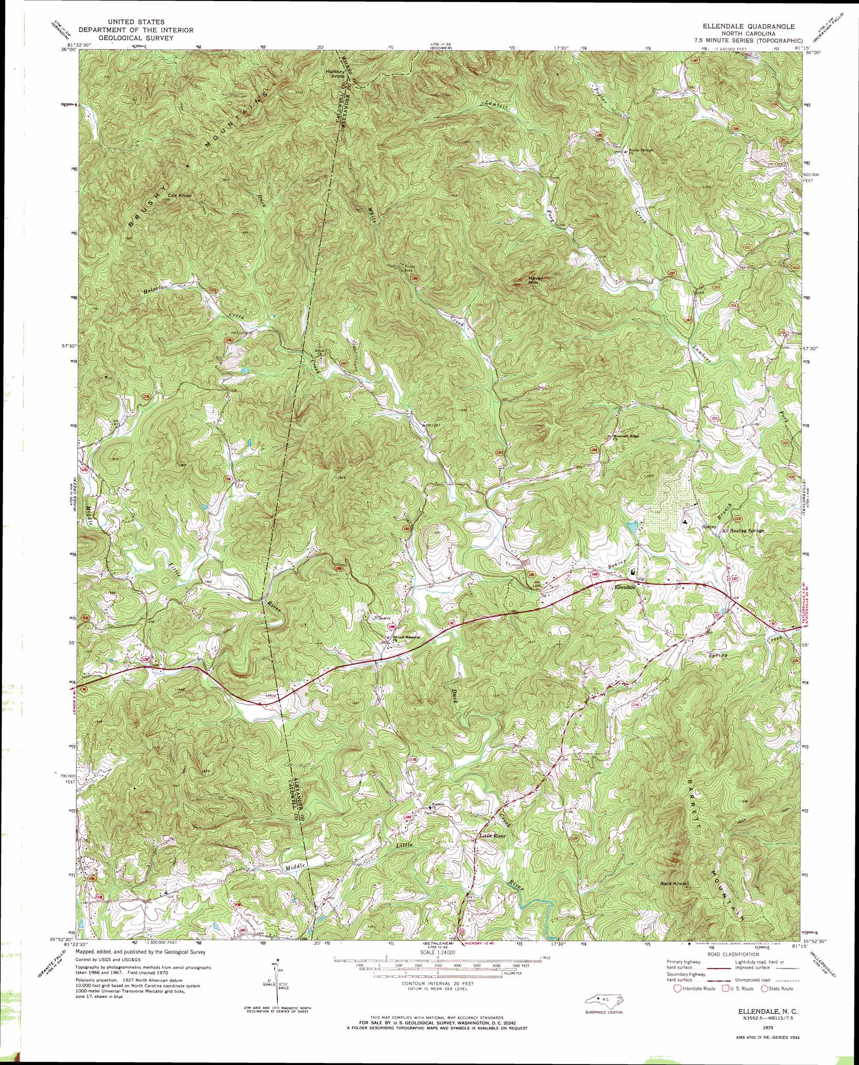
USGS Topo Quad 35081h3 - 1:24,000 scale
| Topo Map Name: | Ellendale |
| USGS Topo Quad ID: | 35081h3 |
| Print Size: | ca. 21 1/4" wide x 27" high |
| Southeast Coordinates: | 35.875° N latitude / 81.25° W longitude |
| Map Center Coordinates: | 35.9375° N latitude / 81.3125° W longitude |
| U.S. State: | NC |
| Filename: | o35081h3.jpg |
| Download Map JPG Image: | Ellendale topo map 1:24,000 scale |
| Map Type: | Topographic |
| Topo Series: | 7.5´ |
| Map Scale: | 1:24,000 |
| Source of Map Images: | United States Geological Survey (USGS) |
| Alternate Map Versions: |
Ellendale NC 1970, updated 1973 Download PDF Buy paper map Ellendale NC 1997, updated 2000 Download PDF Buy paper map Ellendale NC 2010 Download PDF Buy paper map Ellendale NC 2013 Download PDF Buy paper map Ellendale NC 2016 Download PDF Buy paper map |
1:24,000 Topo Quads surrounding Ellendale
Deep Gap |
Maple Springs |
Purlear |
Wilkesboro |
Roaring River |
Buffalo Cove |
Grandin |
Boomer |
Moravian Falls |
Gilreath |
Lenoir |
Kings Creek |
Ellendale |
Taylorsville |
Hiddenite |
Drexel |
Granite Falls |
Bethlehem |
Millersville |
Stony Point |
Valdese |
Longview |
Hickory |
Newton |
Catawba |
> Back to 35081e1 at 1:100,000 scale
> Back to 35080a1 at 1:250,000 scale
> Back to U.S. Topo Maps home
Ellendale topo map: Gazetteer
Ellendale: Populated Places
Downsville (historical) elevation 376m 1233′Ellendale elevation 387m 1269′
Little River elevation 345m 1131′
Ellendale: Springs
All Healing Springs elevation 356m 1167′Ellendale: Streams
Duck Creek elevation 313m 1026′Ginger Creek elevation 422m 1384′
Holsclaw Creek elevation 403m 1322′
Poplar Creek elevation 357m 1171′
White Creek elevation 351m 1151′
Ellendale: Summits
Bald Knob elevation 585m 1919′Cox Knob elevation 727m 2385′
Hickory Knob elevation 767m 2516′
Little Brush Mountain elevation 426m 1397′
Never Mountain elevation 607m 1991′
Ellendale digital topo map on disk
Buy this Ellendale topo map showing relief, roads, GPS coordinates and other geographical features, as a high-resolution digital map file on DVD:
South Carolina, Western North Carolina & Northeastern Georgia
Buy digital topo maps: South Carolina, Western North Carolina & Northeastern Georgia