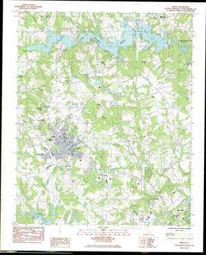
Inman Topo Map South Carolina
To zoom in, hover over the map of Inman
USGS Topo Quad 35082a1 - 1:24,000 scale
| Topo Map Name: | Inman |
| USGS Topo Quad ID: | 35082a1 |
| Print Size: | ca. 21 1/4" wide x 27" high |
| Southeast Coordinates: | 35° N latitude / 82° W longitude |
| Map Center Coordinates: | 35.0625° N latitude / 82.0625° W longitude |
| U.S. State: | SC |
| Filename: | o35082a1.jpg |
| Download Map JPG Image: | Inman topo map 1:24,000 scale |
| Map Type: | Topographic |
| Topo Series: | 7.5´ |
| Map Scale: | 1:24,000 |
| Source of Map Images: | United States Geological Survey (USGS) |
| Alternate Map Versions: |
Inman SC 1983, updated 1983 Download PDF Buy paper map Inman SC 2011 Download PDF Buy paper map Inman SC 2014 Download PDF Buy paper map |
1:24,000 Topo Quads surrounding Inman
> Back to 35082a1 at 1:100,000 scale
> Back to 35082a1 at 1:250,000 scale
> Back to U.S. Topo Maps home
Inman topo map: Gazetteer
Inman: Bridges
Campton Bridge elevation 248m 813′Inman: Crossings
Interchange 10 elevation 279m 915′Interchange 15 elevation 270m 885′
Interchange 16 elevation 270m 885′
Inman: Dams
Chestnut Lake Dam D-3336 elevation 262m 859′E W Martin Lake Dam D-3395 elevation 278m 912′
F Bush Pond Dam D-3319 elevation 275m 902′
Gramling Brothers Lake Dam Number Three D-3310 elevation 276m 905′
J M Gentry Pond Dam D-3320 elevation 277m 908′
R Milliken Pond Dam Number One D-3313 elevation 285m 935′
R Milliken Pond Dam Number Two D-3327 elevation 271m 889′
R W Miller Pond Dam D-3326 elevation 280m 918′
Sloans Meadow Creek Dam elevation 286m 938′
South Carolina Noname 42006 Dam elevation 246m 807′
South Carolina Noname 42017 D-3351 Dam elevation 262m 859′
South Carolina Noname 42027 D-3328 Dam elevation 274m 898′
W E Morris Junior Pond Dam D-3312 elevation 301m 987′
W W Wilkins Pond Dam D-3306 elevation 282m 925′
Inman: Populated Places
Bondale elevation 266m 872′Brannons Store (historical) elevation 291m 954′
Brown Arrow elevation 260m 853′
Campton elevation 270m 885′
Chestnut Lake elevation 268m 879′
Clark Estates elevation 253m 830′
Dodd Hill elevation 272m 892′
Gaines Mobile Home Park elevation 291m 954′
Hickory Hills elevation 262m 859′
Highland Park elevation 293m 961′
Inman elevation 305m 1000′
Inman Mills elevation 283m 928′
Meadowbrook Farms elevation 261m 856′
Mountain View Mobile Home Park elevation 270m 885′
North Ridge elevation 272m 892′
River Forest elevation 245m 803′
River Oak Ranchettes elevation 276m 905′
River Oaks elevation 262m 859′
Riverdale elevation 256m 839′
Shiloh elevation 258m 846′
Stone Creek elevation 251m 823′
Tidmans Place elevation 265m 869′
Twin Brooks elevation 264m 866′
Willow Wood elevation 254m 833′
Woodfin elevation 262m 859′
Woodridge elevation 322m 1056′
Inman: Post Offices
Inman Post Office elevation 305m 1000′Inman: Reservoirs
Chestnut Lake elevation 262m 859′E W Martin Lake elevation 278m 912′
F Bush Pond elevation 275m 902′
J M Gentry Pond elevation 277m 908′
Lake Bowen elevation 246m 807′
Lake William C Bowen elevation 236m 774′
Milliken Lake elevation 285m 935′
R Milliken Pond elevation 274m 898′
W E Morris Junior Lake elevation 301m 987′
W W Wilkins Pond elevation 282m 925′
Inman: Streams
Alexander Creek elevation 251m 823′Greene Creek elevation 250m 820′
Meadow Creek elevation 246m 807′
Turkey Creek elevation 248m 813′
Inman: Summits
Windmill Hill elevation 361m 1184′Inman digital topo map on disk
Buy this Inman topo map showing relief, roads, GPS coordinates and other geographical features, as a high-resolution digital map file on DVD:
South Carolina, Western North Carolina & Northeastern Georgia
Buy digital topo maps: South Carolina, Western North Carolina & Northeastern Georgia


