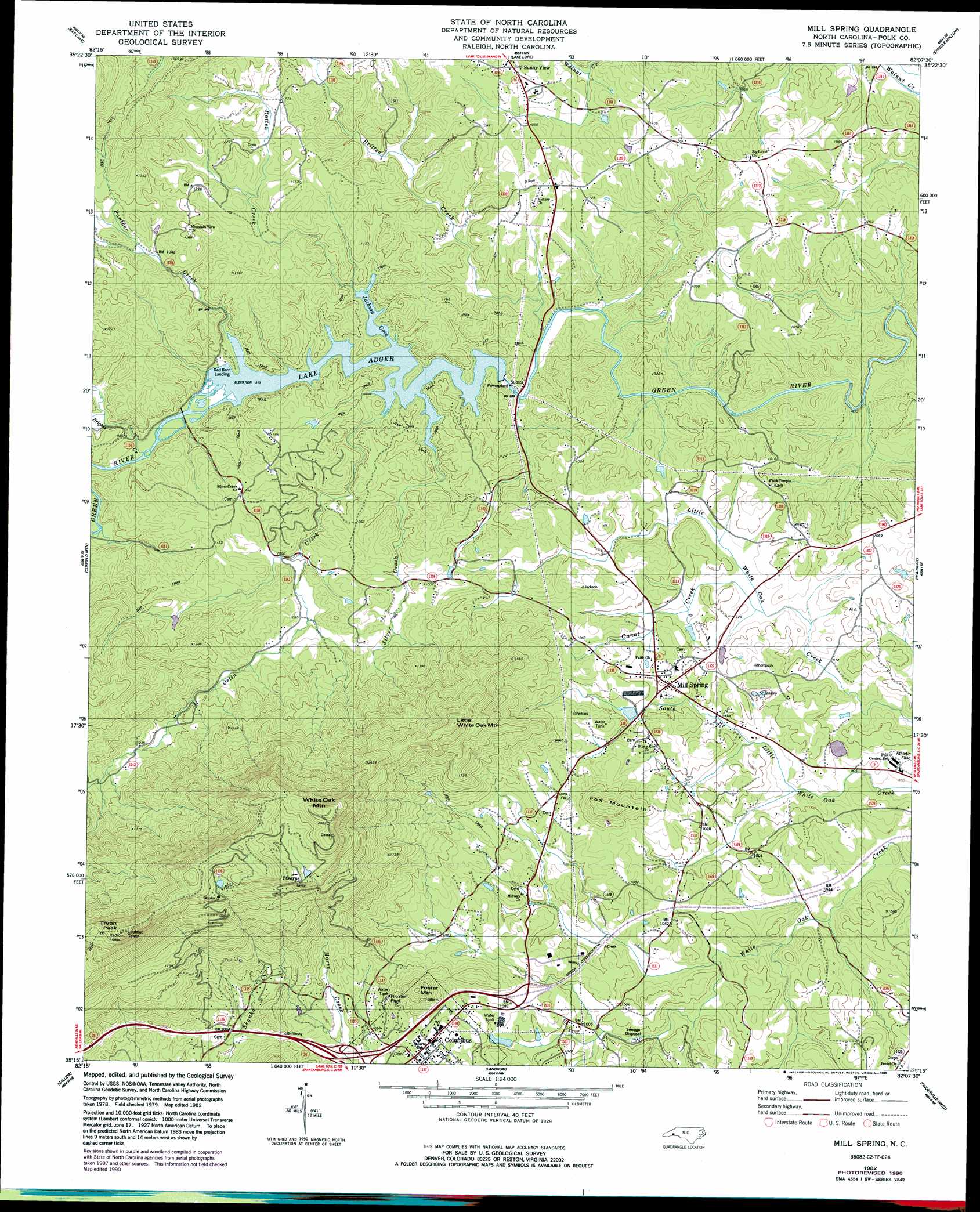
Mill Spring Topo Map North Carolina
To zoom in, hover over the map of Mill Spring
USGS Topo Quad 35082c2 - 1:24,000 scale
| Topo Map Name: | Mill Spring |
| USGS Topo Quad ID: | 35082c2 |
| Print Size: | ca. 21 1/4" wide x 27" high |
| Southeast Coordinates: | 35.25° N latitude / 82.125° W longitude |
| Map Center Coordinates: | 35.3125° N latitude / 82.1875° W longitude |
| U.S. State: | NC |
| Filename: | o35082c2.jpg |
| Download Map JPG Image: | Mill Spring topo map 1:24,000 scale |
| Map Type: | Topographic |
| Topo Series: | 7.5´ |
| Map Scale: | 1:24,000 |
| Source of Map Images: | United States Geological Survey (USGS) |
| Alternate Map Versions: |
Mill Spring NC 1982, updated 1983 Download PDF Buy paper map Mill Spring NC 1982, updated 1990 Download PDF Buy paper map Mill Spring NC 2010 Download PDF Buy paper map Mill Spring NC 2013 Download PDF Buy paper map Mill Spring NC 2016 Download PDF Buy paper map |
1:24,000 Topo Quads surrounding Mill Spring
Oteen |
Black Mountain |
Moffitt Hill |
Sugar Hill |
Glenwood |
Fruitland |
Bat Cave |
Lake Lure |
Shingle Hollow |
Rutherfordton North |
Hendersonville |
Cliffield Mountain |
Mill Spring |
Pea Ridge |
Rutherfordton South |
Zirconia |
Saluda |
Landrum |
Fingerville West |
Fingerville East |
Slater |
Tigerville |
Campobello |
Inman |
Valley Falls |
> Back to 35082a1 at 1:100,000 scale
> Back to 35082a1 at 1:250,000 scale
> Back to U.S. Topo Maps home
Mill Spring topo map: Gazetteer
Mill Spring: Bays
Jackson Cove elevation 277m 908′Mill Spring: Dams
Deering Milliken Dam elevation 322m 1056′Kaye Thompson Dam elevation 317m 1040′
Turner Shoals Dam elevation 268m 879′
Mill Spring: Populated Places
Columbus elevation 337m 1105′Mill Spring elevation 305m 1000′
Stearns elevation 783m 2568′
Sunny View elevation 340m 1115′
Mill Spring: Post Offices
Stearns Post Office (historical) elevation 783m 2568′Mill Spring: Reservoirs
Deering Milliken Lake elevation 322m 1056′Kaye Thompson Lake elevation 317m 1040′
Lake Adger elevation 268m 879′
Mill Spring: Streams
Brights Creek elevation 279m 915′Britten Creek elevation 250m 820′
Canal Creek elevation 279m 915′
Ostin Creek elevation 281m 921′
Panther Creek elevation 279m 915′
Rash Creek elevation 279m 915′
Rotten Creek elevation 278m 912′
Silver Creek elevation 282m 925′
Mill Spring: Summits
Foster Mountain elevation 483m 1584′Fox Mountain elevation 463m 1519′
Little White Oak Mountain elevation 714m 2342′
Tryon Peak elevation 974m 3195′
White Oak Mountain elevation 926m 3038′
Mill Spring: Valleys
Spicer Cove elevation 292m 958′Mill Spring digital topo map on disk
Buy this Mill Spring topo map showing relief, roads, GPS coordinates and other geographical features, as a high-resolution digital map file on DVD:
South Carolina, Western North Carolina & Northeastern Georgia
Buy digital topo maps: South Carolina, Western North Carolina & Northeastern Georgia