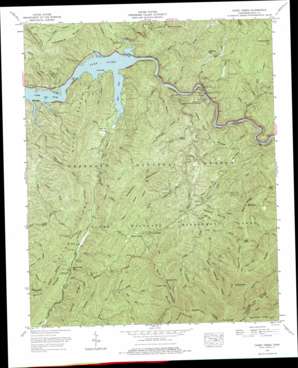
Caney Creek Topo Map Tennessee
To zoom in, hover over the map of Caney Creek
USGS Topo Quad 35084a5 - 1:24,000 scale
| Topo Map Name: | Caney Creek |
| USGS Topo Quad ID: | 35084a5 |
| Print Size: | ca. 21 1/4" wide x 27" high |
| Southeast Coordinates: | 35° N latitude / 84.5° W longitude |
| Map Center Coordinates: | 35.0625° N latitude / 84.5625° W longitude |
| U.S. State: | TN |
| Filename: | o35084a5.jpg |
| Download Map JPG Image: | Caney Creek topo map 1:24,000 scale |
| Map Type: | Topographic |
| Topo Series: | 7.5´ |
| Map Scale: | 1:24,000 |
| Source of Map Images: | United States Geological Survey (USGS) |
| Alternate Map Versions: |
Caney Creek TN 1935 Download PDF Buy paper map Caney Creek TN 1938 Download PDF Buy paper map Caney Creek TN 1938, updated 1954 Download PDF Buy paper map Caney Creek TN 1967, updated 1970 Download PDF Buy paper map Caney Creek TN 1967, updated 1975 Download PDF Buy paper map Caney Creek TN 1999, updated 2001 Download PDF Buy paper map Caney Creek TN 2003, updated 2004 Download PDF Buy paper map Caney Creek TN 2011 Download PDF Buy paper map Caney Creek TN 2013 Download PDF Buy paper map Caney Creek TN 2016 Download PDF Buy paper map |
| FStopo: | US Forest Service topo Caney Creek is available: Download FStopo PDF Download FStopo TIF |
1:24,000 Topo Quads surrounding Caney Creek
> Back to 35084a1 at 1:100,000 scale
> Back to 35084a1 at 1:250,000 scale
> Back to U.S. Topo Maps home
Caney Creek topo map: Gazetteer
Caney Creek: Bays
Sylco Inlet elevation 255m 836′Caney Creek: Canals
Ocoee Flume elevation 349m 1145′Caney Creek: Crossings
Haskins Ford (historical) elevation 255m 836′Caney Creek: Flats
Dutch Fields elevation 466m 1528′Caney Creek: Gaps
Blue Ridge Gap elevation 374m 1227′Eaststep Gap elevation 405m 1328′
Grassy Gap elevation 769m 2522′
Low Gap elevation 744m 2440′
Low Gap elevation 659m 2162′
Pace Gap elevation 496m 1627′
Caney Creek: Islands
Mitchell Hill elevation 260m 853′Caney Creek: Parks
Mac Point Recreation Area elevation 255m 836′Ocoee Wildlife Management Area elevation 500m 1640′
Parksville Lake Recreation Area elevation 260m 853′
Caney Creek: Populated Places
Caney Creek elevation 267m 875′Chable (historical) elevation 316m 1036′
Sylco elevation 333m 1092′
Caney Creek: Ridges
Bark Legging Lead elevation 936m 3070′Fork Ridge elevation 882m 2893′
Fork Ridge elevation 1007m 3303′
Groundhog Ridge elevation 1083m 3553′
Hogback Ridge elevation 477m 1564′
Indian Flat Ridge elevation 441m 1446′
Licklog Ridge elevation 1113m 3651′
Peavine Ridge elevation 835m 2739′
Peavine Ridge elevation 909m 2982′
Sylco Ridge elevation 505m 1656′
Sylco Ridge elevation 434m 1423′
Tarkiln Ridge elevation 507m 1663′
Thornburg Ridge elevation 576m 1889′
Wolf Ridge elevation 712m 2335′
Yellow Stand Lead elevation 588m 1929′
Caney Creek: Streams
Big Creek elevation 452m 1482′Big Creek elevation 255m 836′
Brown Camp Branch elevation 395m 1295′
Clear Creek elevation 269m 882′
Coon Branch elevation 356m 1167′
Coon Creek elevation 275m 902′
Coulter Branch elevation 269m 882′
Dutch Creek elevation 308m 1010′
Fall Branch elevation 260m 853′
Gate Branch elevation 349m 1145′
Goforth Creek elevation 287m 941′
Graham Branch elevation 434m 1423′
Greasy Creek elevation 256m 839′
Gunterpole Branch elevation 387m 1269′
Haigler Branch elevation 333m 1092′
Hand Branch elevation 352m 1154′
Haskins Creek elevation 255m 836′
Hawkins Branch elevation 324m 1062′
Indian Flat Branch elevation 416m 1364′
Iron Ore Branch elevation 258m 846′
Island Creek elevation 255m 836′
Jake Branch elevation 255m 836′
Johnson Branch elevation 256m 839′
Laurel Branch elevation 350m 1148′
Laurel Branch elevation 443m 1453′
Laurel Creek elevation 382m 1253′
Left Prong Caney Creek elevation 257m 843′
Little Caney Branch elevation 256m 839′
Little Fall Branch elevation 304m 997′
Little Sylco Branch elevation 309m 1013′
Low Gap Branch elevation 445m 1459′
Madden Branch elevation 288m 944′
Middle Fork Sheeds Creek elevation 423m 1387′
Milan Branch elevation 256m 839′
Mitchell Branch elevation 256m 839′
North Fork Sheeds Creek elevation 424m 1391′
North Prong Brown Camp Branch elevation 434m 1423′
Pace Branch elevation 427m 1400′
Parks Branch elevation 352m 1154′
Penitentiary Branch elevation 518m 1699′
Peter Camp Branch elevation 418m 1371′
Peter Hall Branch elevation 256m 839′
Right Prong Caney Creek elevation 280m 918′
Rock Creek elevation 256m 839′
Short Creek elevation 303m 994′
South Fork Sheeds Creek elevation 423m 1387′
Sylco Creek elevation 255m 836′
Tollgate Branch elevation 257m 843′
Tolliver Shanty Branch elevation 287m 941′
Wildcat Branch elevation 335m 1099′
York Branch elevation 403m 1322′
Caney Creek: Summits
Bearpen Hill elevation 791m 2595′Chestnut Mountain elevation 628m 2060′
Chimneytop elevation 1137m 3730′
Hogback Mountain elevation 649m 2129′
Peavine Mountain elevation 864m 2834′
Caney Creek: Trails
Big Creek Trail elevation 752m 2467′Big Frog Trail elevation 1065m 3494′
Blue Ridge Trail elevation 442m 1450′
Caney Creek Trail elevation 475m 1558′
Chestnut Mountain Trail elevation 940m 3083′
Fork Ridge Trail elevation 861m 2824′
Grassy Gap Trail elevation 725m 2378′
Grassy Gap Trail elevation 696m 2283′
Hogback Trail elevation 459m 1505′
Indian Flat Trail elevation 444m 1456′
Licklog Ridge Trail elevation 1029m 3375′
Low Gap Trail elevation 661m 2168′
Rough Creek Trail elevation 651m 2135′
Sylco Creek Trail elevation 368m 1207′
Wolf Ridge Trail elevation 684m 2244′
Wolf Ridge Trail elevation 1109m 3638′
Caney Creek digital topo map on disk
Buy this Caney Creek topo map showing relief, roads, GPS coordinates and other geographical features, as a high-resolution digital map file on DVD:


