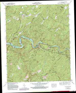
Mcfarland Topo Map Tennessee
To zoom in, hover over the map of Mcfarland
USGS Topo Quad 35084b4 - 1:24,000 scale
| Topo Map Name: | Mcfarland |
| USGS Topo Quad ID: | 35084b4 |
| Print Size: | ca. 21 1/4" wide x 27" high |
| Southeast Coordinates: | 35.125° N latitude / 84.375° W longitude |
| Map Center Coordinates: | 35.1875° N latitude / 84.4375° W longitude |
| U.S. State: | TN |
| Filename: | o35084b4.jpg |
| Download Map JPG Image: | Mcfarland topo map 1:24,000 scale |
| Map Type: | Topographic |
| Topo Series: | 7.5´ |
| Map Scale: | 1:24,000 |
| Source of Map Images: | United States Geological Survey (USGS) |
| Alternate Map Versions: |
Mc Farland TN 1936 Download PDF Buy paper map Mc Farland TN 1957, updated 1959 Download PDF Buy paper map Mc Farland TN 1957, updated 1974 Download PDF Buy paper map Mc Farland TN 1957, updated 1980 Download PDF Buy paper map Mc Farland TN 2003, updated 2004 Download PDF Buy paper map McFarland TN 2011 Download PDF Buy paper map McFarland TN 2013 Download PDF Buy paper map McFarland TN 2016 Download PDF Buy paper map |
| FStopo: | US Forest Service topo McFarland is available: Download FStopo PDF Download FStopo TIF |
1:24,000 Topo Quads surrounding Mcfarland
> Back to 35084a1 at 1:100,000 scale
> Back to 35084a1 at 1:250,000 scale
> Back to U.S. Topo Maps home
Mcfarland topo map: Gazetteer
Mcfarland: Bridges
Long Ford Bridge elevation 250m 820′Mcfarland: Crossings
Long Ford elevation 250m 820′Mcfarland: Gaps
Chestnut Gap elevation 630m 2066′Kirkland Gap elevation 655m 2148′
The Narrows elevation 268m 879′
Mcfarland: Islands
Big Island elevation 234m 767′Cane Island elevation 244m 800′
Little Rock Island elevation 235m 770′
Woody Island elevation 231m 757′
Mcfarland: Parks
Big Bend Recreation Area elevation 250m 820′Hiwassee State Scenic River elevation 232m 761′
Lost Creek Recreation Area elevation 332m 1089′
Powerhouse Recreation Area elevation 270m 885′
Towee Recreation Area elevation 268m 879′
Mcfarland: Populated Places
Maggies Mill elevation 253m 830′McFarland elevation 286m 938′
Probst elevation 249m 816′
Reliance elevation 235m 770′
Rymers (historical) elevation 451m 1479′
Servilla elevation 293m 961′
Towee elevation 337m 1105′
Mcfarland: Ridges
Bearpen Lead elevation 640m 2099′Duckett Ridge elevation 494m 1620′
Finger Board Ridge elevation 491m 1610′
Flint Ridge elevation 517m 1696′
Jones Ridge elevation 465m 1525′
Towee Ridge elevation 491m 1610′
Mcfarland: Streams
Beach Bottom Branch elevation 245m 803′Bearpen Branch elevation 322m 1056′
Big Hopper Camp Branch elevation 261m 856′
Big Lost Creek elevation 230m 754′
Boring Branch elevation 281m 921′
Butler Branch elevation 271m 889′
Cappy Branch elevation 244m 800′
Carden Branch elevation 268m 879′
Chestnut Gap Branch elevation 429m 1407′
Childers Creek elevation 229m 751′
Coker Creek elevation 277m 908′
Deep Branch elevation 270m 885′
Ellis Creek elevation 229m 751′
Hicks Branch elevation 350m 1148′
Laurel Branch elevation 312m 1023′
Little Branch elevation 277m 908′
Little Hopper Camp Branch elevation 285m 935′
Little Lost Creek elevation 245m 803′
Loss Creek elevation 271m 889′
Lower Jobe Patch Branch elevation 253m 830′
Mary Branch elevation 289m 948′
Perrys Branch elevation 240m 787′
Piney Flats Branch elevation 320m 1049′
Plum Branch elevation 250m 820′
Puncheon Camp Branch elevation 401m 1315′
Rock Island Branch elevation 259m 849′
Rymer Camp Branch elevation 338m 1108′
Smith Branch elevation 248m 813′
Smith Creek elevation 260m 853′
Springtown Branch elevation 255m 836′
Sulphur Springs Branch elevation 434m 1423′
Switch Branch elevation 235m 770′
Tinker Branch elevation 248m 813′
Towee Creek elevation 249m 816′
Wallace Creek elevation 351m 1151′
West Fork Butler Branch elevation 301m 987′
West Fork Wolf Creek elevation 425m 1394′
Wildcat Creek elevation 259m 849′
Wolf Creek elevation 289m 948′
Mcfarland: Summits
Big Rock Island elevation 270m 885′Hankins Mountain elevation 469m 1538′
McCulley Mountain elevation 489m 1604′
Pond Mountain elevation 437m 1433′
Towee Mountain elevation 499m 1637′
White Oak Mountain elevation 500m 1640′
Mcfarland: Trails
John Muir National Recreation Trail elevation 308m 1010′Smith Mountain Trail elevation 659m 2162′
Mcfarland: Valleys
Big Hollow elevation 243m 797′Dark Hollow elevation 291m 954′
Mcfarland digital topo map on disk
Buy this Mcfarland topo map showing relief, roads, GPS coordinates and other geographical features, as a high-resolution digital map file on DVD:


