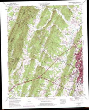
South Cleveland Topo Map Tennessee
To zoom in, hover over the map of South Cleveland
USGS Topo Quad 35084b8 - 1:24,000 scale
| Topo Map Name: | South Cleveland |
| USGS Topo Quad ID: | 35084b8 |
| Print Size: | ca. 21 1/4" wide x 27" high |
| Southeast Coordinates: | 35.125° N latitude / 84.875° W longitude |
| Map Center Coordinates: | 35.1875° N latitude / 84.9375° W longitude |
| U.S. State: | TN |
| Filename: | o35084b8.jpg |
| Download Map JPG Image: | South Cleveland topo map 1:24,000 scale |
| Map Type: | Topographic |
| Topo Series: | 7.5´ |
| Map Scale: | 1:24,000 |
| Source of Map Images: | United States Geological Survey (USGS) |
| Alternate Map Versions: |
South Cleveland TN 1935 Download PDF Buy paper map South Cleveland TN 1943, updated 1946 Download PDF Buy paper map South Cleveland TN 1943, updated 1946 Download PDF Buy paper map South Cleveland TN 1943, updated 1960 Download PDF Buy paper map South Cleveland TN 1943, updated 1966 Download PDF Buy paper map South Cleveland TN 1965, updated 1966 Download PDF Buy paper map South Cleveland TN 1965, updated 1977 Download PDF Buy paper map South Cleveland TN 2010 Download PDF Buy paper map South Cleveland TN 2013 Download PDF Buy paper map South Cleveland TN 2016 Download PDF Buy paper map |
1:24,000 Topo Quads surrounding South Cleveland
> Back to 35084a1 at 1:100,000 scale
> Back to 35084a1 at 1:250,000 scale
> Back to U.S. Topo Maps home
South Cleveland topo map: Gazetteer
South Cleveland: Crossings
Interchange 20 elevation 268m 879′Interchange 25 elevation 267m 875′
South Cleveland: Gaps
Lewis Gap elevation 345m 1131′Payne Gap elevation 291m 954′
South Cleveland: Mines
King Mine elevation 384m 1259′King Mine elevation 349m 1145′
King Prospect elevation 335m 1099′
South Cleveland: Parks
Johnston Park elevation 264m 866′South Cleveland: Populated Places
Annadale elevation 263m 862′Baugh Spring elevation 263m 862′
Bent Tree Acres elevation 263m 862′
Bigsby Creek Estates elevation 228m 748′
Brentwood Estates elevation 254m 833′
Cleveland elevation 265m 869′
Countryside Village elevation 226m 741′
Davis Heights elevation 219m 718′
Eureka Hills elevation 234m 767′
Freewill elevation 237m 777′
Hidden Valley elevation 242m 793′
Hills and Dales elevation 243m 797′
Hope Acres elevation 233m 764′
Hopewell elevation 220m 721′
Hopewell Estates elevation 229m 751′
Imperial Group Subdivision elevation 334m 1095′
Jacen Gorbett Subdivision elevation 238m 780′
Laurel Ridge elevation 281m 921′
Laurel Springs elevation 227m 744′
Laurel Valley elevation 225m 738′
Lee Estates elevation 226m 741′
Meadowview elevation 240m 787′
Mountainbrook elevation 238m 780′
Northwest Acres elevation 221m 725′
Overbrook elevation 235m 770′
Prospect elevation 242m 793′
Ridgewood elevation 229m 751′
Rolling Hills elevation 231m 757′
South Rolling Hills elevation 230m 754′
Varnell Estates elevation 244m 800′
Villa Heights elevation 226m 741′
Westview Heights elevation 244m 800′
South Cleveland: Post Offices
Cleveland Post Office elevation 264m 866′South Cleveland: Reservoirs
Stone Lake elevation 251m 823′South Cleveland: Ridges
Apison Ridge elevation 301m 987′Candies Creek Ridge elevation 309m 1013′
Orphan Ridge elevation 282m 925′
Rollins Ridge elevation 329m 1079′
South Cleveland: Springs
Baugh Spring elevation 273m 895′Fletcher Spring elevation 232m 761′
Hall Spring elevation 236m 774′
Reed Spring elevation 250m 820′
Varnell Springs elevation 242m 793′
South Cleveland: Streams
Allen Mill Fork elevation 237m 777′Apison Fork elevation 233m 764′
Beech Springs Branch elevation 222m 728′
Bigsby Creek elevation 214m 702′
Blackburn Creek elevation 255m 836′
Bulldog Branch elevation 242m 793′
Harris Creek elevation 224m 734′
Johnson Branch elevation 226m 741′
Lick Branch elevation 216m 708′
North Fork Harris Creek elevation 266m 872′
Runner Branch elevation 223m 731′
South Fork Harris Creek elevation 266m 872′
Spring Branch elevation 238m 780′
South Cleveland: Valleys
Blackburn Hollow elevation 262m 859′Hoot'n Hollow elevation 267m 875′
Rabbit Valley elevation 234m 767′
Shingle Hollow elevation 242m 793′
Stillhouse Hollow elevation 310m 1017′
Vines Hollow elevation 233m 764′
White Oak Valley elevation 262m 859′
South Cleveland digital topo map on disk
Buy this South Cleveland topo map showing relief, roads, GPS coordinates and other geographical features, as a high-resolution digital map file on DVD:


