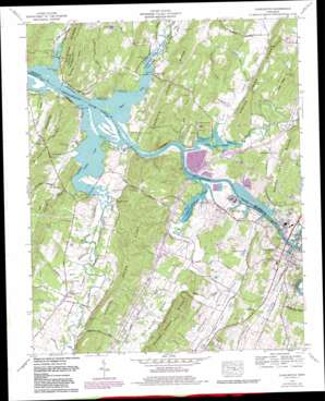
Charleston Topo Map Tennessee
To zoom in, hover over the map of Charleston
USGS Topo Quad 35084c7 - 1:24,000 scale
| Topo Map Name: | Charleston |
| USGS Topo Quad ID: | 35084c7 |
| Print Size: | ca. 21 1/4" wide x 27" high |
| Southeast Coordinates: | 35.25° N latitude / 84.75° W longitude |
| Map Center Coordinates: | 35.3125° N latitude / 84.8125° W longitude |
| U.S. State: | TN |
| Filename: | o35084c7.jpg |
| Download Map JPG Image: | Charleston topo map 1:24,000 scale |
| Map Type: | Topographic |
| Topo Series: | 7.5´ |
| Map Scale: | 1:24,000 |
| Source of Map Images: | United States Geological Survey (USGS) |
| Alternate Map Versions: |
Charleston TN 1935 Download PDF Buy paper map Charleston TN 1942, updated 1960 Download PDF Buy paper map Charleston TN 1942, updated 1965 Download PDF Buy paper map Charleston TN 1943, updated 1946 Download PDF Buy paper map Charleston TN 1965, updated 1966 Download PDF Buy paper map Charleston TN 1965, updated 1980 Download PDF Buy paper map Charleston TN 2010 Download PDF Buy paper map Charleston TN 2013 Download PDF Buy paper map Charleston TN 2016 Download PDF Buy paper map |
1:24,000 Topo Quads surrounding Charleston
> Back to 35084a1 at 1:100,000 scale
> Back to 35084a1 at 1:250,000 scale
> Back to U.S. Topo Maps home
Charleston topo map: Gazetteer
Charleston: Cliffs
Eads Bluff elevation 212m 695′Sivils Bluff elevation 239m 784′
Charleston: Crossings
Interchange 33 elevation 236m 774′Interchange 36 elevation 221m 725′
Raht Ferry (historical) elevation 208m 682′
Walkers Ferry (historical) elevation 208m 682′
Charleston: Gaps
Hooper Gap elevation 294m 964′Charleston: Islands
Ledford Island elevation 208m 682′Charleston: Parks
Candies Creek Wildlife Management Area elevation 209m 685′Rogers Creek Wildlife Management Area elevation 208m 682′
Charleston: Populated Places
Carriage Hills elevation 265m 869′Charleston elevation 222m 728′
Eureka elevation 224m 734′
Gibson Farm Subdivision elevation 218m 715′
Harbor Hills elevation 219m 718′
Lamontville elevation 211m 692′
Marina Hills elevation 218m 715′
Monte Carlo Estates elevation 226m 741′
Mount Harmony elevation 218m 715′
Wilson Heights elevation 232m 761′
Charleston: Reservoirs
Simpson Pond elevation 218m 715′Charleston: Ridges
Gilbreath Ridge elevation 294m 964′Humphreys Ridge elevation 299m 980′
Peak Ridge elevation 272m 892′
Charleston: Springs
Bradford Spring elevation 214m 702′Cofer Spring elevation 223m 731′
Gibson Spring elevation 217m 711′
Renslow Spring elevation 212m 695′
Russell Spring elevation 220m 721′
Charleston: Streams
Beaverdam Branch elevation 210m 688′Buckhorn Creek elevation 208m 682′
Candies Creek elevation 208m 682′
Copper Branch elevation 208m 682′
Gee Branch elevation 209m 685′
Kibble Branch elevation 211m 692′
Little South Mouse Creek elevation 210m 688′
Monk Branch elevation 208m 682′
North Mouse Creek elevation 208m 682′
Price Creek elevation 208m 682′
Riggins Branch elevation 212m 695′
Rogers Creek elevation 208m 682′
Sivils Branch elevation 208m 682′
South Mouse Creek elevation 209m 685′
Spring Creek elevation 208m 682′
Charleston: Summits
Mount Evil elevation 310m 1017′Charleston: Valleys
Candies Creek Valley elevation 208m 682′Mouse Creek Valley elevation 208m 682′
Racepath Hollow elevation 211m 692′
Rogers Creek Valley elevation 208m 682′
Walker Valley elevation 211m 692′
Charleston digital topo map on disk
Buy this Charleston topo map showing relief, roads, GPS coordinates and other geographical features, as a high-resolution digital map file on DVD:


