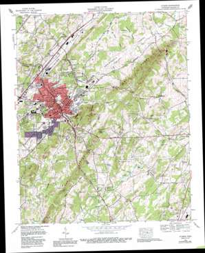
Athens Topo Map Tennessee
To zoom in, hover over the map of Athens
USGS Topo Quad 35084d5 - 1:24,000 scale
| Topo Map Name: | Athens |
| USGS Topo Quad ID: | 35084d5 |
| Print Size: | ca. 21 1/4" wide x 27" high |
| Southeast Coordinates: | 35.375° N latitude / 84.5° W longitude |
| Map Center Coordinates: | 35.4375° N latitude / 84.5625° W longitude |
| U.S. State: | TN |
| Filename: | o35084d5.jpg |
| Download Map JPG Image: | Athens topo map 1:24,000 scale |
| Map Type: | Topographic |
| Topo Series: | 7.5´ |
| Map Scale: | 1:24,000 |
| Source of Map Images: | United States Geological Survey (USGS) |
| Alternate Map Versions: |
Athens TN 1935 Download PDF Buy paper map Athens TN 1944, updated 1946 Download PDF Buy paper map Athens TN 1944, updated 1960 Download PDF Buy paper map Athens TN 1964, updated 1966 Download PDF Buy paper map Athens TN 1964, updated 1977 Download PDF Buy paper map Athens TN 1964, updated 1980 Download PDF Buy paper map Athens TN 1964, updated 1989 Download PDF Buy paper map Athens TN 1964, updated 1996 Download PDF Buy paper map Athens TN 2010 Download PDF Buy paper map Athens TN 2013 Download PDF Buy paper map Athens TN 2016 Download PDF Buy paper map |
1:24,000 Topo Quads surrounding Athens
> Back to 35084a1 at 1:100,000 scale
> Back to 35084a1 at 1:250,000 scale
> Back to U.S. Topo Maps home
Athens topo map: Gazetteer
Athens: Airports
McMinn County Airport elevation 254m 833′Athens: Dams
Chilohowee Rod and Gun Club Dam elevation 241m 790′Athens: Parks
Fisher Field elevation 292m 958′Knox Park elevation 251m 823′
McMinn Field elevation 282m 925′
Sunset Park elevation 262m 859′
Athens: Populated Places
Addison elevation 270m 885′Alta Vista elevation 299m 980′
Athens elevation 262m 859′
Avalon Heights elevation 299m 980′
Bethsalem elevation 244m 800′
Bohannon Addition elevation 287m 941′
Brewer Addition elevation 280m 918′
Bryson elevation 292m 958′
Cedar Springs elevation 259m 849′
Clem Jones Heights elevation 297m 974′
Fairview elevation 298m 977′
Forrest Hills elevation 318m 1043′
Heritage Park elevation 281m 921′
Housley Addition elevation 280m 918′
Hutsell elevation 296m 971′
Ingleside Hill elevation 274m 898′
Knox Park elevation 285m 935′
Lockmiller Addition elevation 273m 895′
Mashburn elevation 256m 839′
Morningside elevation 273m 895′
Mount Cumberland elevation 269m 882′
Mount Verd elevation 291m 954′
North Liberty elevation 259m 849′
Ridgeway elevation 291m 954′
Sunset View elevation 296m 971′
Tellico Hills elevation 292m 958′
Westwood Heights elevation 293m 961′
Zion Hill elevation 254m 833′
Athens: Post Offices
Athens Post Office elevation 269m 882′Athens: Reservoirs
Chilohowee Rod and Gun Club Lake elevation 241m 790′Athens: Ridges
Mill Ridge elevation 351m 1151′Athens: Springs
Cave Spring elevation 257m 843′Cave Spring elevation 264m 866′
Cedar Springs elevation 256m 839′
Glenn Spring elevation 287m 941′
Guthrie Spring elevation 261m 856′
Ingleside Spring elevation 267m 875′
Rudd Spring elevation 242m 793′
Athens: Streams
Black Branch elevation 255m 836′Cave Spring Branch elevation 243m 797′
Cedar Springs Branch elevation 252m 826′
Dry Branch elevation 231m 757′
Guthrie Branch elevation 249m 816′
Jackson Branch elevation 243m 797′
Johnson Branch elevation 277m 908′
Liberty Branch elevation 249m 816′
Little North Mouse Creek elevation 249m 816′
Middle Creek elevation 237m 777′
Rudd Spring Branch elevation 233m 764′
Snyder Branch elevation 253m 830′
Sokey Branch elevation 263m 862′
Walker Branch elevation 255m 836′
Wilkins Spring Branch elevation 235m 770′
Athens: Summits
Kelly Hill elevation 346m 1135′The Knobs elevation 349m 1145′
Athens: Valleys
Gilbert Hollow elevation 261m 856′Johns River Hollow elevation 279m 915′
Sweetwater Valley elevation 285m 935′
Valley View Hollow elevation 272m 892′
Athens digital topo map on disk
Buy this Athens topo map showing relief, roads, GPS coordinates and other geographical features, as a high-resolution digital map file on DVD:


