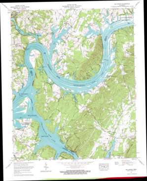
Big Spring Topo Map Tennessee
To zoom in, hover over the map of Big Spring
USGS Topo Quad 35084d8 - 1:24,000 scale
| Topo Map Name: | Big Spring |
| USGS Topo Quad ID: | 35084d8 |
| Print Size: | ca. 21 1/4" wide x 27" high |
| Southeast Coordinates: | 35.375° N latitude / 84.875° W longitude |
| Map Center Coordinates: | 35.4375° N latitude / 84.9375° W longitude |
| U.S. State: | TN |
| Filename: | o35084d8.jpg |
| Download Map JPG Image: | Big Spring topo map 1:24,000 scale |
| Map Type: | Topographic |
| Topo Series: | 7.5´ |
| Map Scale: | 1:24,000 |
| Source of Map Images: | United States Geological Survey (USGS) |
| Alternate Map Versions: |
Big Spring TN 1935 Download PDF Buy paper map Big Spring TN 1942 Download PDF Buy paper map Big Spring TN 1943, updated 1946 Download PDF Buy paper map Big Spring TN 1967, updated 1969 Download PDF Buy paper map Big Spring TN 1967, updated 1970 Download PDF Buy paper map Big Spring TN 1967, updated 1996 Download PDF Buy paper map Big Spring TN 2010 Download PDF Buy paper map Big Spring TN 2013 Download PDF Buy paper map Big Spring TN 2016 Download PDF Buy paper map |
1:24,000 Topo Quads surrounding Big Spring
> Back to 35084a1 at 1:100,000 scale
> Back to 35084a1 at 1:250,000 scale
> Back to U.S. Topo Maps home
Big Spring topo map: Gazetteer
Big Spring: Airports
Mark Anton Airport elevation 216m 708′Big Spring: Bars
Hiwassee Shoals elevation 208m 682′Kellys Shoals elevation 208m 682′
Leas Shoals elevation 208m 682′
Big Spring: Bays
Armstrong Slough elevation 208m 682′Early Slough elevation 208m 682′
Holder Slough elevation 208m 682′
Powell Slough elevation 208m 682′
Purser Slough elevation 208m 682′
Roberts Slough elevation 208m 682′
Big Spring: Bends
Armstrong Bend elevation 210m 688′Gillespie Bend elevation 257m 843′
Big Spring: Bridges
Rattan Bridge elevation 208m 682′The Culbert Bridge elevation 209m 685′
Big Spring: Cliffs
Garrison Bluff elevation 237m 777′Powell Bluff elevation 214m 702′
Big Spring: Crossings
Armstrong Ferry (historical) elevation 208m 682′Cotton Port Ferry (historical) elevation 208m 682′
Pineland Ferry (historical) elevation 208m 682′
Tucker Ferry (historical) elevation 208m 682′
Big Spring: Guts
Gholdston Slough elevation 208m 682′Good Hope Slough elevation 208m 682′
Hardin Slough elevation 208m 682′
Hiwassee Slough elevation 208m 682′
Ziegler Slough elevation 208m 682′
Big Spring: Islands
Hiwassee Island elevation 214m 702′Moon Island elevation 211m 692′
Ziegler Island (historical) elevation 208m 682′
Big Spring: Parks
Armstrong Ferry Recreation Area elevation 220m 721′Blythe Ferry Goose Management Area elevation 209m 685′
Cotton Port Wildlife Management Area elevation 208m 682′
Hiwassee Wildlife Refuge elevation 210m 688′
Tennessee Wildlife Refuge elevation 211m 692′
Big Spring: Populated Places
Big Spring elevation 215m 705′Cayuga Town (historical) elevation 208m 682′
Cotton Port (historical) elevation 215m 705′
Edgewater elevation 257m 843′
Pineland (historical) elevation 215m 705′
Piney Acres elevation 214m 702′
Big Spring: Ridges
Jenkins Ridge elevation 294m 964′Mount Carmel Ridge elevation 294m 964′
Big Spring: Springs
Armstrong Spring elevation 213m 698′Ashley Spring elevation 213m 698′
Big Spring elevation 213m 698′
Powell Spring elevation 218m 715′
Powell Spring elevation 230m 754′
Russell Spring elevation 224m 734′
Whitmore Spring elevation 213m 698′
Big Spring: Streams
Barley Branch elevation 208m 682′Beta Branch elevation 218m 715′
Brown Branch elevation 208m 682′
Chatton Spring Branch elevation 208m 682′
Clear Branch elevation 208m 682′
Coppinger Creek elevation 208m 682′
Crawford Branch elevation 208m 682′
Crooked Branch elevation 208m 682′
Good Hope Branch elevation 208m 682′
Lagoon Branch elevation 208m 682′
Lick Branch elevation 208m 682′
Mud Creek elevation 208m 682′
Nance Branch elevation 208m 682′
Rattan Branch elevation 208m 682′
Richland Creek elevation 208m 682′
Russell Branch elevation 208m 682′
Sexton Branch elevation 208m 682′
Big Spring: Valleys
Bird Hollow elevation 211m 692′Colbaugh Hollow elevation 226m 741′
McDonald Hollow elevation 208m 682′
Roberts Hollow elevation 208m 682′
Big Spring digital topo map on disk
Buy this Big Spring topo map showing relief, roads, GPS coordinates and other geographical features, as a high-resolution digital map file on DVD:


