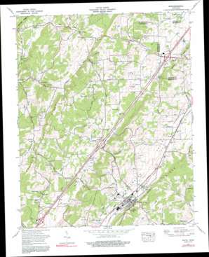
Niota Topo Map Tennessee
To zoom in, hover over the map of Niota
USGS Topo Quad 35084e5 - 1:24,000 scale
| Topo Map Name: | Niota |
| USGS Topo Quad ID: | 35084e5 |
| Print Size: | ca. 21 1/4" wide x 27" high |
| Southeast Coordinates: | 35.5° N latitude / 84.5° W longitude |
| Map Center Coordinates: | 35.5625° N latitude / 84.5625° W longitude |
| U.S. State: | TN |
| Filename: | o35084e5.jpg |
| Download Map JPG Image: | Niota topo map 1:24,000 scale |
| Map Type: | Topographic |
| Topo Series: | 7.5´ |
| Map Scale: | 1:24,000 |
| Source of Map Images: | United States Geological Survey (USGS) |
| Alternate Map Versions: |
Niota TN 1935 Download PDF Buy paper map Niota TN 1941, updated 1960 Download PDF Buy paper map Niota TN 1941, updated 1967 Download PDF Buy paper map Niota TN 1942 Download PDF Buy paper map Niota TN 1974, updated 1976 Download PDF Buy paper map Niota TN 1974, updated 1991 Download PDF Buy paper map Niota TN 1974, updated 1996 Download PDF Buy paper map Niota TN 2010 Download PDF Buy paper map Niota TN 2013 Download PDF Buy paper map Niota TN 2016 Download PDF Buy paper map |
1:24,000 Topo Quads surrounding Niota
> Back to 35084e1 at 1:100,000 scale
> Back to 35084a1 at 1:250,000 scale
> Back to U.S. Topo Maps home
Niota topo map: Gazetteer
Niota: Crossings
Interchange 52 elevation 268m 879′Interchange 56 elevation 277m 908′
Interchange 60 elevation 303m 994′
Niota: Dams
C A Waymier Dam elevation 283m 928′Sweetwater Creek Watershed Dam Number Sixteen elevation 293m 961′
Niota: Mines
Anderson Mine elevation 304m 997′Dupont Mine elevation 295m 967′
Garrison Mine elevation 318m 1043′
Holt Mine elevation 311m 1020′
Jones Mine elevation 309m 1013′
Kyker Mine elevation 286m 938′
McManus Mine elevation 319m 1046′
Richardson Mine elevation 313m 1026′
Richesin Mine elevation 314m 1030′
Small Mine elevation 309m 1013′
Wattenberger Mine elevation 292m 958′
Webb Mine elevation 323m 1059′
Niota: Populated Places
Acme Mill elevation 280m 918′Barton Mill elevation 264m 866′
Marshall Hill elevation 285m 935′
Mount Harmony elevation 320m 1049′
Murray Store elevation 286m 938′
Niota elevation 307m 1007′
Pine Grove elevation 247m 810′
Pond Hill elevation 308m 1010′
Prigmore elevation 299m 980′
Reagan elevation 294m 964′
Riddles Store elevation 303m 994′
Union Grove elevation 329m 1079′
Niota: Post Offices
Niota Post Office elevation 298m 977′Niota: Reservoirs
C A Waymier Lake elevation 283m 928′Sweetwater Creek Watershed Number Sixteen Reservoir elevation 293m 961′
Niota: Ridges
Niota Ridge elevation 370m 1213′Niota: Springs
Arnwine Spring elevation 268m 879′Cocker Spring elevation 268m 879′
Denton Spring elevation 272m 892′
Lathan Spring elevation 277m 908′
Malone Spring elevation 292m 958′
Murray Spring elevation 292m 958′
Richardson Spring elevation 280m 918′
Niota: Streams
East Fork North Mouse Creek elevation 272m 892′Foster Branch elevation 259m 849′
Lathan Spring Branch elevation 256m 839′
Niota digital topo map on disk
Buy this Niota topo map showing relief, roads, GPS coordinates and other geographical features, as a high-resolution digital map file on DVD:


