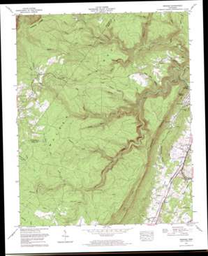
Pennine Topo Map Tennessee
To zoom in, hover over the map of Pennine
USGS Topo Quad 35084f8 - 1:24,000 scale
| Topo Map Name: | Pennine |
| USGS Topo Quad ID: | 35084f8 |
| Print Size: | ca. 21 1/4" wide x 27" high |
| Southeast Coordinates: | 35.625° N latitude / 84.875° W longitude |
| Map Center Coordinates: | 35.6875° N latitude / 84.9375° W longitude |
| U.S. State: | TN |
| Filename: | o35084f8.jpg |
| Download Map JPG Image: | Pennine topo map 1:24,000 scale |
| Map Type: | Topographic |
| Topo Series: | 7.5´ |
| Map Scale: | 1:24,000 |
| Source of Map Images: | United States Geological Survey (USGS) |
| Alternate Map Versions: |
Pennine TN 1935 Download PDF Buy paper map Pennine TN 1949 Download PDF Buy paper map Pennine TN 1973, updated 1974 Download PDF Buy paper map Pennine TN 1973, updated 1996 Download PDF Buy paper map Pennine TN 2010 Download PDF Buy paper map Pennine TN 2013 Download PDF Buy paper map Pennine TN 2016 Download PDF Buy paper map |
1:24,000 Topo Quads surrounding Pennine
> Back to 35084e1 at 1:100,000 scale
> Back to 35084a1 at 1:250,000 scale
> Back to U.S. Topo Maps home
Pennine topo map: Gazetteer
Pennine: Bends
Horseshoe Bend elevation 537m 1761′Whiteoak Bottoms elevation 297m 974′
Pennine: Falls
Stinging Fork Falls elevation 425m 1394′Pennine: Gaps
Shut in Gap elevation 461m 1512′Pennine: Mines
Kirkwood Number One Mine elevation 508m 1666′Norris Number One Mine elevation 497m 1630′
Rector Mine elevation 396m 1299′
Rocky Creek Number Six Mine elevation 494m 1620′
Pennine: Populated Places
Bonham elevation 468m 1535′Bonneville (historical) elevation 551m 1807′
Edgewood Hills elevation 250m 820′
Ideal Valley elevation 272m 892′
Milo elevation 563m 1847′
Pennine elevation 267m 875′
Pennine: Post Offices
Pennine Post Office (historical) elevation 268m 879′Pennine: Ridges
Walden Ridge elevation 534m 1751′Pennine: Springs
McCabe Spring elevation 235m 770′Rowe Spring elevation 540m 1771′
Seven Spring elevation 269m 882′
Pennine: Streams
Bearpen Branch elevation 403m 1322′Bumbee Creek elevation 387m 1269′
Dunlap Creek elevation 333m 1092′
Duskin Creek elevation 315m 1033′
Edwards Branch elevation 304m 997′
Evans Branch elevation 388m 1272′
Garrison Spring Branch elevation 546m 1791′
Georgia Branch elevation 487m 1597′
Ivy Branch elevation 517m 1696′
Little Rockhouse Branch elevation 431m 1414′
Little Rocky Branch elevation 395m 1295′
Little Soak Creek elevation 346m 1135′
Long Branch elevation 481m 1578′
Maple Branch elevation 498m 1633′
Mapleslush Branch elevation 472m 1548′
Moccasin Creek elevation 462m 1515′
Newby Branch elevation 431m 1414′
Pine Branch elevation 440m 1443′
Pine Branch elevation 304m 997′
Piney Creek elevation 315m 1033′
Rockhouse Branch elevation 314m 1030′
Shingle Mill Branch elevation 411m 1348′
Soak Creek elevation 259m 849′
Stinging Fork elevation 345m 1131′
Sweeny Branch elevation 468m 1535′
Thurman Spring Branch elevation 515m 1689′
Turkey Cock Branch elevation 484m 1587′
Youngs Creek elevation 515m 1689′
Pennine: Valleys
Coalbank Hollow elevation 510m 1673′Dead Negro Hollow elevation 308m 1010′
Schoolhouse Hollow elevation 257m 843′
Sow Hollow elevation 244m 800′
Pennine digital topo map on disk
Buy this Pennine topo map showing relief, roads, GPS coordinates and other geographical features, as a high-resolution digital map file on DVD:


