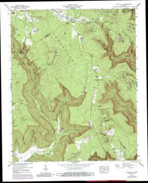
White City Topo Map Tennessee
To zoom in, hover over the map of White City
USGS Topo Quad 35085b6 - 1:24,000 scale
| Topo Map Name: | White City |
| USGS Topo Quad ID: | 35085b6 |
| Print Size: | ca. 21 1/4" wide x 27" high |
| Southeast Coordinates: | 35.125° N latitude / 85.625° W longitude |
| Map Center Coordinates: | 35.1875° N latitude / 85.6875° W longitude |
| U.S. State: | TN |
| Filename: | o35085b6.jpg |
| Download Map JPG Image: | White City topo map 1:24,000 scale |
| Map Type: | Topographic |
| Topo Series: | 7.5´ |
| Map Scale: | 1:24,000 |
| Source of Map Images: | United States Geological Survey (USGS) |
| Alternate Map Versions: |
White City TN 1936 Download PDF Buy paper map White City TN 1947, updated 1974 Download PDF Buy paper map White City TN 1947, updated 1976 Download PDF Buy paper map White City TN 1947, updated 1987 Download PDF Buy paper map White City TN 1947, updated 1987 Download PDF Buy paper map White City TN 1950 Download PDF Buy paper map White City TN 2010 Download PDF Buy paper map White City TN 2013 Download PDF Buy paper map White City TN 2016 Download PDF Buy paper map |
1:24,000 Topo Quads surrounding White City
> Back to 35085a1 at 1:100,000 scale
> Back to 35084a1 at 1:250,000 scale
> Back to U.S. Topo Maps home
White City topo map: Gazetteer
White City: Capes
Anderson Point elevation 543m 1781′Ellidge Point elevation 543m 1781′
Raven Point elevation 528m 1732′
Speegle Point elevation 543m 1781′
White City: Dams
Haskell Foster Lake Dam elevation 549m 1801′White City: Falls
Foster Falls elevation 484m 1587′White City: Mines
Marshal Meeks Number 3 Mine elevation 572m 1876′White City: Populated Places
Comfort elevation 199m 652′Lankford Town elevation 575m 1886′
Oak Grove elevation 560m 1837′
White City elevation 562m 1843′
White City: Reservoirs
Haskell Foster Lake elevation 549m 1801′White City: Ridges
Big Ridge elevation 609m 1998′Higgins Ridge elevation 593m 1945′
Long Ridge elevation 583m 1912′
Pryor Ridge elevation 580m 1902′
White City: Springs
Plummeting Springs elevation 340m 1115′White City: Streams
Bell Branch elevation 336m 1102′Denny Cove Branch elevation 235m 770′
Laurel Branch elevation 309m 1013′
Little Gizzard Creek elevation 244m 800′
Little Indian Creek elevation 381m 1250′
Long Branch elevation 309m 1013′
McAlloyd Branch elevation 366m 1200′
North Fork Pryor Cove Branch elevation 346m 1135′
Sams Branch elevation 381m 1250′
White City: Valleys
Anderson Cove elevation 199m 652′Denny Cove elevation 243m 797′
Lick Hollow elevation 271m 889′
Little Cove elevation 334m 1095′
Robinson Cove elevation 250m 820′
Speegle Cove elevation 216m 708′
Sugarcamp Hollow elevation 301m 987′
White City digital topo map on disk
Buy this White City topo map showing relief, roads, GPS coordinates and other geographical features, as a high-resolution digital map file on DVD:


