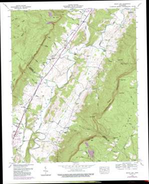
Mount Airy Topo Map Tennessee
To zoom in, hover over the map of Mount Airy
USGS Topo Quad 35085d3 - 1:24,000 scale
| Topo Map Name: | Mount Airy |
| USGS Topo Quad ID: | 35085d3 |
| Print Size: | ca. 21 1/4" wide x 27" high |
| Southeast Coordinates: | 35.375° N latitude / 85.25° W longitude |
| Map Center Coordinates: | 35.4375° N latitude / 85.3125° W longitude |
| U.S. State: | TN |
| Filename: | o35085d3.jpg |
| Download Map JPG Image: | Mount Airy topo map 1:24,000 scale |
| Map Type: | Topographic |
| Topo Series: | 7.5´ |
| Map Scale: | 1:24,000 |
| Source of Map Images: | United States Geological Survey (USGS) |
| Alternate Map Versions: |
Mount Airy TN 1935 Download PDF Buy paper map Mount Airy TN 1946, updated 1965 Download PDF Buy paper map Mount Airy TN 1946, updated 1965 Download PDF Buy paper map Mount Airy TN 1946, updated 1974 Download PDF Buy paper map Mount Airy TN 1946, updated 1991 Download PDF Buy paper map Mount Airy TN 1947, updated 1948 Download PDF Buy paper map Mount Airy TN 2010 Download PDF Buy paper map Mount Airy TN 2013 Download PDF Buy paper map Mount Airy TN 2016 Download PDF Buy paper map |
1:24,000 Topo Quads surrounding Mount Airy
> Back to 35085a1 at 1:100,000 scale
> Back to 35084a1 at 1:250,000 scale
> Back to U.S. Topo Maps home
Mount Airy topo map: Gazetteer
Mount Airy: Bridges
Kelly Bridge elevation 214m 702′Standifer Bridge elevation 220m 721′
Thermans Bridge (historical) elevation 213m 698′
Mount Airy: Capes
High Point elevation 708m 2322′Hog Point elevation 477m 1564′
Mount Airy: Cliffs
Raven Cliff elevation 677m 2221′Yellow Cliff elevation 525m 1722′
Mount Airy: Crossings
Gates Ford elevation 225m 738′Harris Ford elevation 214m 702′
Stephen Chapel Ford elevation 225m 738′
Walker Ford elevation 228m 748′
Mount Airy: Flats
The Big Flat elevation 549m 1801′Mount Airy: Gaps
Alexander Gap elevation 570m 1870′Hixson Gap elevation 666m 2185′
Swanner Pass elevation 671m 2201′
Mount Airy: Lakes
Brushy Pond elevation 625m 2050′Mount Airy: Populated Places
Elm Hill elevation 238m 780′Mount Airy elevation 233m 764′
Pailo elevation 230m 754′
Mount Airy: Springs
Henson Spring elevation 277m 908′Mount Airy: Streams
Austin Branch elevation 217m 711′Bowman Branch elevation 225m 738′
Cannon Creek elevation 225m 738′
Clark Branch elevation 226m 741′
Cove Branch elevation 591m 1938′
Dry Branch elevation 261m 856′
Dry Branch elevation 217m 711′
Dry Branch elevation 231m 757′
Johnson Branch elevation 223m 731′
Lamb Creek elevation 225m 738′
Little Brush Creek elevation 219m 718′
McWilliams Creek elevation 213m 698′
Minton Branch elevation 215m 705′
Natural Bridge Branch elevation 570m 1870′
Pond Creek elevation 236m 774′
Rains Creek elevation 232m 761′
Rattlesnake Branch elevation 512m 1679′
Rogers Branch elevation 219m 718′
Stillhouse Branch elevation 223m 731′
Thomas Branch elevation 222m 728′
Welch Branch elevation 219m 718′
Wolfe Branch elevation 579m 1899′
Mount Airy: Summits
Buck Knob elevation 693m 2273′Mount Airy: Valleys
Lamb Gulf elevation 264m 866′Mount Airy digital topo map on disk
Buy this Mount Airy topo map showing relief, roads, GPS coordinates and other geographical features, as a high-resolution digital map file on DVD:


