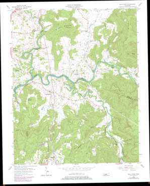
Bald Knob Topo Map Tennessee
To zoom in, hover over the map of Bald Knob
USGS Topo Quad 35085g4 - 1:24,000 scale
| Topo Map Name: | Bald Knob |
| USGS Topo Quad ID: | 35085g4 |
| Print Size: | ca. 21 1/4" wide x 27" high |
| Southeast Coordinates: | 35.75° N latitude / 85.375° W longitude |
| Map Center Coordinates: | 35.8125° N latitude / 85.4375° W longitude |
| U.S. State: | TN |
| Filename: | o35085g4.jpg |
| Download Map JPG Image: | Bald Knob topo map 1:24,000 scale |
| Map Type: | Topographic |
| Topo Series: | 7.5´ |
| Map Scale: | 1:24,000 |
| Source of Map Images: | United States Geological Survey (USGS) |
| Alternate Map Versions: |
Bald Knob TN 1956, updated 1957 Download PDF Buy paper map Bald Knob TN 1956, updated 1970 Download PDF Buy paper map Bald Knob TN 1956, updated 1979 Download PDF Buy paper map Bald Knob TN 2010 Download PDF Buy paper map Bald Knob TN 2013 Download PDF Buy paper map Bald Knob TN 2016 Download PDF Buy paper map |
1:24,000 Topo Quads surrounding Bald Knob
> Back to 35085e1 at 1:100,000 scale
> Back to 35084a1 at 1:250,000 scale
> Back to U.S. Topo Maps home
Bald Knob topo map: Gazetteer
Bald Knob: Bridges
Double Bridges (historical) elevation 240m 787′Bald Knob: Crossings
Hodge Ferry (historical) elevation 242m 793′Plumlees Ford elevation 241m 790′
River Hill Ferry (historical) elevation 239m 784′
River Hill Ford elevation 242m 793′
Bald Knob: Dams
Spencer Water Supply Dam elevation 488m 1601′Bald Knob: Populated Places
Cane Creek elevation 271m 889′Cummingsville elevation 265m 869′
Greenwood elevation 303m 994′
Meade (historical) elevation 281m 921′
River Hill elevation 282m 925′
Sweetgum elevation 268m 879′
Young (historical) elevation 256m 839′
Bald Knob: Reservoirs
Spencer Water Supply Lake elevation 488m 1601′Bald Knob: Streams
Calfkiller River elevation 242m 793′Camps Gulf Branch elevation 271m 889′
Cane Creek elevation 239m 784′
Cummings Cove Branch elevation 273m 895′
Dry Creek elevation 250m 820′
Hickory Valley Branch elevation 241m 790′
Millstone Branch elevation 254m 833′
Perry Branch elevation 262m 859′
Turkey Cot Cove elevation 444m 1456′
Bald Knob: Summits
Bald Knob elevation 435m 1427′Big Butte elevation 518m 1699′
Little Top elevation 537m 1761′
Milksick Mountain elevation 497m 1630′
Pine Mountain elevation 529m 1735′
Bald Knob: Valleys
Cane Hollow elevation 251m 823′Fox Hollow elevation 249m 816′
Hickory Valley elevation 252m 826′
Waterfall Hollow elevation 281m 921′
Bald Knob digital topo map on disk
Buy this Bald Knob topo map showing relief, roads, GPS coordinates and other geographical features, as a high-resolution digital map file on DVD:


