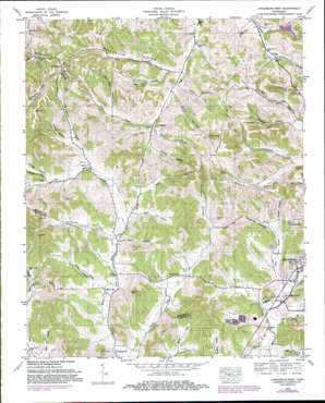
Lynchburg West Topo Map Tennessee
To zoom in, hover over the map of Lynchburg West
USGS Topo Quad 35086c4 - 1:24,000 scale
| Topo Map Name: | Lynchburg West |
| USGS Topo Quad ID: | 35086c4 |
| Print Size: | ca. 21 1/4" wide x 27" high |
| Southeast Coordinates: | 35.25° N latitude / 86.375° W longitude |
| Map Center Coordinates: | 35.3125° N latitude / 86.4375° W longitude |
| U.S. State: | TN |
| Filename: | o35086c4.jpg |
| Download Map JPG Image: | Lynchburg West topo map 1:24,000 scale |
| Map Type: | Topographic |
| Topo Series: | 7.5´ |
| Map Scale: | 1:24,000 |
| Source of Map Images: | United States Geological Survey (USGS) |
| Alternate Map Versions: |
Booneville TN 1936 Download PDF Buy paper map Booneville TN 1949, updated 1974 Download PDF Buy paper map Lynchburg West TN 1949, updated 1982 Download PDF Buy paper map Booneville TN 1951 Download PDF Buy paper map Booneville TN 1951, updated 1967 Download PDF Buy paper map Lynchburg West TN 2010 Download PDF Buy paper map Lynchburg West TN 2013 Download PDF Buy paper map Lynchburg West TN 2016 Download PDF Buy paper map |
1:24,000 Topo Quads surrounding Lynchburg West
> Back to 35086a1 at 1:100,000 scale
> Back to 35086a1 at 1:250,000 scale
> Back to U.S. Topo Maps home
Lynchburg West topo map: Gazetteer
Lynchburg West: Dams
Elaine Lake Dam elevation 265m 869′Lynchburg West: Lakes
Sebastian Pond elevation 279m 915′Lynchburg West: Populated Places
Booneville elevation 225m 738′Hawthorne elevation 271m 889′
Mount Herman elevation 368m 1207′
New Herman elevation 266m 872′
Lynchburg West: Reservoirs
Elaine Lake elevation 265m 869′Lynchburg West: Streams
Bailey Branch elevation 224m 734′Charity Creek elevation 253m 830′
Farrar Branch elevation 265m 869′
Kirby Branch elevation 265m 869′
Pitts Branch elevation 229m 751′
Possumtrot Branch elevation 251m 823′
Price Branch elevation 229m 751′
Ray Branch elevation 254m 833′
Rudd Branch elevation 236m 774′
Spankem Branch elevation 234m 767′
Lynchburg West: Summits
Hobbs Hill elevation 335m 1099′Wagoner Hill elevation 326m 1069′
Lynchburg West: Valleys
Anderson Hollow elevation 271m 889′Bagley Hollow elevation 248m 813′
Bartlett Hollow elevation 254m 833′
Bedford Hollow elevation 269m 882′
Buckeye Hollow elevation 254m 833′
Carter Hollow elevation 256m 839′
Eden Hollow elevation 261m 856′
Enoch Hollow elevation 251m 823′
John Allen Hollow elevation 285m 935′
Kinkaid Hollow elevation 274m 898′
Martin Hollow elevation 228m 748′
Martin Hollow elevation 236m 774′
McNatt Hollow elevation 259m 849′
Morris Hollow elevation 256m 839′
Morris Hollow elevation 255m 836′
Mullins Hollow elevation 267m 875′
Polecat Hollow elevation 233m 764′
Possumtrot Hollow elevation 254m 833′
Raby Hollow elevation 249m 816′
Reed Hollow elevation 224m 734′
Robertson Hollow elevation 250m 820′
Roe Hollow elevation 241m 790′
Sam Hart Hollow elevation 262m 859′
Ward Hollow elevation 257m 843′
Warren Hollow elevation 259m 849′
Lynchburg West digital topo map on disk
Buy this Lynchburg West topo map showing relief, roads, GPS coordinates and other geographical features, as a high-resolution digital map file on DVD:


