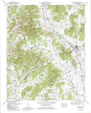
Petersburg Topo Map Tennessee
To zoom in, hover over the map of Petersburg
USGS Topo Quad 35086c6 - 1:24,000 scale
| Topo Map Name: | Petersburg |
| USGS Topo Quad ID: | 35086c6 |
| Print Size: | ca. 21 1/4" wide x 27" high |
| Southeast Coordinates: | 35.25° N latitude / 86.625° W longitude |
| Map Center Coordinates: | 35.3125° N latitude / 86.6875° W longitude |
| U.S. State: | TN |
| Filename: | o35086c6.jpg |
| Download Map JPG Image: | Petersburg topo map 1:24,000 scale |
| Map Type: | Topographic |
| Topo Series: | 7.5´ |
| Map Scale: | 1:24,000 |
| Source of Map Images: | United States Geological Survey (USGS) |
| Alternate Map Versions: |
Petersburg TN 1936 Download PDF Buy paper map Petersburg TN 1951 Download PDF Buy paper map Petersburg TN 1951, updated 1967 Download PDF Buy paper map Petersburg TN 1951, updated 1980 Download PDF Buy paper map Petersburg TN 2010 Download PDF Buy paper map Petersburg TN 2013 Download PDF Buy paper map Petersburg TN 2016 Download PDF Buy paper map |
1:24,000 Topo Quads surrounding Petersburg
> Back to 35086a1 at 1:100,000 scale
> Back to 35086a1 at 1:250,000 scale
> Back to U.S. Topo Maps home
Petersburg topo map: Gazetteer
Petersburg: Cliffs
Leonard Bluff elevation 264m 866′Petersburg: Gaps
Saddle Gap elevation 325m 1066′Petersburg: Parks
Petersburg Historic District elevation 230m 754′Petersburg: Populated Places
Bidwell elevation 230m 754′Blakeville elevation 235m 770′
Browns Shop elevation 254m 833′
Catalpa elevation 247m 810′
Delina elevation 240m 787′
Luna elevation 292m 958′
Petersburg elevation 230m 754′
Talley elevation 250m 820′
Petersburg: Post Offices
Petersburg Post Office elevation 230m 754′Petersburg: Ridges
Maple Hill Ridge elevation 358m 1174′Petersburg: Springs
Bryant Spring elevation 273m 895′Sanders Spring elevation 245m 803′
Twin Springs elevation 230m 754′
Petersburg: Streams
Dyer Branch elevation 225m 738′Gingerbread Creek elevation 209m 685′
Lazy Branch elevation 244m 800′
Little Cane Creek elevation 220m 721′
Middle Cane Creek elevation 232m 761′
Pinhook Branch elevation 209m 685′
Pleasant Valley Creek elevation 213m 698′
Sanders Creek elevation 225m 738′
Short Branch elevation 213m 698′
West Cane Creek elevation 230m 754′
Petersburg: Summits
Copperas Hill elevation 352m 1154′Gaunt Hill elevation 280m 918′
Gould Hill elevation 358m 1174′
Larwood Hill elevation 363m 1190′
McCrady Hill elevation 331m 1085′
Porter Hill elevation 354m 1161′
Slip Hill elevation 340m 1115′
Talley Hill elevation 361m 1184′
Taylor Hill elevation 300m 984′
Toll Gate Hill elevation 352m 1154′
Tuley Hill elevation 312m 1023′
Welch Hill elevation 336m 1102′
Petersburg: Valleys
Albright Hollow elevation 227m 744′Bryant Hollow elevation 253m 830′
California Hollow elevation 222m 728′
Caneer Hollow elevation 281m 921′
Crabtree Hollow elevation 240m 787′
Davis Hollow elevation 250m 820′
Dockworth Hollow elevation 249m 816′
Duckworth Hollow elevation 272m 892′
Fuss Hollow elevation 245m 803′
Goshen Hollow elevation 226m 741′
Haislip Hollow elevation 232m 761′
Hampton Hollow elevation 232m 761′
Larwood Hollow elevation 266m 872′
Long Hollow elevation 252m 826′
Pack Hollow elevation 227m 744′
Pigg Hollow elevation 231m 757′
Pigg Hollow elevation 280m 918′
Pleasant Valley elevation 224m 734′
Poarch Hollow elevation 264m 866′
Steep Hollow elevation 257m 843′
Tate Hollow elevation 252m 826′
Wakefield Hollow elevation 241m 790′
Wakefield Hollow elevation 285m 935′
Whitaker Hollow elevation 250m 820′
Whorley Hollow elevation 245m 803′
Petersburg digital topo map on disk
Buy this Petersburg topo map showing relief, roads, GPS coordinates and other geographical features, as a high-resolution digital map file on DVD:


